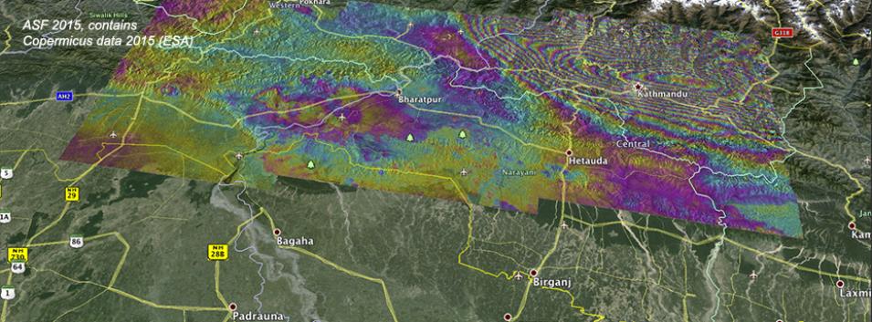
Ground deformation caused by the April 25 Nepal earthquake is clearly visible in this new interferogram processed from Sentinel-1A data by NASA's Alaska Satellite Facility Distributed Active Archive Center (ASF DAAC) scientists Franz Meyer and Wenyu Gong. The image uses synthetic aperture radar (SAR) data from April 17 and April 29. Each colored fringe indicates about 8.5 cm of surface motion, with ground motion exceeding 1.4 m in areas north of Kathmandu. Sentinel-1A data are available from ASF DAAC through an agreement between NASA and the European Space Agency (ESA). Visit ASF DAAC to download Sentinel-1A SAR imagery.
Due to the lapse in federal government funding, NASA is not updating this website. We sincerely regret this inconvenience.
