New Map Viewer Shows Population Characteristics in Relation to Reported COVID-19 Cases

The Global COVID-19 Viewer may be especially helpful for regional analyses or for countries with limited access to spatial population data.

A new mapping tool shows the density of population in relationship to reported coronavirus disease (COVID-19) cases at national and sub-national levels, and permits users to obtain custom estimates of the number of people by age and sex living in an area of interest, including areas not currently reporting large numbers of cases.

Developed by NASA's Socioeconomic Data and Applications Center (SEDAC), the Global COVID-19 Viewer lets users quickly access relevant population information without having to download and analyze large amounts of spatial population data. The Viewer’s unique capability is that it allows users to obtain population estimates for specific age and sex categories for any area, such as a metropolitan region that cuts across multiple jurisdictions or countries. The Viewer displays age and sex structure charts and pyramids in response to a user-drawn circle or polygon. Data on COVID-19 cases from the Johns Hopkins University are updated multiple times per day.
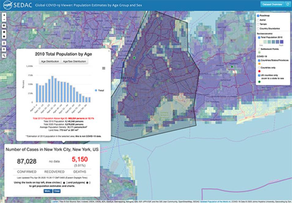
Screenshot of the Global COVID-19 Viewer tool showing parts of New York City with pop-up boxes showing data points such as number of active cases.
Image Caption

The Global COVID-19 Viewer allows users to obtain population estimates for specific age and sex categories for any area.

The SEDAC Global COVID-19 Viewer is meant for researchers, educators, and policymakers who are interested in visualizing key population characteristics such as high concentrations of elderly individuals in urban or rural areas that are, or may become, affected by the COVID-19 pandemic. The Viewer may be especially helpful for regional analyses or for countries with limited access to spatial population data. 

The underlying population data are from SEDAC’s Gridded Population of the World (GPW) Basic Demographic Characteristics, v4.11, for the year 2010, with estimates to 2020. The COVID-19 data are from Johns Hopkins University & Medicine Coronavirus Resource Center

SEDAC is operated by the Center for International Earth Science Information Network (CIESIN) of the Earth Institute at Columbia University.

Details

Last Updated

Published

Data Center/Project

Socioeconomic Data and Applications Center (SEDAC)