Suomi NPP SIPS Help Ease the Transition from EOS to JPSS Satellites

Work by five Science Investigator-led Processing Systems (SIPS) enhance data continuity for next-generation instruments and missions.
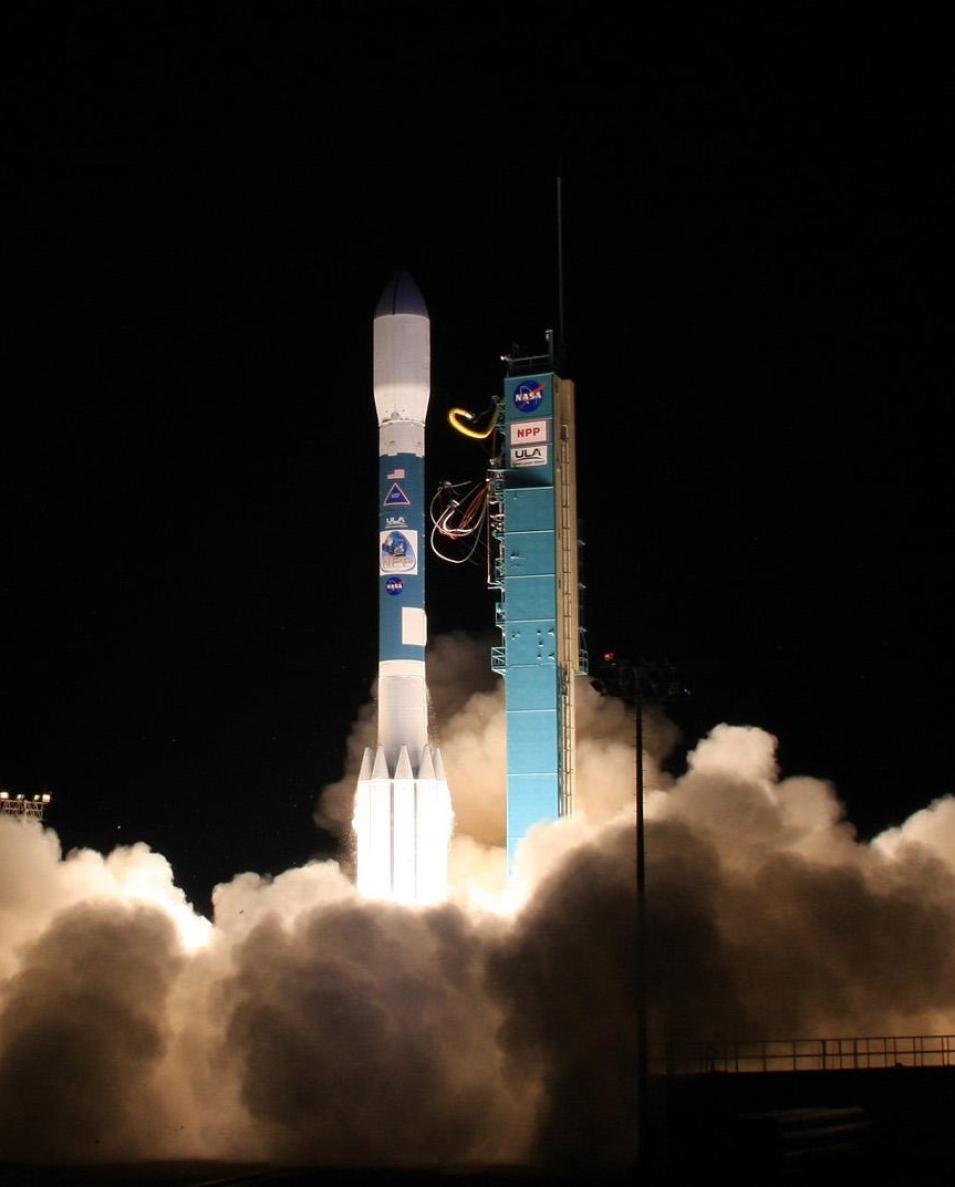
A United Launch Alliance Delta II rocket carrying the joint NASA-NOAA Suomi National Polar-orbiting Partnership (Suomi NPP) satellite lifts off from  California's Vandenberg Air Force Base on October 28, 2011.
Image Caption

A United Launch Alliance (ULA) Delta II rocket carrying the joint NASA-NOAA Suomi National Polar-orbiting Partnership (Suomi NPP) satellite lifts off from California's Vandenberg Air Force Base on October 28, 2011. Credit: NASA/ULA.

The joint NASA-NOAA Suomi National Polar-orbiting Partnership (Suomi NPP) satellite launched into space on October 28, 2011. Designed as a bridge mission to provide continuity between NASA’s Earth Observation System (EOS) satellites and the next-generation spacecraft of the Joint Polar Satellite System (JPSS), Suomi NPP’s successful entry into low Earth orbit paved the way for the launch of NOAA-20 (formerly JPSS-1) on November 18, 2017, and JPSS-2, which rocketed into space November 10, 2022, and will be known as NOAA-21.

Like their EOS predecessors, JPSS satellites collect critical meteorological data for short-term, seasonal, and long-term forecasting; global measurements of atmospheric, oceanic, and terrestrial conditions; and extend the multidecade data records that enable the study of long-term climate trends.

As the first JPSS satellite, Suomi NPP provided nearly an order of magnitude more data than the spacecraft of the EOS system. It also gave NASA and its partner agencies access to and experience with the JPSS' latest and most advanced sensors, thereby facilitating the data continuity efforts associated with the transition from NASA's EOS. In addition, working with Suomi NPP also gave scientists and engineers an opportunity to test the operations systems on the ground and validate sensors and algorithms while the technologies of the current system were still in place.

As part of the efforts to validate those new sensors and the algorithms that interpret the data they provide, NASA's Earth Science Data and Information System (ESDIS) Project supports five Science Investigator-led Processing Systems (SIPS), which are responsible for producing, assessing, processing, and reprocessing products from Suomi NPP's instruments: the Advanced Technology Microwave Sounder (ATMS), the Clouds and the Earth's Radiant Energy System (CERES), the Cross-Track Infrared Sounder (CrIS), the Ozone Mapping and Profiler Suite (OMPS), and the Visible Infrared Imaging Radiometer Suite (VIIRS).

Over the years, the SIPS' work has helped NASA and NOAA meet the goals of the Suomi NPP mission and benefitted long-term studies of global change.

"The Suomi NPP SIPS are responsible for processing and reprocessing data products," said Evelyn Ho, SIPS Manager for ESDIS. "They work very closely with the Principal Investigators (PIs) and science team leads (TLs), who develop the algorithms, in testing the updated algorithm in a production-like environment and generating test datasets for evaluation to ensure it produces consistent and good quality data."

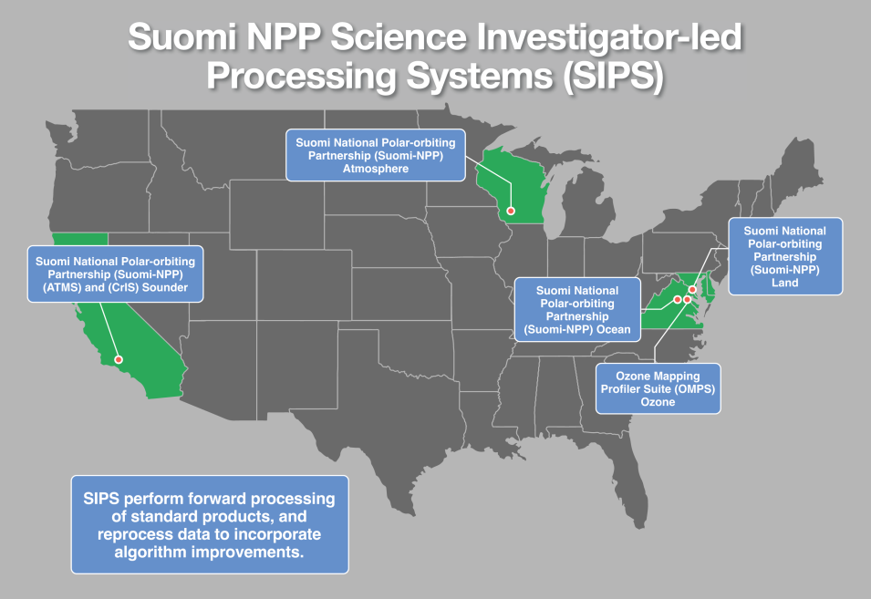
Like all NASA SIPS, the Suomi NPP SIPS are geographically distributed across the United States and are generally (but not always) collocated with the Science Computing Facilities (SCFs) that process data from a specific instrument or mission. When a new or reprocessed data product is ready for release, the SIPS sends it to the appropriate NASA Distributed Active Archive Center (DAAC) for archiving and distribution. Thanks to the SIPS, data users have more than 10,000 unique data products that are constantly reprocessed and improved to provide the best research-caliber data possible.

NASA's five Suomi NPP SIPS are:

  • The Atmosphere SIPS is responsible for the production, processing, reprocessing, and general assessment of Suomi NPP VIIRS Atmosphere Products. It delivers its data products along with scientific algorithm software, associated metadata, and documentation to NASA's Level 1 and Atmosphere Archive and Distribution System DAAC (LAADS DAAC) via the Land SIPS, the Goddard Earth Sciences Data Information Services Center (GES DISC), the Atmospheric Science Data Center (ASDC), and NASA's Land, Atmosphere Near real-time Capability for EOS (LANCE).
  • The Land SIPS is responsible for the production, processing, reprocessing, and general assessment of the Suomi NPP Science Team standard and experimental VIIRS Land Products. It delivers its data products along with the scientific algorithm software, associated metadata, and documentation to NASA's LAADS DAAC, National Snow and Ice Data Center DAAC (NSIDC DAAC), and Land Processes DAAC (LP DAAC).
  • The Ocean SIPS is responsible for producing, processing, reprocessing, and general assessments of Suomi NPP VIIRS Ocean Products. It delivers its data products along with scientific algorithm software, associated metadata, and documentation to NASA's Ocean Biology DAAC (OB.DAAC).
  • The Ozone SIPS is responsible for processing and reprocessing Suomi NPP OMPS Nadir and Limb products. It delivers its data products along with scientific algorithm software, associated metadata, and documentation to the OMPS website and GES DISC.
  • The Sounder SIPS is responsible for the production, processing, and reprocessing of data products from Suomi NPP's ATMS and CrIS, which are collectively referred to as the Cross-track Infrared and Microwave Sounding Suite (CrIMSS). It too delivers its data products along with scientific algorithm software, associated metadata, and documentation to GES DISC.
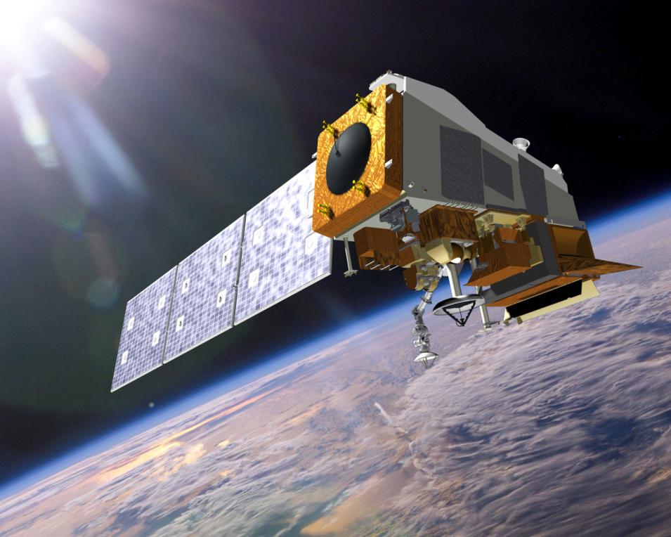
An artist’s rendering of the Suomi NPP satellite in low-Earth orbit.
Image Caption

An artist's rendering of the Suomi NPP satellite in low Earth orbit. Credit: JPSS.

In addition to these five SIPS, there is the CERES SCF, which is co-located with ASDC and managed and funded by the CERES Principal Investigator. The CERES SCF is responsible for the production, processing, reprocessing, and general assessment of the Suomi NPP Science Team standard and experimental CERES Products. It delivers its data products along with scientific algorithm software, associated metadata, and documentation to ASDC.

The Suomi NPP SIPS process Level 0 data to Level 2 products and global gridded Level 3 products using the scientific algorithm software from their respective Suomi NPP Discipline Group. Four of the five SIPS acquire near real-time algorithms for selected products and then process and deliver them, within three hours, for distribution through LANCE. The Ocean SIPS, however, acquires near real-time algorithms for selected products and then processes and delivers them, within three hours, for distribution through NASA's Physical Oceanography DAAC (PO.DAAC).

Given that Suomi NPP has been in orbit for the past 11 years, one might assume the SIPS' work is somewhat routine. Yet, it remains challenging for several reasons, including the variation with which satellite data are received.

"The SIPS work with different external providers for Level 0 data products, ancillary data products, and any additional supporting information that are needed to generate a standard data product," said Ho. "The difficulty is that not all this information is available at the same time."

Indeed, raw satellite data often arrive at different times and in separate data streams and formats, which requires them to be aligned to meet algorithm requirements. This means the SIPS have to account for the data on each interface and track down missing observations to ensure that processing keeps up with the continuous, operational instrument data flows.

In addition, satellites (and the instrument missions they support) frequently enter and exit the EOS constellation, so the SIPS must regularly and quickly incorporate changes to data calibration parameters and algorithms, and reprocess existing data to ensure the accuracy of long-term data records over the life of a mission as well as from one satellite mission to another.

"[The SIPS] provide various tools and applications to support the science teams in monitoring the products and conducting data analysis," Ho said. "They also reprocess the data if the science teams request it, as a result of algorithm or calibration updates. Reprocessing is done to make sure that the records or that data collection is up to date for an entire mission or long-term data record, which is critically important for research."

This issue is particularly timely now, as NASA's Terra and Aqua satellites have begun their Constellation Exit Maneuvers and the instruments aboard Suomi NPP, NOAA-20, and JPSS-2 become more essential.

"Suomi NPP was meant to bridge the EOS and JPSS missions, so by working with Suomi NPP instruments and data over the years, the PIs and science teams gained early experience with the data from the instruments and their algorithms," Ho said.

This map shows the locations of NASA’s five Suomi NPP SIPS.
Image Caption

This map shows the locations of NASA's five Suomi NPP SIPS and how most, but not all, are collocated with the Scientific Computing Facilities that process data from a specific instrument. Credit: NASA EOSDIS.

Elaine Prins, project manager for the Atmosphere SIPS, concurs and says, "The SIPS have played a pivotal role in meeting the goal of the [Suomi NPP] mission to extend global measurements for long-term monitoring of climate trends that began with NASA's EOS missions and continues into the future with the operational JPSS series."

According to Prins, the success of the Atmosphere SIPS is rooted in the groundwork, tools, and capabilities developed under the precursor to the SIPS—the NPP Product and Evaluation and Test Elements program—and the relationships honed with a variety of science teams that began in 2007.

"This early work played a significant role in facilitating a smooth transition to the Atmosphere SIPS with a focus on implementing and maintaining an investigator-led processing system," she said. "The Atmosphere SIPS team works collaboratively with the VIIRS Atmosphere science teams on initial planning, scientific algorithm software integration, testing, operational implementation, data ingest monitoring, product generation and delivery, and ongoing evaluation."

The Atmosphere SIPS ingests Suomi NPP and JPSS VIIRS, CrIS, and other ancillary data 24 hours per day, seven days a week, with global atmosphere products generated in standard processing mode and, for select products, near real-time mode. When science teams deliver updated code with product improvements, the Atmosphere SIPS can reprocess Suomi NPP and JPSS mission records within days to weeks. The SIPS also preserve information about the origins and development of science production software and product generation, which is essential for future researchers and user communities.

Hence Prins' assessment that, "The support and capabilities provided by the SIPS for Suomi NPP and the follow-on JPSS series satellites are crucial for producing high quality consistent multi-decade Earth system data records for global change evaluation studies."

In this way, the work of the SIPS is also important to NASA's ESDIS Project as a whole, as its mission is to process, archive, and distribute high-quality data to the scientists and others conducting the research required to meet the on-going and complex challenges of climate and environmental change.

Details

Last Updated

Published

Data Center/Project

Atmospheric Science Data Center (ASDC)
Goddard Earth Sciences Data and Information Services Center (GES DISC)
Level 1 and Atmosphere Archive and Distribution System DAAC (LAADS DAAC)
Land Processes DAAC (LP DAAC)
National Snow and Ice Data Center DAAC (NSIDC DAAC)
Ocean Biology DAAC (OB.DAAC)
Physical Oceanography DAAC (PO.DAAC)