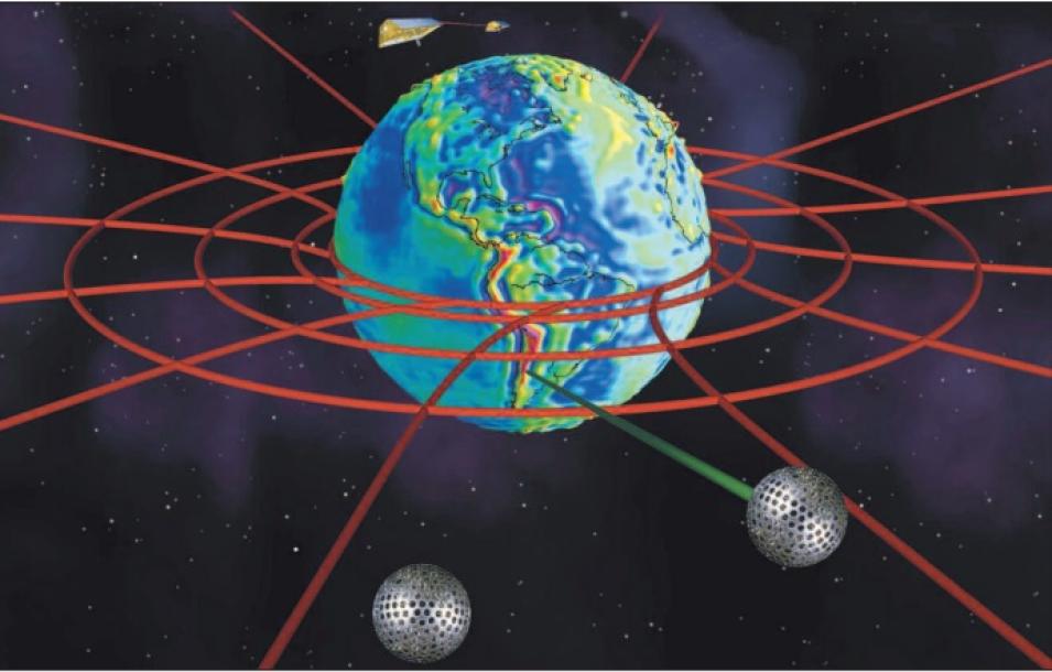
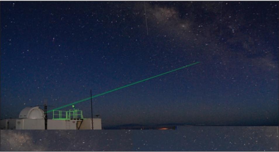
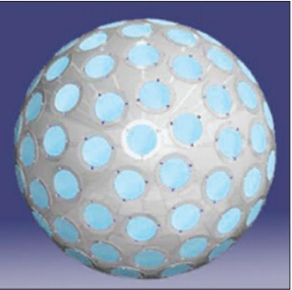
The LAGEOS mission was primarily designed to gather data to explore topics such as plate tectonics and the measurements of Earth’s shape. The two LAGEOS satellites currently orbiting Earth are physically identical, and orbit at about 6,000 kilometers (4,000 miles) above Earth so that they experience as little of Earth’s gravitational pull as possible. Pavlis said, “They are basically like cannonballs put up in space; they have no power or sensors and they don’t transmit anything.” So what do they do? Put simply, they reflect light back to Earth. Each LAGEOS satellite is a perfect sphere covered with 426 glass prisms. Light entering these prisms bounces back in exactly the same direction, in this case back down to international laser ranging stations polka-dotting Earth. The laser-ranging data (accurate to a few millimeters) gave Ciufolini and Pavlis a reliable measurement of the satellites’ location in their orbit around Earth, accurate to a fraction of a centimeter. The scientists needed extremely precise measurements in order to observe the minute effects of frame-dragging on the orbits.
Accounting for gravity
However, before Ciufolini and Pavlis could measure the effects of frame-dragging on the LAGEOS satellites, they first needed to account for and remove other effects, like the pull of Earth’s gravity on the two satellites. To account for gravity and other effects in their equations, the scientists used a model of Earth’s gravitational field, based on data from the GRACE satellite mission. The GRACE mission, like LAGEOS, happens to rely on two identical satellites. However, the similarities between the missions end there. Pavlis said, “The GRACE satellites fly in a low 450-kilometer [280-mile] orbit so that the effects of Earth’s gravitational pull will be as strong as possible to capture more detail.” The twin satellites work as a team to maintain continuous data on the distance between them, sending radio frequency signals back and forth to each other and receiving Global Positioning System (GPS) signals; laser stations on Earth also track the satellites. As the satellites pass over the planet, features like mountains and bodies of water tug at them because of their varying densities, allowing the satellites to map the details of Earth’s gravitational field. Pavlis said, “Using GRACE data improved the models of Earth’s gravitational field by several orders of magnitude almost overnight, and that meant we improved the accuracy of our measurements of the tiny effects of frame-dragging on the LAGEOS satellites.”
The scientists put the data from the LAGEOS and GRACE satellite missions together to measure the effect of frame-dragging on the LAGEOS satellites’ orbit. “Removing the effects of tides, atmosphere, gravity, and so on from the data, we could determine where the satellites were in their orbital arcs,” said Pavlis. “We could see the orbital plane change because of the effects of relativity.” The effects of frame-dragging on the LAGEOS satellite orbits are small, but measurable. Ciufolini said, “We’re observing differences of just small fractions of a second of arc, about 10 to the minus 5 degrees, between the two satellites. But it’s still proof that frame-dragging is real, and it’s another important test validating the general theory of relativity.”
The future of frame-dragging
Ciufolini and Pavlis have long pushed for an addition to the LAGEOS mission; with a third satellite in orbit, the accuracy of their measurements could be improved even further. Talk of launching a hypothetical LAGEOS-III has long subsided. However, the Italian Space Agency, ASI, has designed a new satellite for launch in the next year. Laser-ranging data from the new Laser Relativity Satellite (LARES) would likely be archived at NASA CDDIS. Ciufolini said, “Unless there’s an unknown denser asteroid in our solar system, LARES will be the densest single object: about 387 kilograms [853 pounds] of tungsten in a sphere 36 centimeters [14 inches] in diameter.” Pavlis looks forward to studying the data from LARES, after its planned launch in early 2010.
In addition to a third laser-ranging satellite, the two scientists also hope to see additional laser-ranging stations placed on Earth, improving the coverage of the LAGEOS satellite orbit and, in turn, their frame-dragging measurements. Pavlis said, “Right now, we only have snapshots of the orbit over land; if we don’t have real estate, we can’t put up a station.” Another challenge is the cost of the stations, which require high levels of onsite infrastructure and support; not all countries have stations where they are needed. Automated stations, and new locations in the near future, would help fill in the gaps.
Why do Ciufolini, Pavlis, and so many other scientists spend vast amounts of their time trying to improve our understanding of Einstein’s theory? Ciufolini said, “Space research is incredibly important. We can discover new things, new ways of thinking about our universe and our own lives. And the discoveries that will be made in the future, building on what we’re doing now . . . like Einstein’s theories, they will break our way of thinking about the universe.”
References
Bennett, J., M. Donahue, N. Schneider, and M. Voit. 2007. A Cosmic Perspective. Upper Saddle River, New Jersey: Pearson Education.
Ciufolini, I. 2007. Dragging of inertial frames. Nature 449: 41−47, doi:10.1038/nature06071.
Ciufolini, I., E. Pavlis. 2004. A confirmation of the general relativistic prediction of the Lense-Thirring effect. Nature 431: 958–960, doi:10.1038/nature03007.
Pavlis, E. C. 2003. Geodetic contributions to gravitational experiments in space. In Recent Developments in General Relativity: Genoa 2000, eds. R. Cianci, et al., 217–233. Milan: Springer-Verlag.
For more information
NASA Crustal Dynamics Data and Information System (CDDIS)
NASA Physical Oceanography Distributed Active Archive Center (PO.DAAC)
Gravity Recovery and Climate Experiment (GRACE)
Laser Relativity Satellite (LARES)
PO.DAAC GRACE Home
| About the remote sensing data |
| Satellites |
Laser Geodynamics Satellites 1 and 2 (LAGEOS-1 and -2) |
Gravity Recovery and Climate Experiment (GRACE) |
| Data sets |
ILRS Normal Points for 1993 to 2003 |
GRACE Level 2 Gravity Products |
| Resolution |
Global coverage |
Not applicable |
| Parameters |
Laser ranging data |
Global gravity fields |
| DAACs |
NASA Crustal Dynamics Data and Information System (CDDIS) |
NASA Physical Oceanography Distributed Active Archive Center (PO.DAAC) |


