Stream flow increased again after the 2010 Maule earthquake; Pritchard and his team feel this is key to understanding the ground sinking. “In volcanic areas, there are a lot of hot springs,” he said. “If you visualize Yellowstone, there are pockets of hot fluids coming through and those fluids have minerals in them, which eventually partially clog up the pathways. So our best explanation right now is, when an earthquake shakes them up, the fluids suddenly break through any blockages and are released.” It is possible, then, that this release of fluids somehow made eruptions less likely. And it could explain why the ground around these volcanoes suddenly deflated.
In the case of Japan, magma flow might be key. Takada and Fukushima theorize that the sudden sinking of the five volcanoes near Tohoku-Oki was due to magma flowing out of volcanic chambers. “We think hot and weak plutonic bodies exist in the crust beneath the subsided volcanoes,” Takada said. Unlike the pressure that builds to cause a volcanic eruption, weak rocks called plutons that softened when heated likely allowed the magma to flow out of chambers. What is clear is that both teams independently discovered that volcanoes can sink when shaken.
Jay said, “Because this volcanic subsidence hadn’t been seen before, we did a lot of analysis to make sure this was definitely a real physical phenomenon.” Whether the water and magma theories are proven or disproved remains to be seen, but there is plenty more to learn as InSAR data increasingly become available, particularly with more frequent satellite observations. “Since the [InSAR] technique is relatively new, we don’t have a lot of examples,” Jay said. “And we only get acquisitions every few months, so we really just need more data.”
For both teams there is also still the question of why these underground hydrothermal and magmatic systems have large elliptical shapes. It also remains unclear why they are oriented in a similar north-south direction. One theory is that these features may have something to do with the volcanic arc. Volcano chains that form above a subduction zone and next to a boundary where plates are converging, as both chains had, form a long arc. Identifying future cases of earthquakes triggering volcanic subsidence will help the researchers unravel the mysteries of these processes. Until then, both teams will keep honing their theories. Pritchard said, “Future research will tell us which team is right, or maybe neither of us are. Personally, I think it’s just flat-out cool that there’s stuff happening on the Earth that’s still being discovered.”
References
Darwin, C. 1839. A naturalist’s voyage round the world. Australia: eBooks@Adelaide.
Pritchard, M. E., J. A. Jay, F. Aron, S. T. Henderson and L. E. Lara. 2013. Subsidence at southern Andes volcanoes induced by the 2010 Maule, Chile earthquake. Nature Geoscience 6: 632–636, doi:10.1038/ngeo1855.
Takada, Y. and Y. Fukushima. 2013. Volcanic subsidence triggered by the 2011 Tohoku earthquake in Japan. Nature Geoscience 6: 637–641, doi:10.1038/ngeo1857.
Jónsson, S. Volcanology: Sunken volcanoes. Nature Geoscience 6: 591-592, doi:10.1038/ngeo1876.
NASA Alaska Satellite Facility (ASF) Distributed Active Archive Center (DAAC). 2011. ALOS PALSAR L1 SAR Data. Fairbanks, Alaska USA: NASA ASF DAAC.
NASA Land Processes Distributed Active Archive Center (LP DAAC). 2011. On-Demand L2 Surface Kinetic Temperature. Sioux Falls, South Dakota USA: NASA LP DAAC.
NASA MODIS Level 1 and Atmosphere Archive and Distribution System (LAADS) DAAC. 2011. Terra/Aqua MODIS Calibrated Radiances 5-Min L1B Swath 1 km V005. Version 5. Greenbelt, Maryland: LAADS DAAC.
For more information
NASA Alaska Satellite Facility Distributed Active Archive Center (ASF DAAC)
NASA Land Processes DAAC (LP DAAC)
NASA Level 1 and Atmosphere Archive and Distribution System DAAC (LAADS DAAC)
Japan Aerospace Exploration Agency (JAXA) Advanced Land Observing Satellite (ALOS)
JAXA Phased Array type L-band Synthetic Aperture Radar (PALSAR)
NASA Advanced Spaceborne Thermal Emission and Reflection Radiometer (ASTER)
NASA Moderate Resolution Imaging Spectroradiometer (MODIS)
| About the remote sensing data |
| Satellite |
Japan Aerospace Exploration Agency Advanced Land Observing Satellite (ALOS) |
| Sensor |
Phased Array type L-band Synthetic Aperture Radar (PALSAR) |
| Data set |
L1 SAR Data |
| Resolution |
20 meters |
| Parameter |
Radar backscatter |
| DAAC |
NASA Alaska Satellite Facility Distributed Active Archive Center (ASF DAAC) |
| About the remote sensing data |
| Satellites |
Terra |
Terra and Aqua |
| Sensors |
Advanced Spaceborne Thermal Emission and Reflection Radiometer (ASTER) |
Moderate Resolution Imaging Spectroradiometer (MODIS) |
| Data sets |
On-Demand L2 Surface Kinetic Temperature |
Nighttime Calibrated Radiances 5-min L1B Seath 1 km V005 |
| Resolution |
90 meters |
1 kilometer |
| Parameters |
Surface kinetic temperature |
Surface kinetic temperature |
| DAACs |
NASA Land Processes Distributed Active Archive Center (LP DAAC) |
NASA Level 1 and Atmosphere Archive and Distribution System Distributed Active Archive Center (LAADS DAAC) |
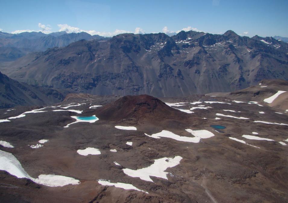
The photograph in the title graphic shows Nevados de Chillan, which is one of the five volcanoes that sank during the 8.8 magnitude earthquake that struck Maule, Chile in 2010. (Courtesy M. Pritchard and L. Lara)


