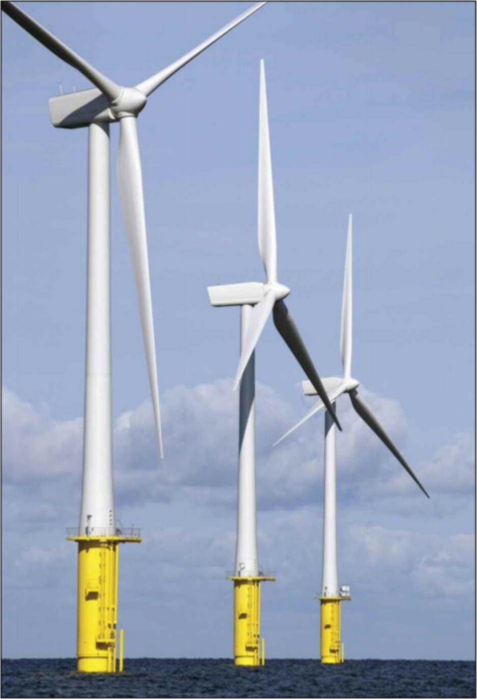
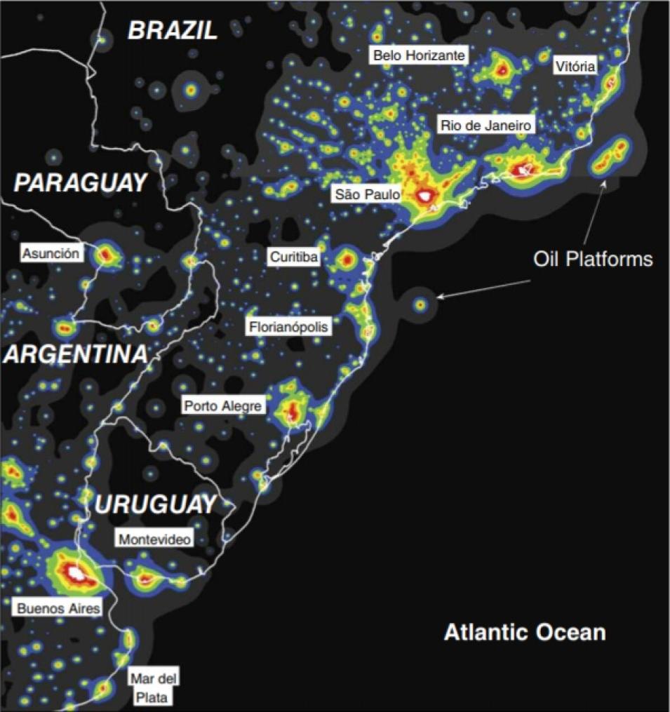
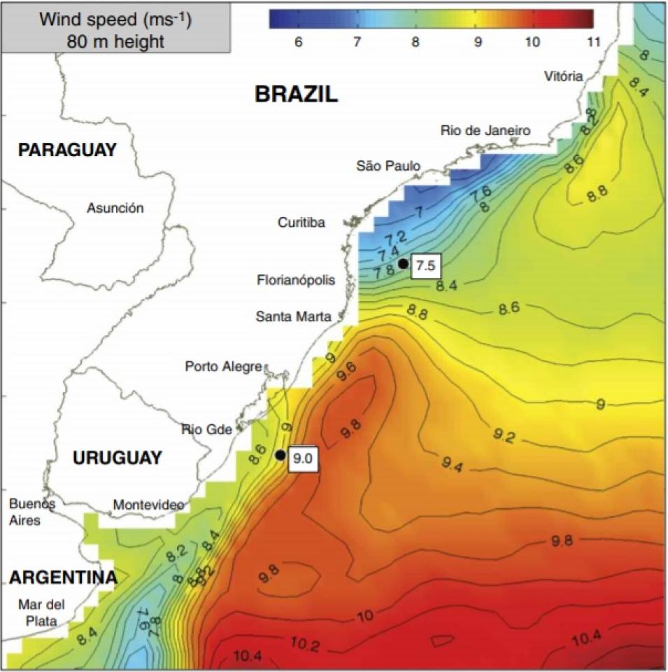
Kempton and his team now had the information needed to assess the practical wind-turbine-worthy wind resource: the wind speed at hub height over a large area from the satellite data; an idea of the fluctuations of wind speed based on the hour and season from both buoy and satellite data; and the depth of the continental shelf, where the turbines would be planted, from the bathymetric data.
Using all of this information, Kempton, Garvine, and Pimenta calculated the potential power production for two different wind turbine models. Kempton said, “The total average electricity use of Brazil is near 100 gigawatts, and the offshore wind resource of this one section of coast, to only 50 meters [164 feet] of water, is 102 gigawatts.” That means that if the study area were fully developed as a wind energy project, it could supply enough electricity for the entire country’s electricity needs.
“However,” Kempton said, “there would certainly be areas that would be excluded from development, and we didn’t attempt to consider those in our calculation. According to previous studies, exclusions for shipping lanes, marine conservation sites, and commercial fishing, could reduce the site’s capacity by 10 to 46 percent.” Even with such areas excluded from development, an offshore wind project in the study region could still meet ProInfra’s efforts to increase Brazil’s renewable energy output.
Kempton feels optimistic about the future of the team’s work. He said, “The work on the Brazilian wind assessment was the first step in a larger picture. We hope to make a database of wind assessments available for various coastal areas, with wind resource, energy demand, potential electrical output and revenue, and so on. We think this would help the wind industry decide whether or not a site is feasible economically and help with government planning.”
Pimenta agreed, adding, “I want to return to Brazil and continue this work. There are still many tools, including satellite data, left for us to explore as we look at wind energy. I hope our work will help other large countries estimate their wind resources, too.” A better understanding of global offshore wind potential could help many countries reduce their portion of humanity’s carbon output.
The main message, from Kempton’s perspective, is one of hope. “In the end,” he said, “people really understand the results of this type of research. They say things like, ‘Wow, this makes me very optimistic. I thought climate change was all doom and gloom. But we can actually do something to turn it around.’ And, given the technologies already available today, offshore wind is one of the best options out there.”
References
Kempton W., C. L. Archer, A. Dhanju, R. W. Garvine, M. Z. Jacobson. 2007. Large CO2 reductions via offshore wind power matched to inherent storage in energy end-uses. Geophysical Research Letters 34, L02817, doi:10.1029/2006GL028016.
Pimenta F., W. Kempton, and R. Garvine. 2008. Combining meteorological stations and satellite data to evaluate the offshore wind power resource of Southeastern Brazil. Renewable Energy, doi:10.1016/j.renene.2008.01.012.
For more information
NASA Physical Oceanography Distributed Active Archive Center (PO.DAAC)
NASA Quick Scatterometer (QuikSCAT) satellite
Centre ERS d’Archivage et de Traitement [French ERS Processing and Archiving Facility] (CERSAT)
Willett Kempton, University of Delaware, College of Marine and Earth Studies
| About the remote sensing data |
| Satellite |
QuikSCAT |
| Sensor |
SeaWinds Scatterometer |
| Data set |
Level 2B Ocean Wind Vectors in 25 km Swath Grid and 12.5 km Swath Grid |
| Resolution |
12.5 and 25 kilometer |
| Parameter |
Wind vectors |
| DAAC |
NASA Physical Oceanography Distributed Active Archive Center (PO.DAAC) |


