During the day, satellites track the rhythms of the natural world. At night, the human rhythms of the planet become apparent. Artificial lights, captured by satellite sensors at night, reveal human activities such as the celebration of Ramadan or the electrification of India. They can also be used to help inform hurricane recovery efforts, detect illegal fishing, and monitor forest fires, among many other applications.
Nighttime Images Show Changes in Human Activity
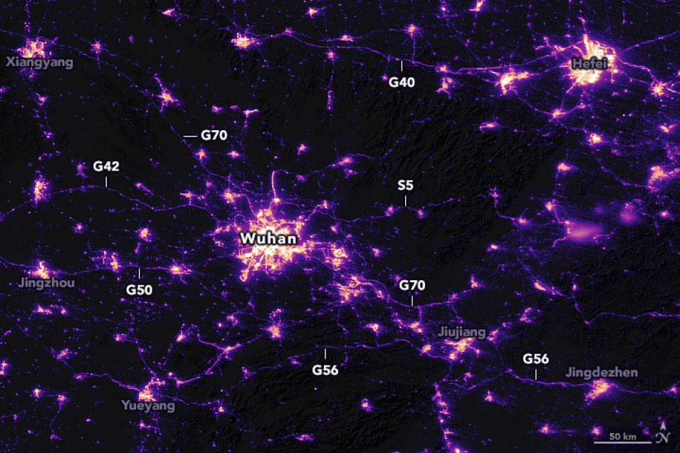
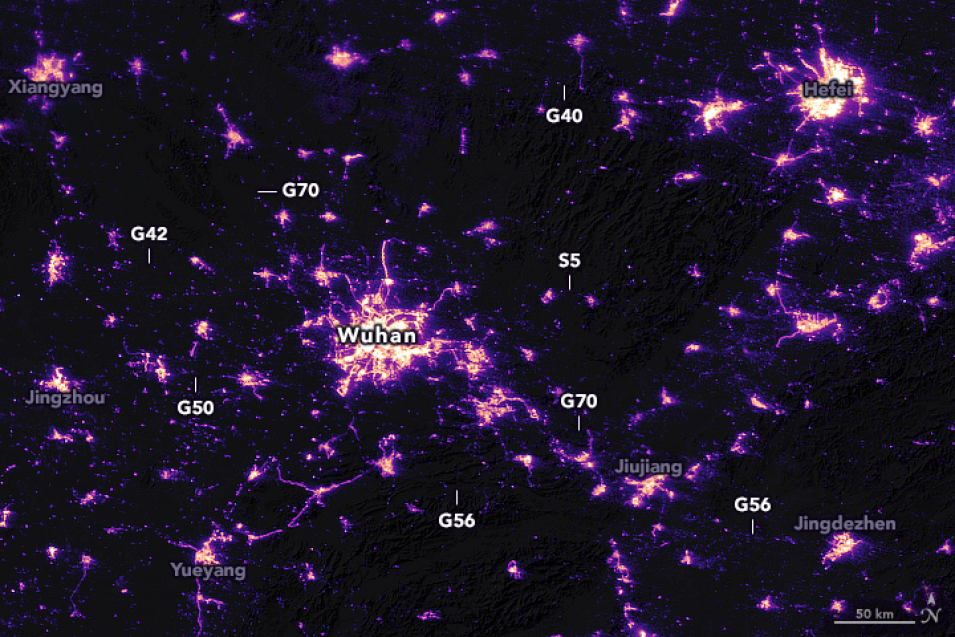
NASA's Visible Infrared Imaging Radiometer Suite (VIIRS) Day/Night Band (DNB) Team, supported by the Earth Science Data Systems (ESDS) Program, recently analyzed nighttime images from the VIIRS instrument aboard the joint NASA/NOAA Suomi National Polar-orbiting Platform (Suomi NPP) satellite. They observed stark changes in lighting patterns close to the city of Wuhan, China between January 19 and February 4, 2020.
In late January 2020, Chinese authorities suspended air, road, and rail travel around Wuhan in response to a COVID-19 outbreak. The government also instituted a city-wide lockdown where all non-essential businesses were closed. The
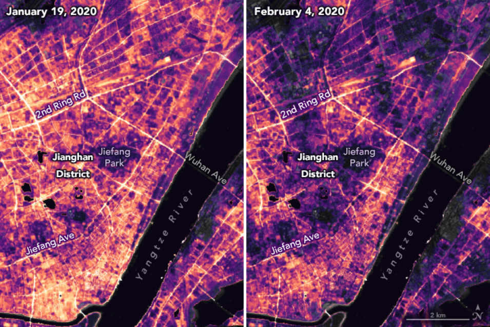
February image shows roads that were once lit up by street lights and headlights became darker and deserted. The "G" or "S" labels in the images above indicate highways where there appears to be a pronounced change. In Jianghan District, the central commercial area of Wuhan, lighting dramatically decreased, while Wuhan’s 11 million residents stayed home.
Lighting changes can be seen between January 19 and February 4, 2020 in Jianghan District, a commercial area of Wuhan, and nearby residential areas. (Courtesy of NASA's Earth Observatory.)
The images on this page were developed by NASA's Earth Observatory using data from the VIIRS DNB team. The acquisition date of each image was 16 nights apart; the time it takes for Suomi NPP to repeat its orbital pattern and observe the city from the same angle. The researchers had to correct for moonlight, clouds, pollution, snow, and other interferences that typically distort these nighttime images and make measurements incomparable across time.
You can view the uncorrected nighttime images on Worldview and they can be downloaded from the Level-1 and Atmosphere Archive and Distribution System Distributed Active Archive Center (LAADS DAAC), located at NASA's Goddard Space Flight Center.
Later this year, nighttime lights data that have been corrected for moon reflectance and other interferences will be available at LAADS DAAC and through Earthdata Search. These data can provide a unique global picture of how human activities are changing on a daily basis.


