Today, MODIS and FIRMS are being used to help manage wildland fires around the world. Along with their use by the UN FAO, the U.S. Forest Service (USFS) uses MODIS fire detection data and maintains public archives of fire data dating back to 2001 through their Remote Sensing Applications Center. LANCE MODIS fire data also are a cornerstone of the Firecast system developed by Conservation International for detecting fires in Peru, Bolivia, Madagascar, and Indonesia. CI uses additional LANCE products as forecasting tools to help predict areas that may be susceptible to wildland fires.
“We have lots of users who broker the FIRMS data – they take the data and add value to it,” Davies says. “For example, in India the Forest Departments in both the Uttar Pradesh and Madhya Pradesh take the data and create their own fire alerts, which they send to mobile phones and distribute via e-mail. In Thailand, the Department of National Parks sends e-mail alerts in Thai to managers at all forest parks. The Vietnam National University recently set up their own version of FIRMS, and the European Union’s Joint Research Centre has created a Web client for fire monitoring in protected areas of Africa using data from FIRMS.”
The first step for using FIRMS data is to visit the FIRMS webpage. From here, you can:
- Download recent and historic global MODIS fire locations in a variety of file formats
- Sign up to receive FIRMS Fire Email Alerts
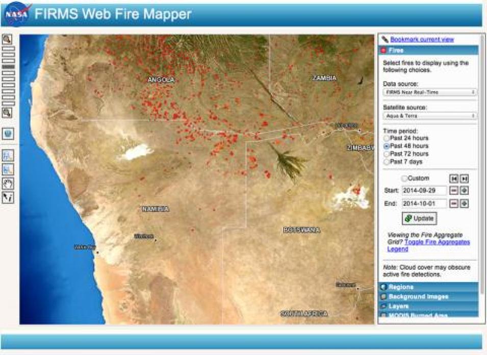
- Interactively browse daily global MODIS fire locations and monthly burned areas through Web Fire Mapper
- View and download global 10-day fire maps and monthly composite animations by year
While wildland fires will continue to be an integral component of wildland development and evolution, the near real-time MODIS data provided through LANCE coupled with FIRMS products makes it easier to manage these global events and give those living in fire-prone areas around the world more control over the chaos these events can bring. For Davies, this is the proof that FIRMS is a valuable addition to the global wildland fire management toolbox.
“We couldn’t do what we’ve done if we didn’t have such good data. The demand for the data was there – people need fire information and they need it in real time,” she says.
References
Conservation International. 2014. “Firecast: About.” Conservation International website.
Davies, D., et al. 2009. “Fire Information for Resource Management System: Archiving and distributing MODIS Active Fire Data.” In IEEE Transactions on Geoscience and Remote Sensing 47(1): 72-79. doi:10.1109/TGRS.2008.2002076
Gabbert, B. 2011. “At what temperature does a forest fire burn?” Wildfire Today.
NASA. Near Real-Time Imagery and Data. Brochure. Washington: National Aeronautics and Space Administration.
Tabor, K. 2014. “Conservation Tools: Satellites Sound Fire Alarm in Tropical Forests.” Conservation International blog, August 26, 2014.
Vizcarra, N. 2012. “Orbiting watchtowers.” In Sensing Our Planet, pp. 48-51. Washington: National Aeronautics and Space Administration.
Helpful Websites
EOSDIS User Registration Service (URS)
FIRMS Near Real-Time Webpage
LANCE Near Real-Time Webpage
NASA Common Metadata Repository
NASA Worldview
We acknowledge the use of FIRMS data and imagery from the Land, Atmosphere Near real-time Capability for Earth observation (LANCE) system operated by the NASA/GSFC/Earth Science Data and Information System (ESDIS).


