ESDS at the EGU 2020: Sharing Geoscience Online Meeting

The Earth Science Data Systems (ESDS) Program presents virtually at the EGU Meeting in 2020 and participates in the ESIP data help desk showcasing tutorials.

NASA’s Earth Science Data Systems (ESDS) Program is looking forward to virtual participation in the 2020 European Geosciences Union: Sharing Geosciences Online meeting, being held May 4–8, 2020.

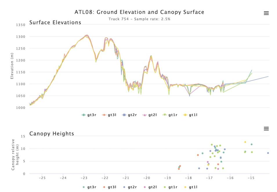
Plot of Ice, Cloud, and Land Elevation Satellite (ICESat-2) surface elevations and canopy heights through the NASA ACCESS OpenAltimetry tool.
Image Caption

Plot of Ice, Cloud, and Land Elevation Satellite-2 (ICESat-2) surface elevations and canopy heights through NASA's OpenAltimetry tool (a NASA ACCESS project).

Program contributions include:

Throughout the week, the Earth Science Information Partners (ESIP) will host a virtual data help desk to provide researchers with opportunities to engage with data experts familiar with their scientific domain and to learn about skills and techniques that will help further their research and make their data and software open and findable, accessible, interoperable, and reusable (FAIR).

There are two ways to participate in the EGU Data Help Desk:

  1. Ask all of your data-related questions via Twitter using the hashtag #DataHelpDesk.
  2. View the video tutorials, showcasing new resources for finding, accessing, and using NASA Earth science data.
    • Discover Earth Science Data Resources at NASA Earthdata This video takes viewers on a tour of new Earth Observing System Data and Information System (EOSDIS) Earth science data resources available at earthdata.nasa.gov to help users find, access, use and visualize NASA Earth science data. Whether you are just getting started, a novice data user, or an expert data user, we have a resource to help get you to your data destination. Come explore Earthdata!
    • Getting Started with NASA Worldview This video will introduce you to NASA's EOSDIS Worldview imagery mapping and visualization application. This tool provides the capability to interactively browse over 900 global, full-resolution satellite imagery layers. Many of these layers are updated daily and are available within three hours of observation.
    • NASA's Goddard Earth Sciences Data and Information Services Center (GES DISC)

Details

Last Updated

Published

Data Center/Project

Goddard Earth Sciences Data and Information Services Center (GES DISC)