Earth Day 2022: Explore Your World with NASA Worldview

This Earth Day we invite you to explore global, full-resolution NASA Earth science imagery to see volcanoes erupting, wildfires spreading, tropical cyclones forming, and city lights illuminating. With NASA Worldview, you can also take a snapshot, create an animated GIF, or compare imagery from two dates to view changes over time.

Hunga-Tonga Hunga Ha'apai Volcano

On January 15, 2022, the sub-marine Hunga Tonga-Hunga Ha’apai volcano in the South Pacific erupted with such force that it caused a tsunami that spread across the Pacific Ocean! This GeoColor data animation derived from the GOES-West satellite’s Advanced Baseline Imager (ABI) shows the explosive eruption and ash cloud of the Hunga Tonga-Hunga Ha'apai volcano on January 15, 2022 between 04:00 - 05:20 UTC/17:00 - 18:20 Tonga Time.
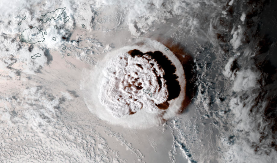
Hunga Tonga-Hunga Ha’apai volcano true color ABI image.
Image Caption

Viewing Tips

  • Click on the image above to visit Worldview, start the animation by pressing play in the lower left.
  • Pause the animation and click on the measure tool in the lower right corner, above the timeline (or right click on your mouse) and select “Measure distance”. Measure the width of the volcanic ash plume. You could also measure the area of the plume.

Direct Link to Volcanic Eruption Animation

Dixie Fire, California 2021

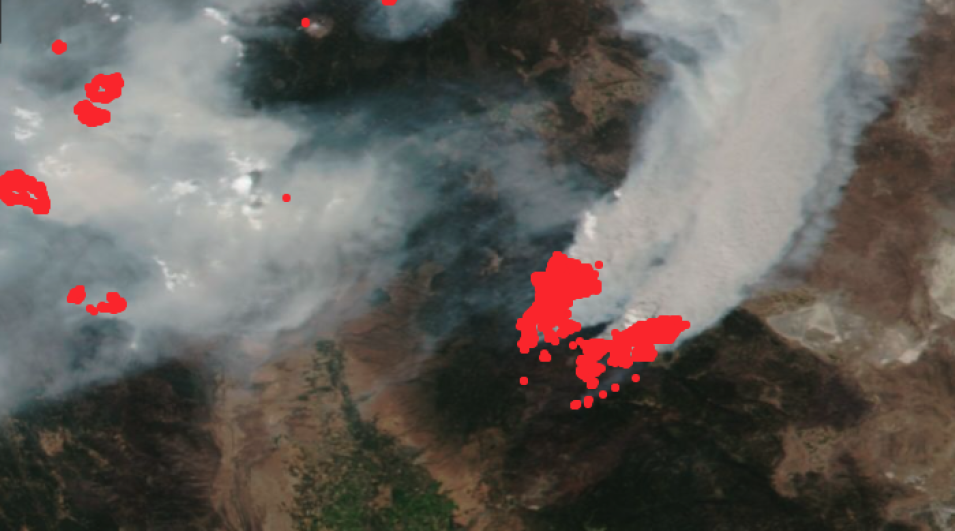
On July 13, 2021, the Dixie Fire ignited in the Feather River Canyon southeast of Chico, California. It was the largest single non-complex wildfire in California history, and the second-largest wildfire overall (after the August Complex fire of 2020). The fire burned 963,309 acres (389,837 hectares) before being contained on October 25, 2021. This true-color image from the Visible Infrared Imaging Radiometer Suite (VIIRS) instrument aboard the joint NASA/NOAA Suomi National Polar-orbiting Partnership (Suomi NPP) satellite shows the fire in red on August 5, 2021.

Fire and thermal anomaly layers in Worldview from VIIRS.
Image Caption

Viewing Tips

  • Click on the image to go to Worldview. Click red fire pixels to reveal fire attribute information such as fire radiative power, latitude and longitude, acquisition date and time, daytime or nighttime flags, brightness temperatures, and detection confidence.
  • To view the burn scar after the fire was 100% contained, see this Suomi NPP VIIRS Corrected Reflectance (Bands M11-I2-I1) false-color image from November 12, 2021.
  • View comparison imagery showing the Dixie Fire burning on August 5th, just three weeks after ignition, and the burn scar on November 12.

Direct Link to the Dixie Fire on August 5, 2021

Typhoon In-Fa Over Eastern China

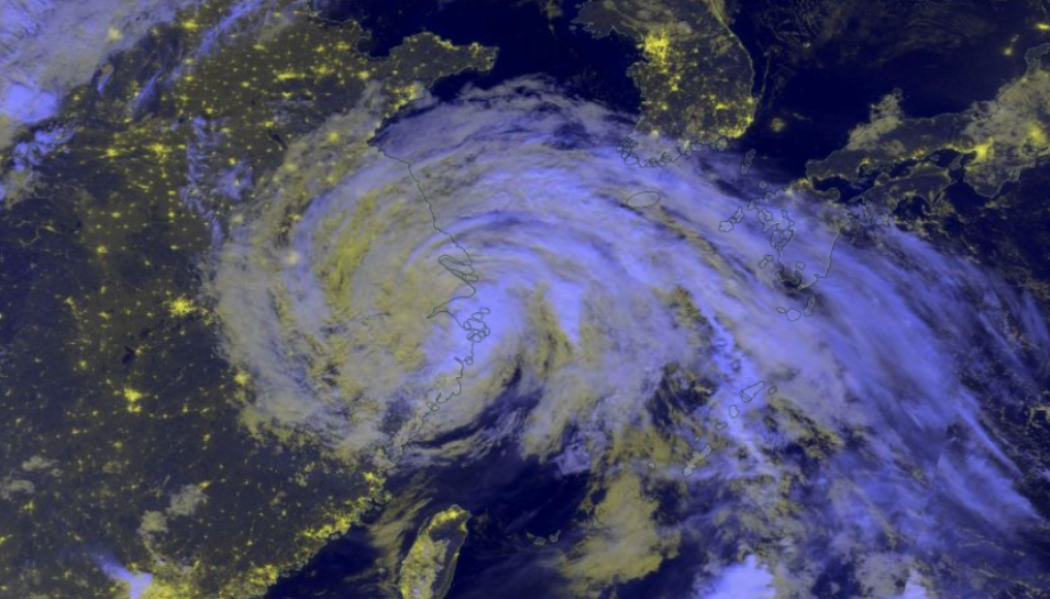
Typhoon In-Fa made landfall in eastern China on July 25, 2021, following historic flooding from storms that caused widespread damage and killed over 50 people in central China in mid-July. The VIIRS instrument aboard the Suomi NPP satellite acquired this Black Marble Nighttime Blue/Yellow Composite (Day/Night Band) image of Typhoon In-Fa over eastern China on July 25, 2021.

Black Marble nighttime blue/yellow composite image using VIIRS data
Image Caption

Viewing Tips

  • Click on the image to open this map in Worldview.
  • Turn off and on the Blue/Yellow Composite layer by clicking on the “eye” icon in the layer panel.
  • Compare the nighttime lights view to the true color view by turning on the Suomi-NPP VIIRS Corrected Reflectance imagery layer in the layer panel.
  • Show the development of the storm by clicking on the dates in the lower left corner of the screen. Consider changing the date to July 21 and advance the dates through July 25, 2021 to view the location and development Typhoon In-Fa.

Direct Link to Typhoon In-Fa on July 25, 2021

Cape Coral, Florida

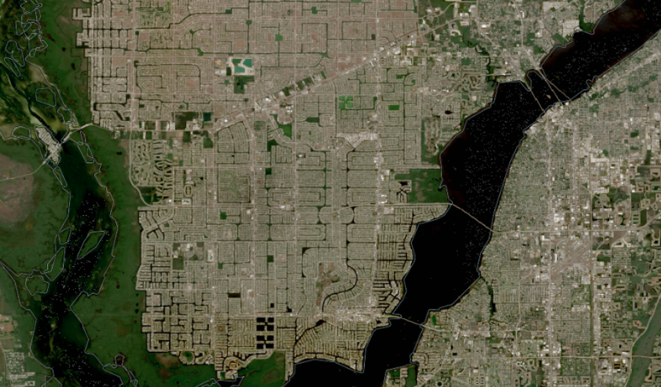
This Harmonized Landsat and Sentinel-2 (HLS-2) image, acquired by the European Union's Copernicus Sentinel-2A and -2B Multi-Spectral Instrument (MSI) on February 2, 2022, shows the city of Cape Coral, located in southwest Florida. The dark or black lines that you can see in this image are part of a more than 400-mile-long system of manmade canals.

Harmonized Landsat and Sentinel-2 (HLS-2) image of canals via land surface reflectance.
Image Caption

Viewing Tips

  • Zoom in to see the canals (indicated in the maze-like series of black lines by clicking the + sign on the right side of the interface.
  • Click on the icon in the upper right corner to open this map in Worldview
  • Turn on the place labels by clicking on the "eye" icon in the layer list to the left.

Direct Link to Cape Coral, FL on February 2, 2022

Sea Surface Temperature: North and South America

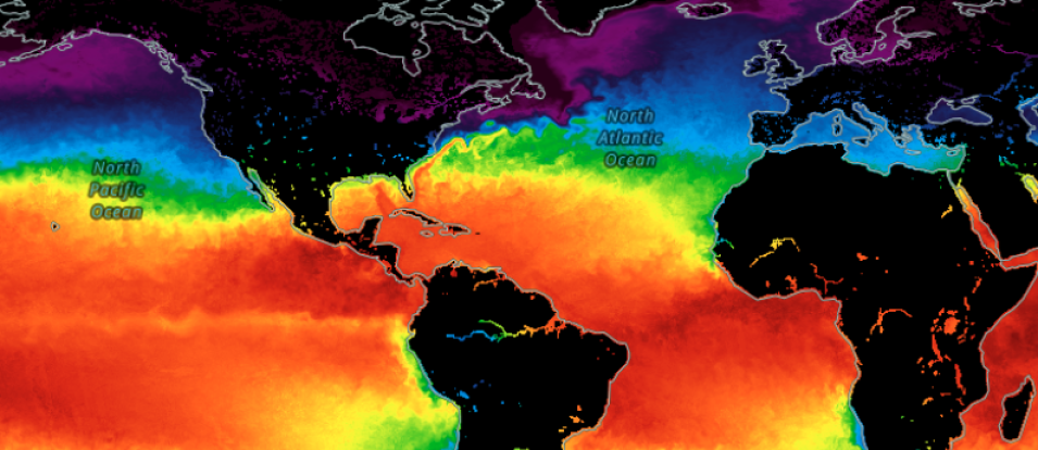
Sea surface temperatures, which are normally warmer near the equator and cooler in the Arctic and Antarctic regions, can impact weather, alter marine ecosystems, and contribute to global climate change. This Group for High-Resolution Sea Surface Temperature image shows sea surface temperature at a depth of approximately 10-20 micrometers.

Sea surface temperature near North and South America, multi-mission data.
Image Caption

Viewing Tips

  • Click on the image to open this map in Worldview
  • Change the temperature from Celsius (C) to Fahrenheit (F) by clicking on the “i” icon in the upper right corner.
  • Select “Settings” and change the Global Temperature from Celsius to Fahrenheit by selecting this button. It will turn orange once activated.

Learning Resources

Whether you are a scientist, an educator, a student, or just interested in learning more about how to use all the openly available data in NASA’s Earth Observing System Data and Information System (EOSDIS) collection, we have the resources to help! NASA's Earthdata Learn page will help you find what you need to get started with NASA Earth science data, services, and tools.

Getting Started with NASA Worldview Tutorial (December 2021)

In this tutorial, learn how to use NASA's EOSDIS Worldview imagery mapping and visualization application. We'll show you how to explore and visualize over 1,000 NASA Earth science satellite imagery layers, many of which are available within hours, even minutes, and spanning back 20 years. Worldview has been used for time-critical applications such as wildfire monitoring and management, supporting science through easy-to-access satellite imagery archives, illustrating disasters and natural events in the media, and for education and outreach. We show you how to create and export an image snapshot, animate imagery to see change over time, compare imagery from different dates, or different types of imagery from the same date, explore vector data layers like Fires and Thermal Anomalies, and much more!

Details

Last Updated

Published