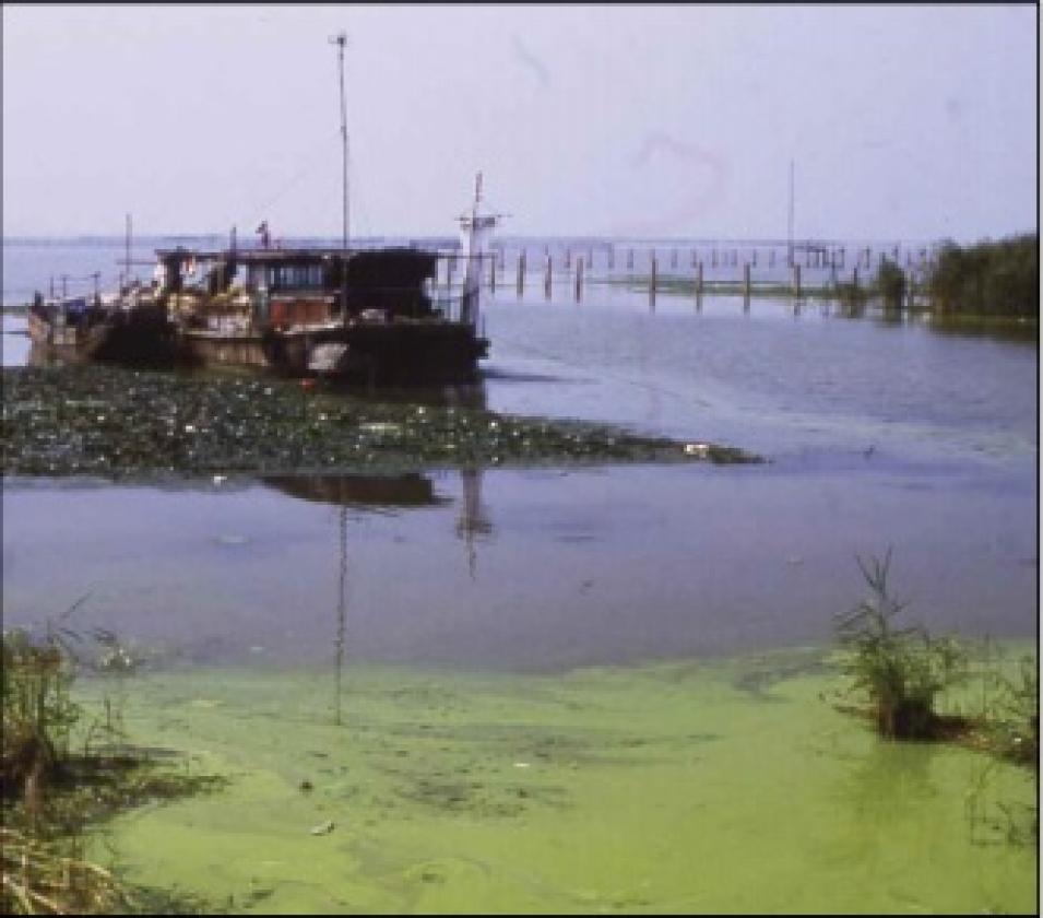
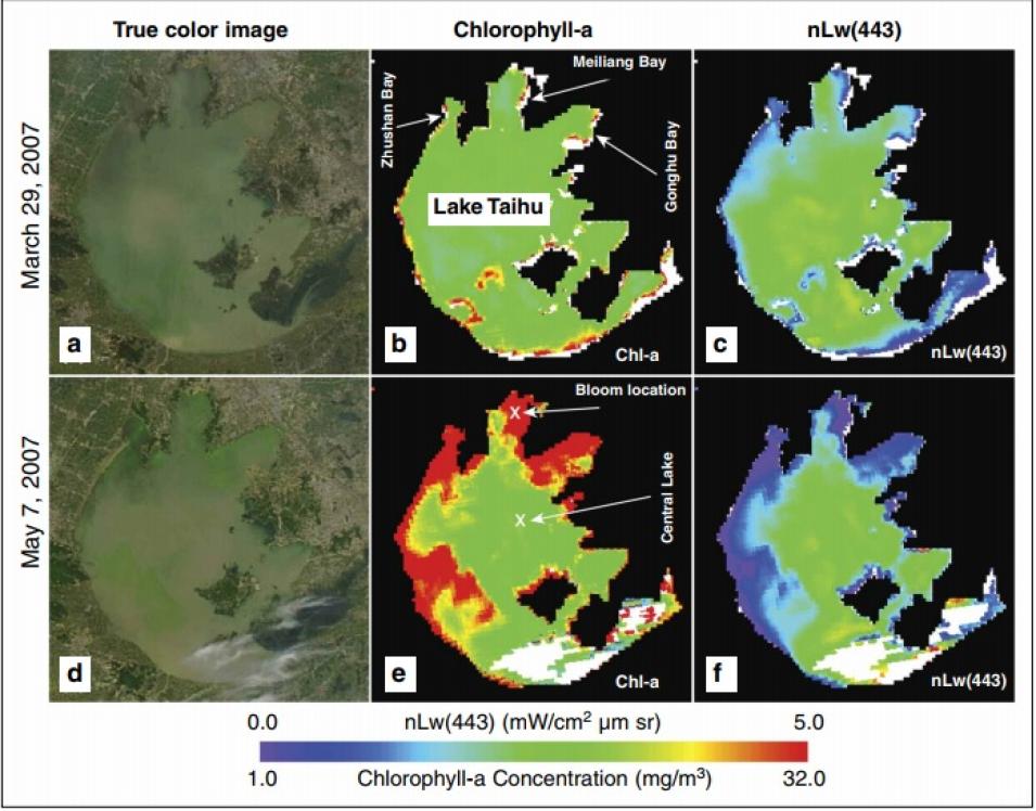
The new algorithm worked. Wang said, “We looked at the MODIS data and sure enough, we could pick up the signal of where the bloom was happening.” Applying the SWIR method, Wang studied Meiliang Bay, one of the main water sources for Wuxi, a city on the Lake Taihu shore. A series of MODIS images on cloud-free days captured the algal bloom as it started the first week of April, peaked around May 7, and then tapered off in early June.
Wang sees a key role for near-real-time space observations of lake water in the Taihu area and in other regions trying to manage increasingly pressured water resources. Wang said, “An image series like this will be very useful for local officials in the management of water quality. We will know what’s happening, and when it’s happening, and can give timely information to local governments for water quality.”
Satellites for drinking water?
After the bloom, cleanup crews removed 6,000 tons of blue algae and 1 million cubic meters (1.3 million cubic yards) of silt from the lake, and after some weeks, restored its potability for local residents. The cleanup resolved only the latest crisis. Agriculture, city sewage, and manufacturing in the area continue to increase, overloading the lake with nutrients. Local officials must work to lower emissions and better treat sewage, while also finding substitutes for nitrogen and phosphorus-rich fertilizers, pesticides, and detergents. Continuous observations from space could help gauge the success of such measures, and in the shorter term enable officials to warn residents well before an algal bloom fouls their drinking water.
While the quarter-kilometer (0.2-mile) view of MODIS may be too coarse to capture data on smaller lakes in his region, Greb thinks that work like Wang’s underscores the possibilities for future sensors. Greb said, “Many of us in the water quality community want a sensor on the next generation of Earth observing satellites that is tuned for measuring inland and coastal water quality.” Banding with like-minded researchers as members of the international Group on Earth Observations (GEO), Wang and Greb helped craft a series of recommendations to this end.
Wang continues his work with existing satellite data, refining and testing the SWIR algorithm. He is inspired by the possibility of making a difference to people who depend on freshwater lakes like Taihu. He said, “I would like to see if someone can use this method for monitoring, or apply it to other regions. We need to learn if this is a useful tool to do not only science, but also to have an effect on people’s daily lives.”
References
Wang, M. 2007. Remote sensing of the ocean contributions from ultraviolet to near-infrared using the shortwave infrared bands: simulations. Applied Optics 46(9): 1535-1547.
Wang, M., J. Tang, and W. Shi. 2007. MODIS-derived ocean color products along the China east coastal region. Geophysical Research Letters 34, L06611, doi:10.1029/2006GL028599.
Wang, M., and W. Shi. 2008. Satellite-observed algae blooms in China’s Lake Taihu. Eos, Transactions, American Geophysical Union 89: 22, 201-202.
For more information
NASA Level-1 and Atmosphere Archive Distribution System Distributed Active Archive Center (LAADS DAAC)
Center for Satellite Applications and Research
Group on Earth Observations
Wisconsin Department of Natural Resources
| About the remote sensing data |
| Satellite |
Aqua |
| Sensor |
Moderate Resolution Imaging Spectroradiometer (MODIS) |
| Data sets |
MYD02QKM-Level 1B Calibrated Radiances-250 km
MYD02HKM-Level 1B Calibrated Radiances-500 km |
| Resolution |
0.25 kilometer and 0.5 kilometer |
| Parameter |
Radiances |
| DAAC |
NASA Level-1 and Atmosphere Archive Distribution System Distributed Active Archive Center (LAADS DAAC) |


