Discover the Help Hub for Ocean Color Learning Resources

The Help Hub hosted by NASA's Ocean Biology Distributed Active Archive Center (OB.DAAC) has been updated with new learning resources for processing ocean color satellite data, working with Plankton, Aerosol, Cloud, ocean Ecosystem (PACE) data, and more.
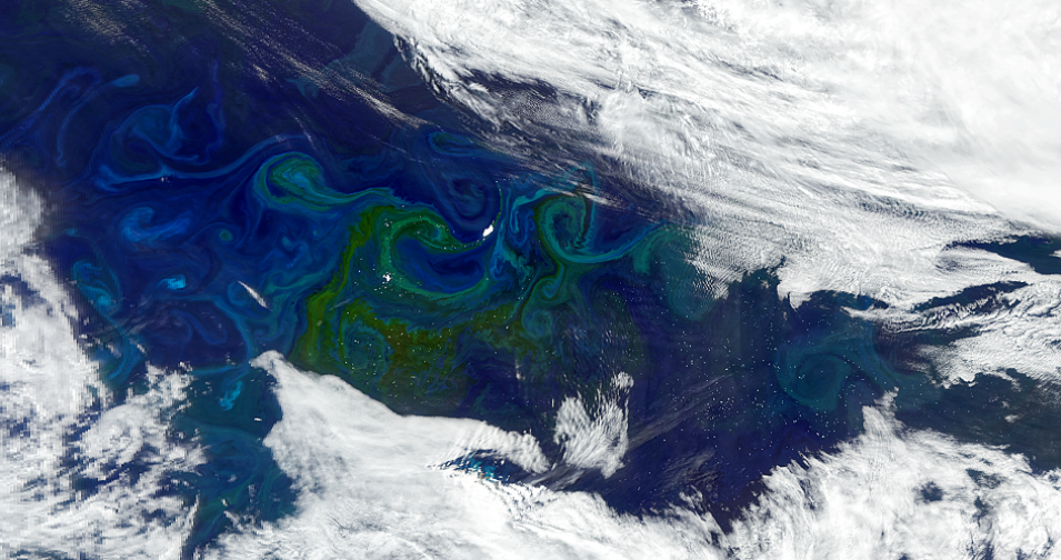
Icebergs circulate in the South Atlantic Ocean currents near the island of South Georgia. Around them, phytoplankton is blooming, creating large green-tinted swirls in this NASA Plankton, Aerosol, Cloud, ocean Ecosystem (PACE) Ocean Color Instrument (OCI) acquired on January 5, 2025.
Image Caption

This image of icebergs circulating in the currents of the Southern portion of the Atlantic Ocean near the South Georgia Islands was acquired by the Ocean Color Instrument (OCI) aboard the PACE satellite on January 5, 2025. It features a large iceberg drifter named A-76B that used to be a part of Iceberg A-76, which was once the largest floating iceberg in the world. A-76B now covers an area of 216 square kilometers, approximately the size of Baltimore, Maryland. The large green-tinted swirls around the icebergs are made of blooming phytoplankton. Iceberg melt plumes can contain fresh, nutrient-rich water that sometimes promote the growth of phytoplankton. Credit: PACE

Are you looking for data learning resources to work with NASA's ocean color datasets, services, and tools? The new Help Hub, released by NASA's Ocean Biology Distributed Active Archive Center (OB.DAAC), provides access to many helpful ocean color resources including:
 
  • Tutorials and webinars that teach users how to access and process ocean color data in a Python Jupyter Notebook environment
  • NASA’s Applied Remote Sensing Training (ARSET) Program's “Introduction to Plankton, Aerosol, Cloud, Ocean Ecosystem (PACE) Hyperspectral Observations for Water Quality” training webinars and tutorials
  • OB.DAAC’s official analysis and visualization of remote sensing data software, and much more
 
OB.DAAC is the discipline-specific data center responsible for managing, archiving, and distributing satellite ocean biology data produced or collected under NASA's Earth Observing System Data and Information System (EOSDIS) as part of NASA's Earth Science Data System (ESDS) Program. OB.DAAC’s holdings include data from a mixture of historical and current missions, as well as data from both NASA and partner space organizations.
 
Do you have an idea for a new resource or tutorial? Share it with us on the Earthdata Forum using the tags OB.DAAC under DAAC and Data Recipes under Services/Usage.
Details

Last Updated

Published

Data Center/Project

Ocean Biology DAAC (OB.DAAC)