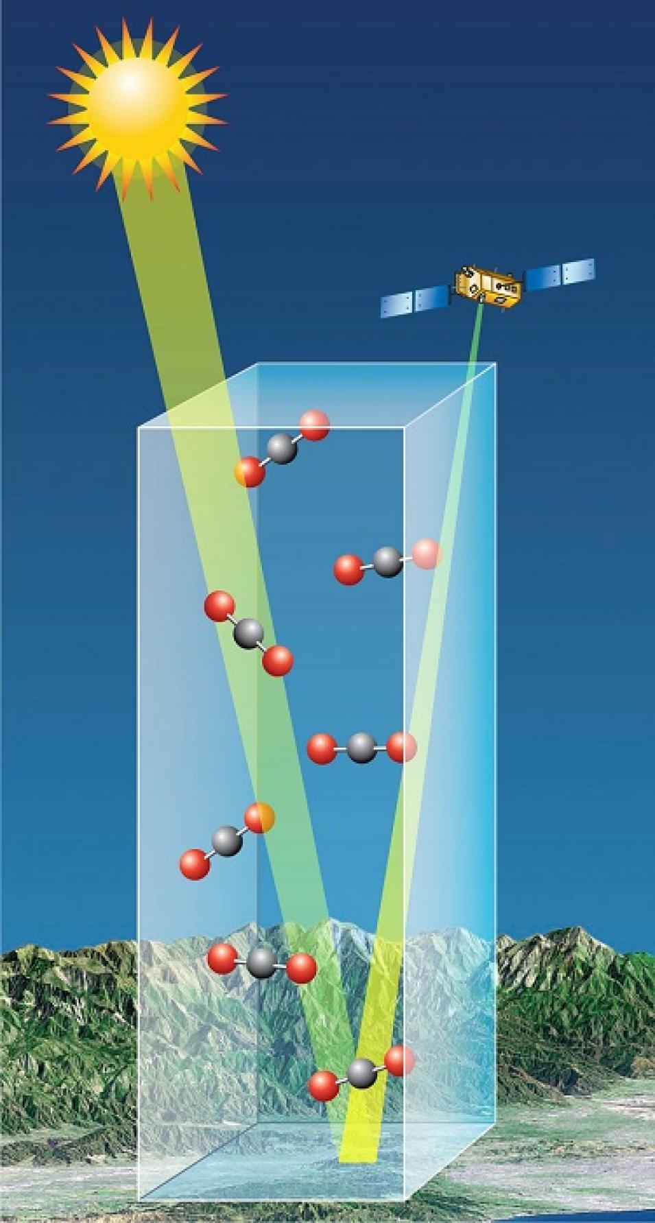
OCO-2 measures CO2 indirectly by measuring the intensity of sunlight reflected by molecules of CO2 in a column of air. Atmospheric CO2 absorbs light energy at specific wavelengths, and the OCO-2 instrument uses a diffraction grating (like the back of a compact disk) to separate incoming sunlight into a spectrum of multiple component colors. OCO-2 CO2 measurements are based on the number of molecules of CO2 per cubic meter. When CO2 is measured, the quantity that is being determined is the “mole fraction” of CO2 in a column of air (see illustration at right). This is the number of CO2 molecules in a column of air after removal of water vapor, and is designated XCO2.
While this measurement strategy works fine in clear air, OCO-2 measurements can be biased by clouds within and outside the instrument’s field of view. The shapes, altitudes, and even colors of clouds constantly change. This, in turn, continually changes the amount of cloud-reflected light that is received by the OCO-2 instrument. As a result, methods for screening out cloud-influenced measurements are a focus of OCO-2 algorithm developers.
In a recent research project, Massie was part of a team that used OCO-2 data along with data from NASA’s Moderate Resolution Imaging Spectroradiometer (MODIS) instrument to examine biases caused by clouds in the retrieval of OCO-2 data. Observing that the OCO-2 objective is to measure CO2 to better than 1 percent accuracy on regional scales (defined on the OCO-2 website as 1,000 kilometers or greater), Massie and his colleagues analyzed OCO‐2 CO2 measurements and MODIS satellite radiance and cloud fields. The team found that as cloud fields become less uniform and more spatially heterogeneous, cloud-reflected light causes greater variations of OCO‐2 CO2 measurements at local scales, which the research team defines as 20 km×20 km. Based on the results of this research, Massie and his colleagues recommend that OCO-2 data algorithm development should incorporate techniques designed to deal with instances when cloud fields are not uniform and light is not reflected evenly to help deal with these potential biases in CO2 retrievals.
Thanks to research by Massie and his colleagues, our ability to retrieve and utilize accurate data about aerosols and clouds, along with our ability to better understand their impacts on Earth’s troposphere, continues to improve. This, in turn, is leading to better data to help develop more informed policies to deal with the effects of aerosols.
Representative data products used:
- OCO-2 data products available through NASA’s GES DISC:
- Calibrated Spectra:
- Retrievals of CO2:
- OCO-2 Level 2 bias-corrected XCO2 and other select fields from the full-physics retrieval aggregated as daily files, Retrospective processing V9r. doi:10.5067/W8QGIYNKS3JC
- MODIS data products available through NASA’s GES DISC:
- Geostationary Radiances from the Advanced Baseline Imager (ABI) aboard the joint NASA/NOAA Geostationary Operational Environmental Satellite-R Series (GOES-R) GOES-16 satellite; available through NOAA’s Comprehensive Large Array-Data Stewardship System (CLASS)
Read about the research:
Massie, S.T., Sebastian Schmidt, K., Eldering, A. & Crisp, D. (2017). Observational evidence of 3D cloud effects in OCO-2 CO2 retrievals. Journal of Geophysical Research: Atmospheres, 122(13): 7064-7085. doi:10.1002/2016JD026111
Massie, S.T., Gille, J, Craig, C., Khosravi, R., Barnett, J., Read, W. & Winker, D. (2010). HIRDLS and CALIPSO observation of tropical cirrus. Journal of Geophysical Research, 115. doi:10.1029/2009JD012100
Massie, S.T., Torres, O. & Smith, S.J. (2004). Total Ozone Mapping Spectrometer (TOMS) observations of increases in Asian aerosol in winter from 1979 to 2000. Journal of Geophysical Research, 109(D18). doi:10.1029/2004JD004620
Explore more Data User Profiles


