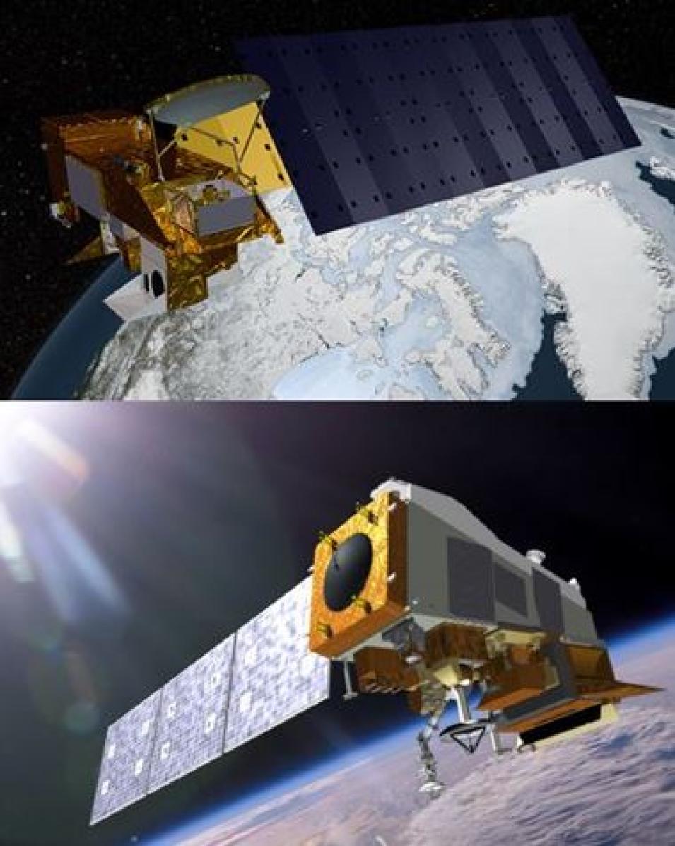
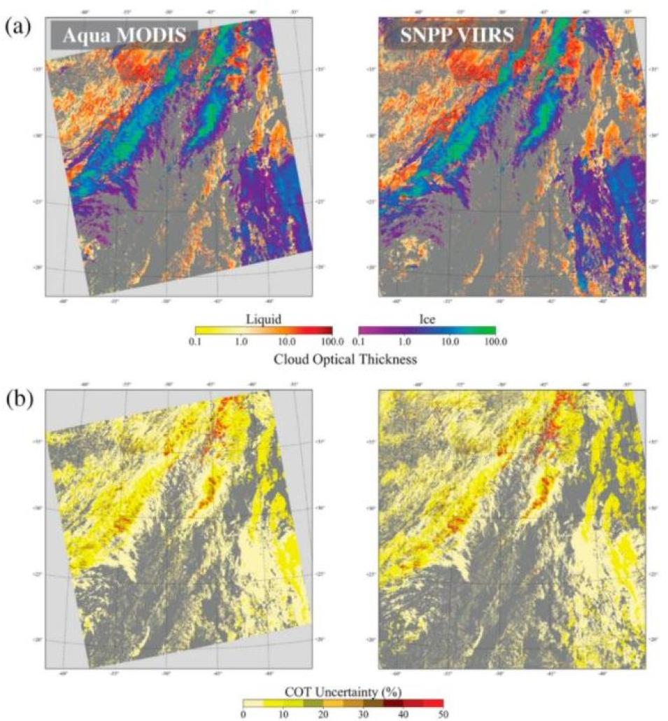
A comparison of the observations between the MODIS and VIIRS products, as well as the Aqua MODIS standard cloud product, revealed that the continuity cloud products did support a continuous record between MODIS and Suomi NPP VIIRS. The researchers acknowledged, however, that there were biases in the cloud optical depth retrievals, likely resulting from differences in the spatial sampling of the instruments (with VIIRS having a significantly higher spatial resolution compared to MODIS). Nevertheless, Holz and his colleagues note that the results of this evaluation will inform future updates to the CLDPROP products and help scientific users determine the appropriate use of the product datasets for their specific needs.
These findings regarding CLDPROP followed those of a 2020 paper, also published in Remote Sensing, wherein Holz, lead author Richard Frey of the SSEC, and others evaluate the Continuity MODIS-VIIRS Cloud Mask (MVCM), a cloud detection algorithm that, in the authors’ words, “makes use of fourteen spectral bands that are common to both MODIS and VIIRS so as to create consistent cloud detection between the two instruments and across the years 2000–2020 and beyond.”
Through the comparison of collocated observations from MODIS (Aqua) and the Cloud-Aerosol Lidar with Orthogonal Polarization, an instrument aboard the joint NASA-Centre National d'Etudes Spatiales (the French space agency) Cloud-Aerosol Lidar and Infrared Pathfinder Satellite Observation (CALIPSO) satellite, this study evaluated the statistical consistency benchmarks between the MODIS Aqua and MVCM cloud masks. The results of this experiment showed that the MVCM produced consistent cloud detection results between Aqua MODIS, Suomi NPP VIIRS, and NOAA-20 VIIRS and that the quality is comparable to the standard Aqua MODIS cloud mask.
In addition to investigating product continuity between MODIS and VIIRS, Holz has also researched ways to improve instrument observations of important cloud parameters like ice cloud optical thickness (IOT), an important radiative cloud property that determines the impact of upper tropospheric clouds on Earth’s radiation balance.
“IOT has proven to be one of the more challenging properties to retrieve from space-based remote sensing measurements,” Holz writes in a 2016 paper published in Atmospheric Chemistry and Physics. “In particular, optically thin upper tropospheric ice clouds (cirrus) have been especially challenging due to their tenuous nature, extensive spatial scales, and complex particle shapes and light-scattering characteristics.”
To address the challenges of IOT retrieval, Holz and his colleagues investigated potential biases in MODIS Collection 5 (C5) and CALIOP Version 3 (V3) IOT measurements by comparing them to collocated observations from instruments aboard satellites in the A-Train, a formation of satellites including the Orbiting Carbon Observatory-2, the Japanese Aerospace Exploration Agency’s Global Change Observation Mission-Water-1, Aqua, CALIPSO, CloudSat, and Aura. (Each of these satellites circle Earth in a polar-orbit and cross the equator each day at around 1:30 p.m., Mean Local Time, hence the name “Afternoon Constellation,” or in short, the “A-Train.”)
The dataset comparisons affirmed a bias in the both the MODIS and CALIOP IOT retrievals, which Holz and his colleagues investigated further by comparing both of the products with MODIS infrared cirrus IOT retrievals. Their analysis found that both the MODIS C5 and the CALIOP V3 retrievals were biased (high and low, respectively) relative to those from the MODIS infrared. It also revealed that the MODIS C5 retrievals could be brought into agreement with the infrared by adopting a new ice scattering model with modified gamma distribution. For CALIOP, a modified lidar ratio greatly improved the agreement with the infrared and provide consistency between the MODIS and CALIOP products. These results have led to improvements in later instances of the MODIS (Collection 6) and CALIOP (Version 4) products.
As these results suggest, Holz’s efforts to enhance algorithms and data products and ensure the continuity of aerosol and cloud products during the transition from MODIS to VIIRS exemplifies the SSEC’s commitment to improving our understanding of weather, climate, and atmospheric processes. NASA's EOSDIS shares this goal, and by archiving and distributing the data that researchers like Holz use in their work, it can help them and others in the global atmospheric research community realize it.
Representative Data Products Used or Created:
Available through LAADS DAAC:
Other data products used:
Read about the Research:
Platnick, S., Meyer, K., Wind, G., Holz, R.E., Amarasinghe, N., Hubanks, P.A., Marchant, B., Dutcher, S., & Veglio, P. (2021). The NASA MODIS-VIIRS Continuity Cloud Optical Properties Products. Remote Sensing, 13(1): 2. doi:10.3390/rs13010002
Frey, R.A., Ackerman, S.A., Holz, R.E., Dutcher, S., & Griffith, Z. (2020). The Continuity MODIS-VIIRS Cloud Mask. Remote Sensing, 12(20): 3334. doi:10.3390/rs12203334
Holz, R.E., Platnick, S., Meyer, K., Vaughan, M., Heidinger, A., Yang, P., Wind, G., Dutcher, S., Ackerman, S., Amarasinghe, N., Nagle, F., & Wang, C. (2016). Resolving ice cloud optical thickness biases between CALIOP and MODIS using infrared retrievals. Atmospheric Chemistry and Physics, 16(8): 5075–5090. doi:10.5194/acp-16-5075-2016
Explore more Data User Profiles


