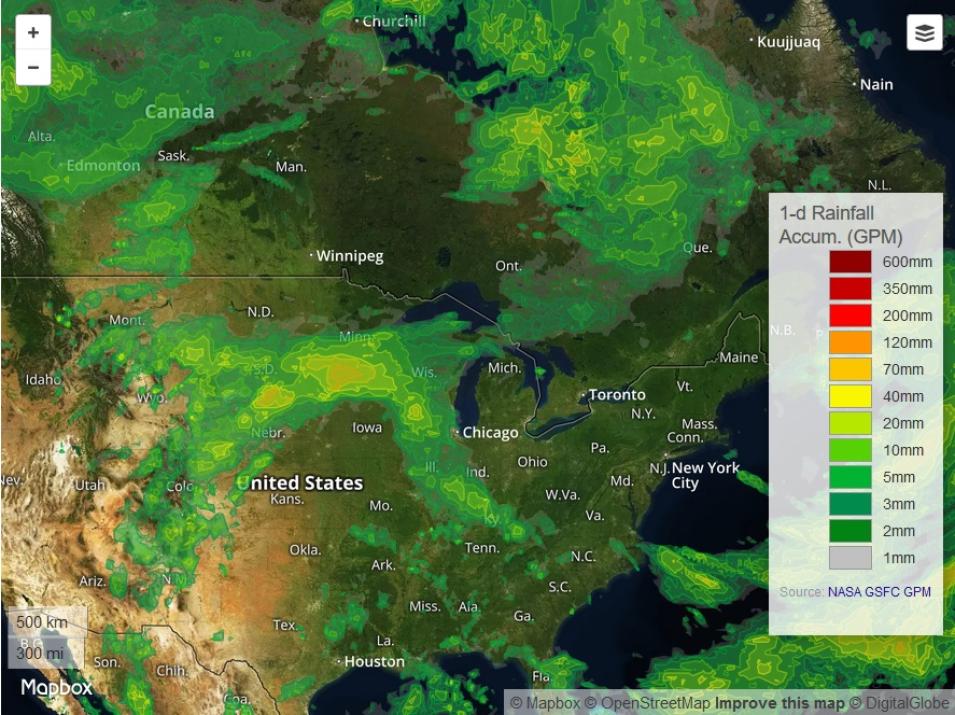
Kirstetter also is a co-developer of the Flooded Locations And Simulated Hydrographs (FLASH) Project. Coordinated through the NSSL, the primary goal of FLASH is to improve the accuracy, timing, and specificity of flash flood warnings in the U.S. FLASH was launched in 2012 largely in response to the successful demonstration and real-time availability of high-resolution, accurate MRMS rainfall observations. The FLASH Project uses MRMS rainfall data as input into a hydrologic model to produce flash-flooding forecasts up to six hours in advance of an event with a five-minute update cycle.
The work and research of Kirstetter, facilitated by data from NASA precipitation missions like GPM, is contributing to the development of more effective ways of forecasting floods and other high-precipitation events. The collaboration between NASA and NOAA on this work is not only helping to save lives and property, but providing a better understanding of one of the planet’s leading weather-related hazards.
Representative data products co-developed or used:
- Datasets co-developed by Kirstetter and available at NASA’s GHRC DAAC:
- Kirstetter, P.E., Petersen, W.A. & Gourley, J.J. (2018). “GPM Ground Validation Multi-Radar/Multi-Sensor (MRMS) Precipitation Reanalysis for Satellite Validation Product.” doi:10.5067/GPMGV/MRMS/DATA101
- Kirstetter, P.E., Gourley, J.J., Zhang, J. & Petersen, W.A. (2018). “GPM Ground Validation National Mosaic and Multi-Sensor QPE (NMQ) System IFloodS.” doi:10.5067/GPMGV/IFLOODS/NMQ/DATA101
- Kirstetter, P.E., Gourley, J.J., Zhang, J. & Petersen, W.A. (2018). “GPM Ground Validation National Mosaic and Multi-Sensor QPE (NMQ) System IPHEx.” doi:10.5067/GPMGV/IPHEX/NMQ/DATA101
- Gourley, J.J., Kirstetter, P.E., Jorgensen, D. & Cifelli, R. (2018). “GPM Ground Validation NOAA X-band Polarimetric Radar (NOXP) IPHEx.” doi:10.5067/GPMGV/IPHEX/NOXP/DATA101
- Various GPM precipitation products; available through NASA’s Goddard Earth Sciences Data and Information Services Center (GES DISC) and NASA’s Precipitation Measurement Missions (PMM) website (GPM-GV data collections are available through NASA’s GHRC DAAC)
- Various products from the joint NASA/NOAA GOES16 satellite; available through NOAA’s National Centers for Environmental Information (NCEI)
Read about the work and research:
Gebregiorgis, A., Kirstetter, P.E., Hong, Y., Gourley, J.J., Huffman, G., Petersen, W., Xue, X. & Schwaller, M. (2018). To what extent is the Day-1 IMERG satellite rainfall estimate improved as compared to TRMM TMPA-RT? Journal of Geophysical Research, 123(3): 1694-1707. doi:10.1002/2017JD027606
Carr, N., Kirstetter, P.E., Gourley, J.J. & Hong, Y. (2017). Polarimetric Signatures of Mid-Latitude Warm-Rain Precipitation Events. Journal of Applied Meteorology and Climatology, 56(3): 697-711. doi:10.1175/JAMC-D-16-0164.1
Saharia, M., Kirstetter, P.E., Vergara, H., Gourley, J.J. & Hong, Y. (2017). Mapping Flash Flood Severity in the United States. Journal of Hydrometeorology, 18(2): 397-411. doi:10.1175/JHM-D-16-0082.1
Smalley, M., Kirstetter, P.E. & L’Ecuyer, T. (2017). How frequent is precipitation over the contiguous United States? Perspectives from ground-based and space-borne radars. Journal of Hydrometeorology, 18(6): 1657-1672. doi:10.1175/JHM-D-16-0242.1
Kirstetter, P.E., Gourley, J.J., Hong, Y., Zhang, J., Moazamigoodarzi, S., Langston, C. & Arthur, A. (2015). Probabilistic Precipitation Rate Estimates with Ground-based Radar Networks. Water Resources Research, 51(3): 1422-1442. doi:10.1002/2014WR015672
Špitalar, M., Lutoff, C., Gourley, J.J., Kirstetter, P.E., Brilly, M. & Carr, N. (2014). Analysis of flash flood parameters and human impacts in the U.S. from 2006 to 2012. Journal of Hydrology, 519(A): 863-870. doi:10.1016/j.jhydrol.2014.07.004
For more information
Explore more Data User Profiles

