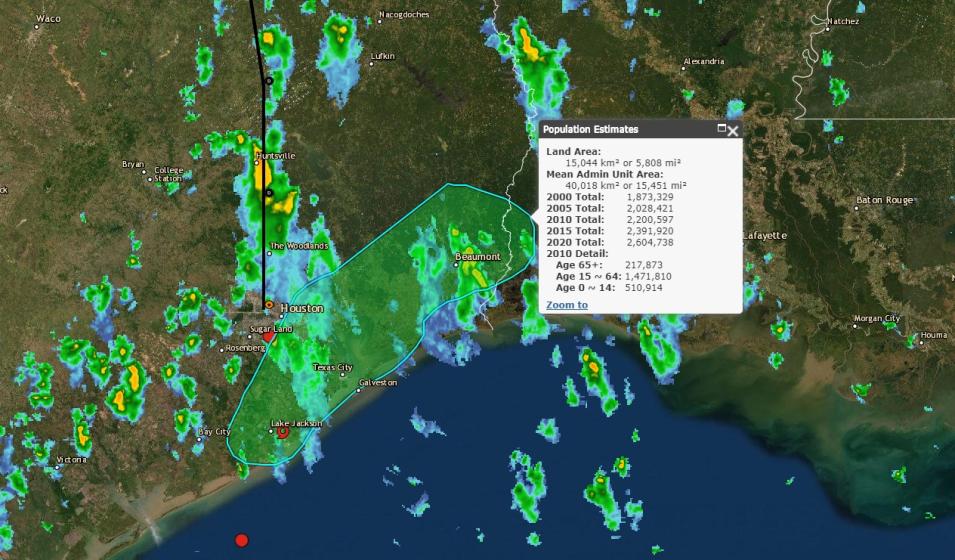
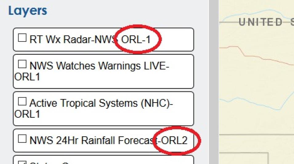
ORLs range from 1 to 4. ORL 1 is the highest trust designation, and indicates data are available now for immediate situational awareness and decision making, among other criteria. ORL 4 is currently the lowest designation and indicates data that are “not likely to be immediately useful for operations, but are emerging datasets that should be ‘on the radar’.” ORLs also facilitate awareness of evolving research datasets moving toward operational use.
While NASA standard data products facilitate in-depth scientific research, NASA near real-time products and socioeconomic data are critical resources for tracking ongoing events and the number of residents that might be affected by these events. For Dave Jones, these data are integral components in his work developing new ways to provide public and private emergency managers and decision-makers with the information they need—at the right time and the right place—to make quick decisions for protecting lives and property using the best data available.
Representative Data Products Used
- Data from NASA’s SEDAC:
- Various MODIS land data products from NASA’s Terra and Aqua Earth observing satellites; available through NASA’s Land Processes Distributed Active Archive Center (LP DAAC)
- MODIS and Visible Infrared Imaging Radiometer Suite (VIIRS) thermal anomaly data:
- Various Landsat products; available through USGS
Read About the Work
Jones, D. & Moe, K. (2018). Operational Readiness Levels: Establishing Trusted Data to Improve Situational Awareness. Presentation at the ESIP Federation Summer Meeting, Tuesday, July 17, 2018.
Robinson, E. (2014). Member Highlight: StormCenter Communications, Inc. ESIP Federation, Partner Highlights, October 22, 2014.
Coleman, D., editor. (2013). Cloud-Based Data Sharing Connects Emergency Managers. NASA Spinoff, NASA Technology Transfer Program, pp. 76-77.
Schwerin, B., editor. (2012). Collaborative Platforms Aid Emergency Decision Making. NASA Spinoff, NASA Technology Transfer Program, pp. 76-77.
Explore more Data User Profiles

