Users of NASA's Fire Information for Resource Management System (FIRMS) routinely leverage active fire detection data derived from the Moderate Resolution Imaging Spectroradiometer (MODIS) and the Visible Infrared Imaging Radiometer Suite (VIIRS). These sensors are aboard polar-orbiting satellites and provide a "snapshot" of fire activity at the time of satellite overpass for a given geographic area.
Polar-orbiting observations by each individual MODIS and VIIRS sensor are conducted once to twice daily in the equatorial region of the globe and as many as eight times daily in the very high latitudes. What if you want multiple observations and updates on detected fire activity every hour? Geostationary satellite instruments can meet that need.
Unlike polar-orbiting satellite instruments, geostationary satellite instruments stay at a fixed point above the equator and follow Earth's daily rotation on its axis. Their orbits are 45 to 50 times higher than MODIS, VIIRS, Landsat, and other polar-orbiting instruments that operate in an orbit about 700 to 800 km above Earth's surface. These characteristics allow geostationary satellite sensors to move with Earth's rotation and persistently observe a very large portion of Earth's surface centered on their location.
Several geostationary platforms and instruments are designed to support meteorological observations and have spectral bands that span the visible, near infrared, and thermal infrared. These capabilities also enable them to support the detection and monitoring of fire activity. Additionally, geostationary instruments provide outstanding temporal resolution acquiring imagery for their entire field of view at 10 to 15 minute intervals or better.
This enables geostationary instruments to potentially detect more fire events and capture their growth and change, particularly between fire detection observations conducted by sensors on polar-orbiting platforms. However, geostationary instruments have a much coarser spatial resolution than polar-orbiting instruments and can be less sensitive to detecting relatively smaller fires.
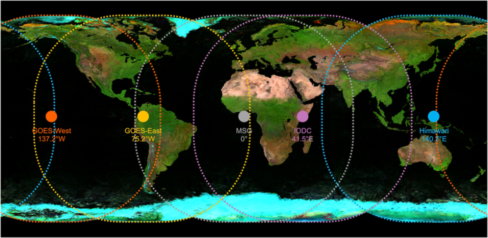
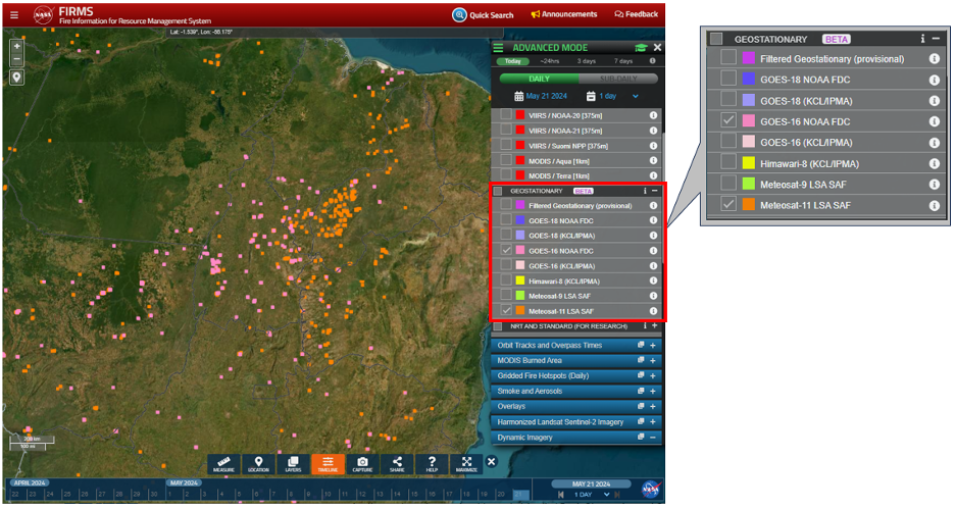
Active fire detection data from five geostationary instruments are available in FIRMS and collectively provide global coverage. Two geostationary satellites—GOES-16 and GOES-18—are operated by NOAA and provide coverage for the Western Hemisphere. The other three satellites—Himawari-8, Meteosat 9, and Meteosat 11—are operated by JAXA (Japan Aerospace Exploration Agency) and the European Organisation for the Exploitation of Meteorological Satellites (EUMETSAT), and provide coverage for the Eastern Hemisphere and a substantial portion of the Western Hemisphere. Overlapping coverage is also provided by adjacent instrument fields of view.
General information about the geostationary satellites used in FIRMS and their associated instruments, fire detection algorithms, and derivative product information are summarized below.

