We are in the process of migrating all NASA Earth science data sites into Earthdata from now until end of 2026. Not all NASA Earth science data and resources will appear here until then. Thank you for your patience as we make this transition.
Read about the Web Unification Project
Data User Stories
NASA's Earth observation data is used by researchers, decision makers, and communities around the globe—from farmers to climate scientists to experts in artificial intelligence. Meet some of our users by reading their stories.
Filters
5 MIN READ
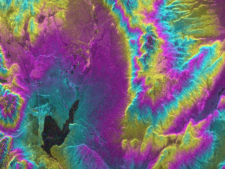
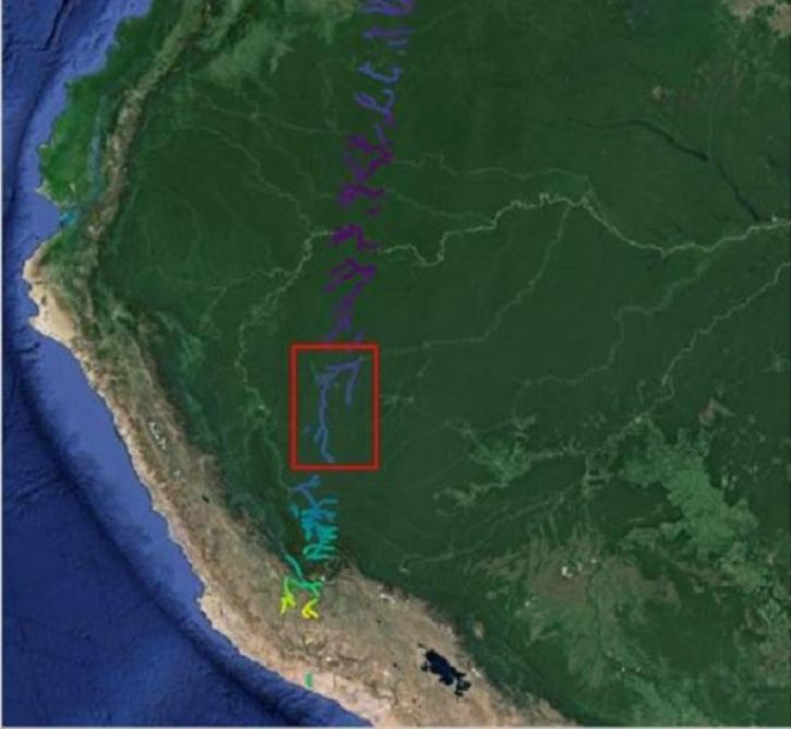
As an expert in interferometric synthetic aperture radar (InSAR), Dr. Bekaert is on the cutting edge of data science.
Nov. 7, 2024

11 MIN READ
Data from NASA’s Land, Atmosphere Near real-time Capability for Earth observations (LANCE) are critical to the Navy’s tropical cyclone forecasts.
July 1, 2024
12 MIN READ
The Surface Water and Ocean Topography (SWOT) mission provides critical data for understanding Earth's water cycle, including data about freshwater systems that have not been available from any previous hydrology-related missions.
May 15, 2024

12 MIN READ
NASA has long used imaging spectroscopy to peer into space. Now, scientists are using the technology to take a closer look at Earth.
Feb. 15, 2024

10 MIN READ
New instruments like the Ka-band Radar Interferometer present NASA Engineers with calibration and validation challenges.
Jan. 8, 2024

11 MIN READ
NASA Earth science data help scientists like Dr. James G. Allen develop processes for better satellite retrievals of ocean parameters.
Nov. 30, 2023

12 MIN READ
NASA Earth science data help Dr. Gonzalo González Abad produce retrievals of formaldehyde and other atmospheric trace gases.
Oct. 26, 2023

11 MIN READ
Salinity data from NASA’s Physical Oceanography Distributed Active Archive Center (PO.DAAC) help Dr. Frederick Bingham study ocean dynamics.
Sept. 28, 2023
SHOWING 8 OF 140