Creating a mosaic dataset using a comma-separated value (CSV) input file is a reliable method, especially for the older versions of ArcGIS Pro.
Step-by-Step Guide
- Select
sdt databasefrom Catalog pane - Create a new mosaic dataset
- Add raster using
Table - Copy CSV input file from S3 to local directory
- Open CSV file from directory
- Use Geoprocessing tool to create multi-dimensional information
- Use Variable as Variable
- If you don't choose other field, such as
long_name, the processing template will not work
- If you don't choose other field, such as
- Leave
DimensionblankStdZwill be picked up as height automatically
- Use Variable as Variable
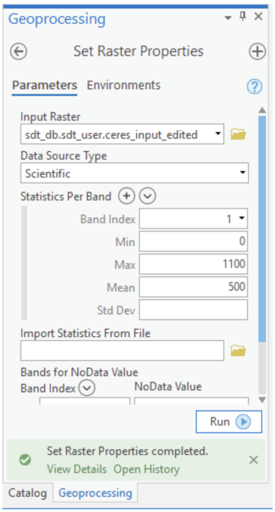
- Search "Set Raster Properties" tools from toolbox under
Analysis- Enter the input raster, min/max/mean, as follows:
