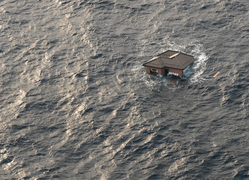
On March 11, 2011, a powerful earthquake shook Japan. Pressure had built along a deep ocean trench off the northeast coast, and then the fault ruptured. The quake began below the seafloor, 43 miles east of the Tohoku Region, jolting part of the seafloor upwards by 30 feet. The force of the temblor thrust Honshu—Japan’s biggest island—about 10 feet to the east.
Seismographs registered the quake’s magnitude at 9.1, the most powerful recorded in the country. In less than a minute after the quake began, early warning systems fed quake data into computer simulations. Computer models processed tide gauge and deep ocean gauge observations throughout the Pacific Ocean. These systems churned out forecasts of when destructive tidal waves, or tsunamis, might arrive at coastlines in Asia and the Americas, and how big they might be.
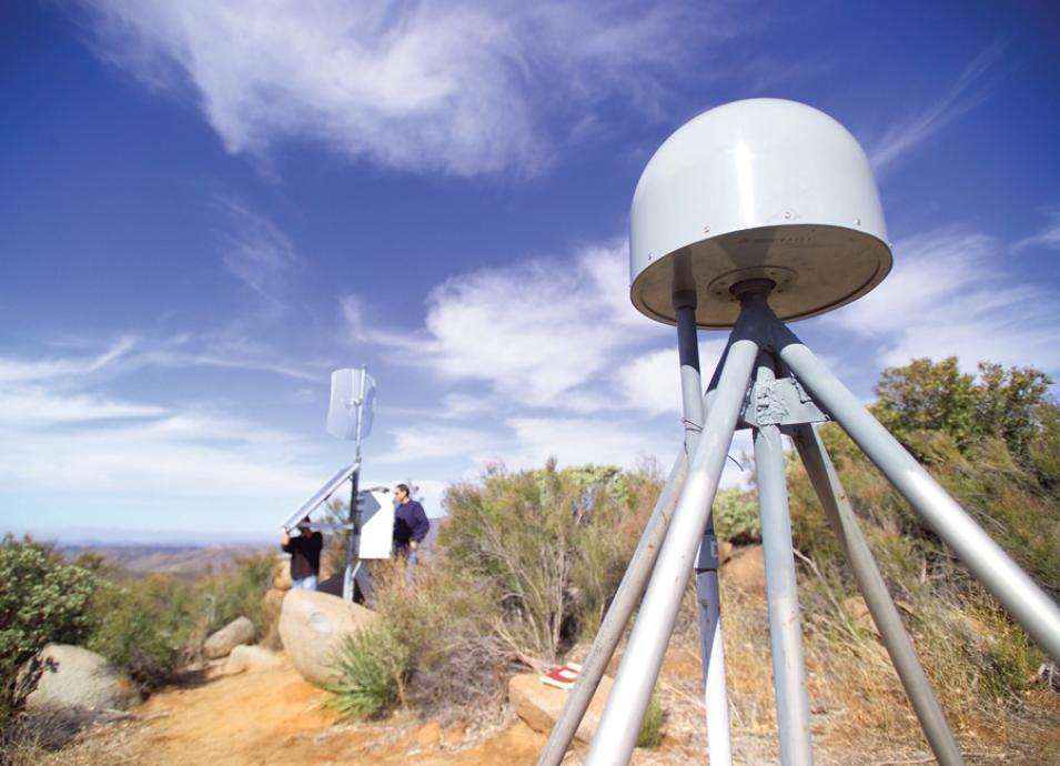
High above Japan, something else detected signals from the quake. Global Positioning System (GPS) satellites sent their usual radio signals to Earth. As the pulses beamed down to the country’s 1,200 ground-based GPS receivers, they intercepted and recorded atmospheric disturbances caused by the quake. When they arrived at the ground receivers, the radio signals carried vital information about the quake that could improve tsunami early warning systems and get people out of hazard zones faster.
A confluence of events
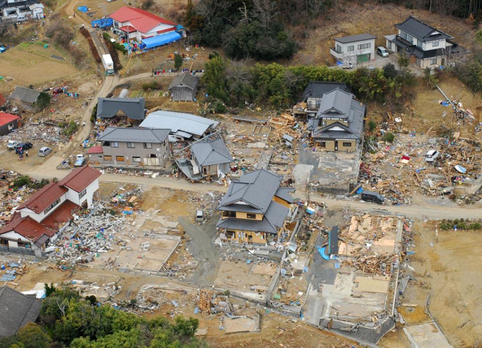
It is hard to separate the quake damage from the tsunami devastation in the Tohoku region and other parts of Japan. The quake lasted about six minutes and it generated tsunamis of up to 133 feet along the northeastern coast, with the worst damages in the cities of Miyako and Sendai, and in the province of Fukushima.
Here are the grim statistics for both the quake and the aftermath. More than 15,000 people died, most of them drowned. About 2,500 people were never found. The tsunami caused a power outage at the Fukushima Daiichi nuclear power plant, disabling the cooling of three reactors. All three cores melted within days, triggering mass evacuations and increased levels of radiation in local water and food supplies.
“I call it a perfect storm and sadly so because it claimed many lives and caused about $300 billion in damages,” said Attila Komjathy, a scientist at NASA's Jet Propulsion Laboratory (JPL) of the California Institute of Technology. “It was a big earthquake and a big tsunami, but it so happened that about 1,200 GPS receivers were operating simultaneously and collecting data when these unfortunate events were happening.” The receivers picked up effects that the quake and the tsunami had caused high in Earth’s atmosphere.
“We are taking advantage of the fact that earthquakes generate surface waves, or what are known technically as Rayleigh waves,” Komjathy said. A Rayleigh wave is one of the many seismic waves produced by an earthquake. It is an undulating wave that travels on Earth’s solid surface.
When the Tohoku earthquake began under the seafloor, it caused Rayleigh waves that reached northeastern Japan’s coastal regions; the Rayleigh waves also triggered waves undetectable to the naked eye.
Detection in the ionosphere
“When the ground shakes, it causes tiny atmospheric waves that can propagate right up to the ionosphere,” Komjathy said. The ionosphere is the layer of Earth’s atmosphere ionized by solar and cosmic radiation and is located roughly between 50 and 600 miles (80 and 1,000 kilometers) above Earth’s surface.
When the atmospheric waves reach the ionosphere, they cause detectable changes to the density of electrons in that atmospheric layer. These changes can be recorded and measured when signals from global navigation satellite systems (GNSS), such as those of GPS, travel through the ionosphere.
The same satellites can also detect disturbances in the ionosphere caused by tsunamis. When a tsunami forms and moves across the ocean, the crests and troughs of its waves compress and extend the air above them, creating motions in the atmosphere known as gravity waves. These undulations of gravity waves are amplified as they travel upward into an atmosphere that becomes thinner with altitude. When they reach the ionosphere, the gravity waves also can be detected using the constellations of GNSS satellites circling Earth.
Real-time warnings
Komjathy and his colleagues have taken the GPS data from the Tohoku earthquake and tsunami, as well as from other earthquake and tsunami events, and developed a new approach to assist in the ongoing development of timely tsunami detection systems. “The goal is to detect tsunamis and warn the coastal communities in real time,” Komjathy said. Komjathy’s group relies on GPS data archived by NASA's Crustal Dynamics Data Information System (CDDIS), among other sources, for their project.
The new approach, called Variometric Approach for Real-time Ionosphere Observation, or VARION, was designed under the leadership of Mattia Crespi of Sapienza University in Rome, Italy. The main author of the algorithm is Giorgio Savastano, a doctoral student in geodesy and geomatics at Sapienza and an affiliate researcher at JPL, which conducted further development and validation of the algorithm.
VARION can be incorporated with tsunami detection systems that use data from a variety of sources, including seismometers, buoys, GNSS receivers, and ocean bottom pressure sensors. Once an earthquake is detected in a location, the system could begin processing real-time measurements of the distribution of electrons in the ionosphere from multiple ground stations near the quake’s epicenter, searching for changes that may be correlated with the expected formation of a tsunami.
The researchers are incorporating the algorithm into JPL’s Global Differential GPS System, which will provide real-time access to data from about 230 GNSS stations around the world that collect data from multiple GNSS constellations. Since large tsunamis like the Tohoku event of 2011 are infrequent, testing VARION using a variety of real-time data will help validate the algorithm.
However, Komjathy said they need access to more real-time GPS data streams, specifically from countries located in the Pacific Ring of Fire, a string of volcanoes and hot spots of seismic activity around the edges of the Pacific Ocean. “Some countries in this area are not always very keen on sharing data,” Komjathy said. “We need real-time access to data. Otherwise we cannot really process a global network of GPS stations.”
The researchers are currently working with the United Nations Development Program and its Environment Program to facilitate cooperation with countries in the Ring of Fire region. “It’s going to be an incremental improvement to the data coverage and we know this is not going to happen overnight,” Komjathy said. “We just need to convince the affected nations that this is for humanity’s benefit, and we are moving in that direction.”
References
Galvan, D. A., A. Komjathy, M. Hickey, P. Stephens, J. B. Snively, T. Song, M. Butala, and A. J. Mannucci. 2012. Ionospheric signatures of Tohoku-Oki tsunami of March 11, 2011: Model comparisons near the epicenter. Radio Science 47, RS4003. doi:10.1029/2012RS005023.
Komjathy, A., Y.-M. Yang, X. Meng, O. Verkhoglyadova, A. J. Mannucci, and R. B. Langley. 2016. Review and perspectives: Understanding natural-hazards-generated ionospheric perturbations using GPS measurements and coupled modeling. Radio Science 51: 951–961. doi:10.1002/2015RS005910.
NASA Crustal Dynamics Data Information System (CDDIS). Global Navigation Satellite Systems Daily 30-second data. Greenbelt, MD, USA. https://cddis.nasa.gov/Data_and_Derived_Products/GNSS/daily_30second_data.html.
Savastano, G., A. Komjathy, O. Verkhoglyadova, A. Mazzoni, M. Crespi, Y. Wei, and A. J. Mannucci. 2017. Real-time detection of tsunami ionospheric disturbances with a stand-alone GNSS receiver: A preliminary feasibility demonstration. Scientific Reports 7: 46607. doi:10.1038/srep46607.
For more information
NASA Crustal Dynamics Data Information System (CDDIS)
CDDIS Global Navigation Satellite Systems (GNSS) Data and Product Archives
About the remote sensing data | |
---|---|
Satellite | Global Navigation Satellite Systems (GNSS) |
Sensor | Global Positioning System (GPS) |
Data set | GNSS Daily 30-second data |
Temporal resolution | 1 second to <1 minute |
Parameter | Geospatial positioning |
DAAC | NASA Crustal Dynamics Data Information System (CDDIS) |