Home
Mobile Menu
Skip to main content
  • About
  • Data
  • Collaborate
  • Learn

Human Dimensions

  1. Learn
  2. Earth Science Disciplines
  3. Human Dimensions
Share on Twitter Share on Facebook Share on Pinterest

EOSDIS Human Dimensions Data

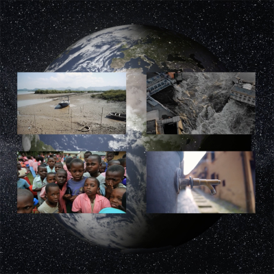
Within the Human Dimensions discipline, Earth Observing System Data and Information System (EOSDIS) Distributed Active Archive Centers (DAACs) hold a wide variety of socioeconomic data (e.g., population, infrastructure, economic resources) and products concerning human interactions in the environment (e.g., natural hazards, human impacts). Most of these data sets are provided by the Socioeconomic Data and Applications Center (SEDAC), whose mission is to develop and operate applications to support the integration of socioeconomic and Earth science data, and to serve as an “information gateway” between the Earth and social sciences. Several other DAACs also hold Human Dimensions data as they relate to their respective disciplines.

Read more about human dimension topics:

New Environmental Performance Index (EPI) Available at NASA’s SEDAC
The 2020 release of the EPI ranks 180 countries in environmental health and ecosystem vitality based on 32 indicators.

See more at

SEDAC ASDC DAAC ASF DAAC GES DISC NSIDC DAAC ORNL DAAC

Learn about other Earth science disciplines

FIND HUMAN DIMENSIONS DATA

VISUALIZE HUMAN DIMENSIONS DATA

Available Measurements

Click on one of the measurements below to explore the data in Earthdata Search:

  • Boundaries
  • Economic Resources
  • Environmental Governance/Management
  • Environmental Impacts
  • Habitat Conversion/Fragmentation
  • Human Settlements
  • Infrastructure
  • Natural Hazards
  • Population
  • Public Health
  • Social Behavior
  • Socioeconomics
  • Sustainability

Learn more about Human Dimensions Data at EOSDIS

Learn more about Human Dimensions Data at EOSDIS by reading Sensing Our Planet articles that feature research utilizing Earth Observing data from the EOSDIS DAACs and watch NASA Earthdata Webinar videos to learn more about NASA Earth science data sets, services and tools to discover, access and use these data.

Access the Earthdata Forum for questions and answers on human dimensions data.

Human Dimensions Data Set Reference Sheet:

Human Dimension one pager

Links

  • YouTube logo
    Webinar: Mapping Global Urbanization from Landsat Data and High-Resolution Reference Data

  • YouTube logo
    Webinar: Explore NASA Socioeconomic Data using Web Mapping Services

    This webinar will provide an overview of the geospatial data holdings and data access tools, and highlight ways this socioeconomic data can be integrated with remote sensing data to address problems such as: climate change and potential impacts on migration; health risks of air pollution; forecasting urban expansion and the impacts of that expansion on biodiversity and carbon pools.

  • YouTube logo
    Webinar: Rapid Assessment of Hazard Impacts - NASA SEDAC Hazard Mapper

  • YouTube logo
    Webinar: Remote Sensing Derived Environmental Indicators for Decision Making

Page Last Updated: May 25, 2021 at 4:02 PM EDT

Resources

  • Map Gallery
  • Map Viewer
  • WMS Map Services
  • Mapping Tools

Discover Data and Services

  • Earthdata Search
  • International Directory Network (IDN)
  • Data Tools

@NASAEarthdata

Loading Tweets by NASAEarthdata...

We're sorry. Our Twitter feed cannot load right now.

In the meantime, visit us below!

@NASAEarthdata

ABOUT

DATA

COLLABORATE

LEARN

USER RESOURCES

SUPPORT

NASA Links

  • NASA Official: Stephen Berrick
  • Web Privacy Policy
  • Data and Information Policy
  • Communications Policy
  • Freedom of Information Act
  • USA.gov
  • Sitemap