Crop Emergence Needs
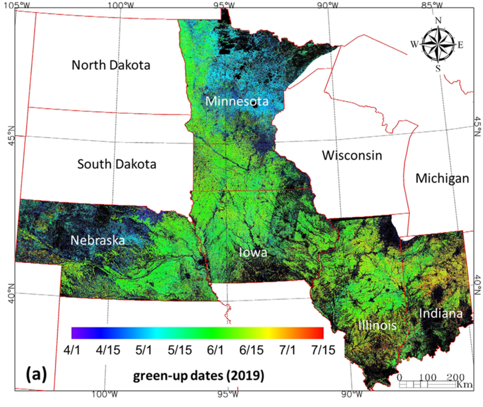
The U.S. Department of Agriculture (USDA) publishes weekly crop progress reports to provide timely information of farmer activities such as planting and harvesting, and crop development and condition. Key to this information is knowing crop green-up dates, or crop emergence. Tracking emergence over large areas requires remote sensing but such data is typically either too coarse or lag green-up dates due to insufficient temporal resolution.
SNWG’s Solution
The Harmonized Landsat and Sentinel-2 (HLS) dataset, provided by the Satellite Needs Working Group (SNWG), combines data from NASA and European Space Agency (ESA) missions to achieve data delivery at a two-day temporal resolution and 30-m spatial resolution.
The availability of HLS data has allowed USDA to determine green-up date and strength across the Corn Belt within 1-2 weeks after crop emergence. Such timely information is used to monitor crop progress and condition in the region for better crop management at field scales.
