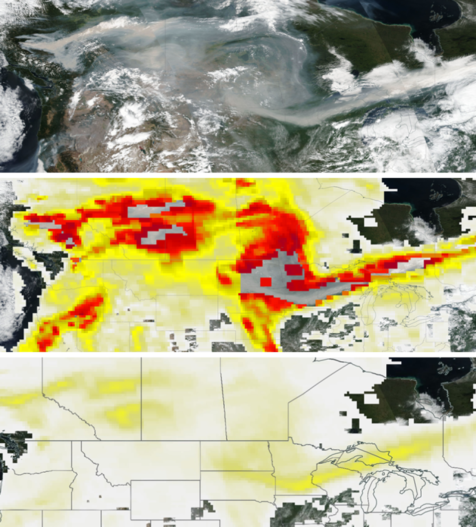
The 2018 wildfire season has been one for the record books. Along with historically high numbers of wildfires in the Western U.S. and in Canada, this season included rare wildfires above the Arctic Circle in Scandinavia and near the Russia-Finland border.
Along with the threat to lives and property, these fires also affect local weather. As heat from these fires rises into the atmosphere, it has the potential for producing pyrocumulonimbus, or pyroCb, events. A pyroCb is a fire-caused or fire-enhanced thunderstorm that in its most extreme form pumps high amounts of smoke and other biomass-burning emissions into the lower stratosphere. Smoke and other suspended particles in the atmosphere are known as "aerosols."
A new near real-time product available through NASA’s Land, Atmosphere Near real-time Capability for EOS (LANCE) system makes it easier to track the extent and spread of pyroCb and other high-aerosol events. This is vital information due to the many impacts caused by areas of high aerosol concentrations.
High aerosol concentrations not only can affect climate and reduce visibility, they also can impact breathing, reproduction, the cardiovascular system, and the central nervous system, according to the U.S. Environmental Protection Agency. Since aerosols are able to remain suspended in the atmosphere and be carried in prevailing high-altitude wind streams, they can travel great distances away from their source and their effects can linger.
Fortunately, the global movement of aerosols can be tracked using instruments aboard Earth observing satellites. One of these instruments is the Ozone Mapping and Profiler Suite (OMPS) aboard the joint NASA/National Oceanic and Atmospheric Administration (NOAA) Suomi National Polar-orbiting Partnership (Suomi-NPP), launched in 2011, and NOAA-20 (launched in 2017) satellites.
