Within three years, NASA’s Earth Observing System Data and Information System (EOSDIS) archive is projected to more than triple, with an annual growth rate of nearly 50 petabytes. EOSDIS’ growing data archive and its migration to the cloud presents unique opportunities for science and significant challenges for data management and access.
11 ACCESS Projects Funded to Support Earth Science at the Petabyte Scale
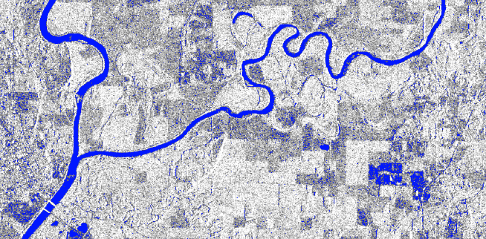
Preliminary surface water map for a region of the Ohio River from the ACCESS project, Training Data for Stream Flow Estimation. The project will create training data for machine learning using the European Space Agency's (ESA) Sentinel-1 C-band synthetic aperture radar (SAR) data. Image courtesy of Fritz Policelli, NASA Goddard Space Flight Center.
Managing data in the cloud is a major challenge facing many Earth scientists. Researchers need open-source tools to help make this transition easier. These large datasets also offer opportunities to use them in innovative ways, such as in machine learning applications.
The 2019 ACCESS announcement specifically sought technology developments for one or a combination of the following areas:
- Machine Learning (ML) for Earth Science Data Systems (including new training datasets for ML);
- Enabling Science in the Cloud; and
- Improvement, Maintenance, and Support of High-value Open Source Earth Science Tools and Libraries.
Adoption of ML techniques relies heavily on availability of large training datasets. Several awarded projects will develop high-quality training datasets for use in machine learning applications. These projects include developing training datasets for use in land cover and disturbance mapping, and for estimating vegetation structure, streamflow, and cloud properties.
Open source tools and libraries have become a critical component to cloud computing in Earth science. The successful proposals clearly identified communities that will benefit from the technology and demonstrated linkages to pressing data management problems or the need for open source library and tool maintenance.
Read more about the 11 projects funded by ACCESS.
