Principal Investigator (PI): Gao Chen, NASA's Langley Research Center Co-Investigators (Co-PI): Morgan Silverman, Damian Gessler, Crystal Gummo, Emily Northrup*, Aubrey Beach*, Amanda Early*, Glover Barker*, Tim See*: NASA's Atmospheric Science Data Center (ASDC) * prior members
Aircraft measurements of atmospheric trace gases and aerosols are an important component of NASA’s Earth observing system. The data are used to study climate change and air quality and to validate satellite measurements.
In 2014, NASA’s Atmospheric Science Data Center (ASDC) developed and released the Toolsets for Airborne Data (TAD) web application to enhance airborne data discovery and usability, focused on atmospheric composition. The goal of the follow-on Subsetting Tools for Advanced Analysis of Airborne Chemistry Data (STA3CD) project (pronounced “stacked”) is to enhance TAD with additional geographical map capabilities to better serve the research community. STA3CD adds new features that provide the ability to extract data through geographic and vertical profile subsetting. This includes:
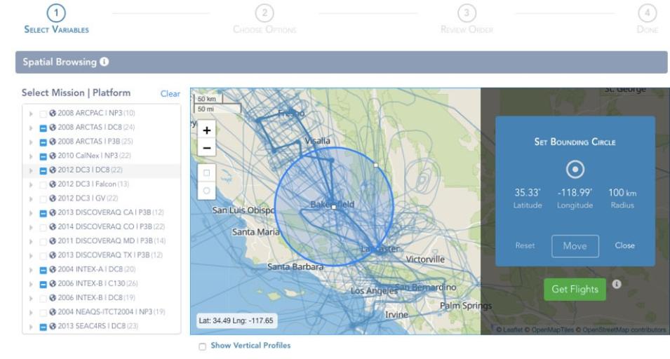
- Interactive display of flights over their geographical ranges, allowing the selection of flights and campaigns based on their geographical coverage and/or date of data collection;
- Visual display of vertical profiling tracks and metadata associated with their collecting flights;
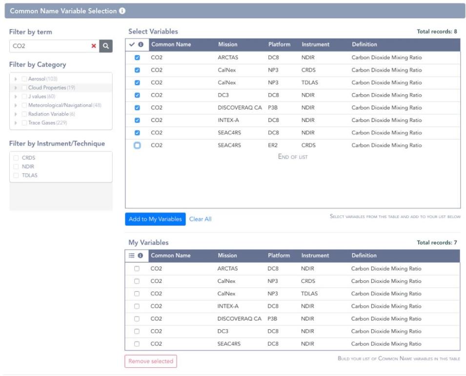
- Integrated map and faceted search: selecting flights automatically filters Common Name variables, allowing the researcher to build a shopping cart of variables based on where and when the data were collected.
The current TAD user interface (UI) has been improved in both design and functionality. The UI uses a modern “reactive data” technology that allows immediate UI updating without round-trips to the server, yielding a more satisfying, “app-like” experience. A middle-layer Application Programming Interface (API) enables programmatic data retrieval, thereby broadening avenues for both data discovery and access.

