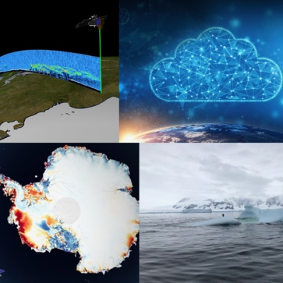
Home
Mobile Menu
Skip to main content
  • About
  • Data
  • Collaborate
  • Learn

Cryosphere

  1. Learn
  2. Earth Science Disciplines
  3. Cryosphere
Share on Twitter Share on Facebook Share on Pinterest

EOSDIS Cryosphere Data

The Cryosphere refers to any place on Earth where water is in its solid form, where low temperatures freeze water and turn it into ice. The frozen water can be in the form of solid ice or snow and occurs in many places around the Earth in addition to the Arctic and Antarctic. Earth Observing System Data and Information System (EOSDIS) Distributed Active Archive Centers (DAACs) provide cryospheric data sets provide information about land and sea ice, frozen ground (permafrost), and snow. The primary DAACs specializing in EOSDIS cryospheric data products are the National Snow and Ice Data Center DAAC (NSIDC DAAC) and Alaska Satellite Facility DAAC (ASF DAAC). Several other DAACs also hold cryospheric data as they relate to their respective disciplines.

Read more about cryosphere topics:

ICESat-2 Data Usher in a New Age of Exploration
Data from NASA’s ICESat-2 mission provide the most accurate measurements of Earth elevation change ever recorded—and much more.

All About the Cryosphere
Some places on Earth are so cold that water is a solid—ice or snow. Scientists call these frozen places of our planet the "cryosphere." The word "cryosphere" comes from the Greek word for cold, "kryos."

See more at

ASF DAAC NSIDC DAAC ASDC DAAC GES DISC LAADS ORNL DAAC SEDAC
ESA Logo Small

Learn about other Earth science disciplines

FIND CRYOSPHERE DATA

VISUALIZE CRYOSPHERE DATA

Available Measurements

Click on one of the measurements below to explore the data in Earthdata Search:

  • Frozen Ground
  • Glaciers/Ice Sheets
  • Sea Ice
  • Snow/Ice

Learn more about Cryosphere Data at EOSDIS

Learn more about Cryosphere Data at EOSDIS by reading Sensing Our Planet articles that feature research utilizing Earth Observing data from the EOSDIS DAACs and watch NASA Earthdata Webinar videos to learn more about NASA Earth science data sets, services and tools to discover, access and use these data.

Access the Earthdata Forum for questions and answers on cryospheric science data.

Cryosphere Data Set Reference Sheet:

Cryosphere one pager

IceBridge Data Portal Data Service Fact Sheet:

Icebridge Data Portal one pagerIceBridge Data Set Fact Sheet:

Icebridge Data one pager

Links

  • YouTube logo
    Webinar: Operation IceBridge: Come Discover a Decade of Polar Data

  • YouTube logo
    Webinar: Operation IceBridge Portal - Discover a Wealth of Polar Data (Part 1)

    NASA's Operation IceBridge is an airborne mission that collects a wide range of remote sensing measurements in the polar regions of the world. The National Snow & Ice Data Center (NSIDC) is managing the data archive for all IceBridge data, and so an easy-to-use Portal has been developed.

  • YouTube logo
    Webinar: Operation IceBridge Portal - Discover a Wealth of Polar Data (Part 2)

    This webinar is designed to help users learn to navigate the IceBridge data collection and show them how to discover and access these polar data products using the data portal. This webinar will cover the objectives of the IceBridge mission and provide information about the wide range of available data.

  • YouTube logo
    A New Era for Gridded Passive Microwave Data at NASA's NSIDC DAAC

Page Last Updated: May 25, 2021 at 4:02 PM EDT

Resources

  • About the Cryosphere
  • Snow, Ice and Climate Change
  • Sea Ice Index

Discover Data and Services

  • Earthdata Search
  • International Directory Network (IDN)
  • Data Tools

@NASAEarthdata

Loading Tweets by NASAEarthdata...

We're sorry. Our Twitter feed cannot load right now.

In the meantime, visit us below!

@NASAEarthdata

ABOUT

DATA

COLLABORATE

LEARN

USER RESOURCES

SUPPORT

NASA Links

  • NASA Official: Stephen Berrick
  • Web Privacy Policy
  • Data and Information Policy
  • Communications Policy
  • Freedom of Information Act
  • USA.gov
  • Sitemap