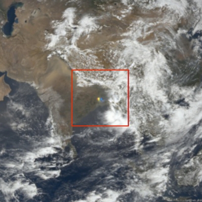
For centuries, many a sailor has learned to heed the message of high, windswept clouds to batten down their hatches. As the proverb goes, “Mares’ tails and mackerel scales make lofty ships to carry low sails.” Together, wispy cirrus clouds resembling horse tails and patchy cirrocumulus signal that a rain storm is on its way.
But scientists are interested in other messages these high altitude clouds can share. Thick, low clouds like cumulus reflect incoming sunlight while thin, high clouds like cirrus trap the sun’s thermal energy in Earth’s atmosphere. For researchers Tristan L’Ecuyer and Graeme Stephens who study how much heat the planet holds or sends back to space, known as Earth’s energy budget, this is an important distinction. Which type wins overall? That is an ongoing scientific debate, but L’Ecuyer and Stephens are chipping away at the answer. What scientists do not debate is that cirrus are no ordinary clouds. Understanding them may be key to understanding how Earth is going to handle continued warming.
Cloud computing
Most cirrus stream out of the chimneys of tropical cyclones or form at the top of boiling thunderstorms, and can stretch over entire continents when pulled by the jet stream. They are made of millions of tiny ice crystals of varying shapes, like disks and rods, and are sometimes so thin they are almost transparent. These features give cirrus an uncanny ability to allow solar radiation into the atmosphere, yet prevent it from reflecting back out into space.
Like large lids over the atmosphere, cirrus effectively prevent warm air from rising. Stephens and L’Ecuyer found they do this especially well over warm surfaces. Stephens, a senior scientist at NASA's Jet Propulsion Laboratory, said, “Think about high, cold cirrus at 14 kilometers [9 miles] sitting above the tropics over a 300 degree Kelvin [80 degree Fahrenheit] ocean temperature. That’s when they’re most effective at trapping heat.”
The power to trap heat means they can also squelch storms. Storms build when warm air rises over a pocket of cold air like a conveyer belt, causing the cycle of convection. When that warm air finds its higher spot in the atmosphere, it condenses into rain or ice droplets, depending on the altitude. But cirrus clouds hamper this cycling of air, and much of the precipitation that should follow. More heat and less rain may be a welcome change for seafarers, but it means cirrus also create a powerful form of positive feedback to a warming climate.
Put a cloud below the cirrus, however, and the dynamic changes. “What happens now that you have a cloud below the cirrus?” Stephens said. “It reduces the ability of the cirrus to trap heat. So the greenhouse effect of a cirrus cloud depends on what’s below it.” This complicates the already perplexing task of mapping clouds on a global scale, which is exactly what scientists need to do to calculate the sway clouds hold over the energy budget. Yet Stephens and L’Ecuyer took it a step further to capture a profile of clouds throughout the entire atmosphere, from top to bottom. Stephens said, “We needed to know: Is it just cirrus and one cloud layer below, or cirrus and two cloud layers? And how high are they?”

Portrait of a cloud
Answering those complex questions required digging into data from not just one satellite, but three. They began their search with the NASA/French Space Agency Cloud-Aerosol Lidar and Infrared Pathfinder Satellite Observation (CALIPSO) satellite. Onboard, the Cloud-Aerosol Lidar with Orthogonal Polarization (CALIOP) instrument was designed to size up a cloud by pointing its laser at it and measuring the light that bounces back, what scientists refer to as lidar backscatter. L’Ecuyer, an assistant professor of atmospheric physics at the University of Wisconsin-Madison, explained how this works. “Suppose you turn on your headlights when it’s foggy outside. You can tell how much fog there is essentially by seeing how much light gets reflected back at you.” In a similar way, the CALIOP instrument measures the thickness of clouds from space, and is particularly adept at sensing the finer particles of cirrus clouds. It can also penetrate through thin cirrus clouds to see what lies below.
Flying nearby on the CloudSat satellite was the perfect complement. Its Cloud Profiling Radar instrument was designed to measure another type of backscatter: radio waves. With radio waves, the researchers could begin to make out larger particles like snow and ice within a cloud, especially those in thicker clouds like puffy cumulus. They then combined these data with readings of optical thickness, yet another assessment of how bright clouds are, from the Moderate Resolution Imaging Spectroradiometer (MODIS) satellite.
Together, the new data were groundbreaking. Not only could the researchers identify different types of clouds, but they could also track and catalog a vertical view of cloud layers, which helped them understand much more about cirrus than was previously known. L’Ecuyer said, “We now know how often there’s a cirrus cloud in every environment on the globe. And maybe more importantly, we know how high and how cold they are.”

Modeling mares’ tails
That information was a giant step toward refining their computerized cloud models, which is what they rely on to calculate the net effect of all clouds on Earth’s energy budget. These models helped sort out surprising patterns about cloud behavior. It turns out the higher and thinner the cloud, the more heat it will trap. “It’s counterintuitive,” Stephens said. “You think big, thick clouds would be a thicker blanket, but they reflect a lot of sunlight, actually. The thin, cold cirrus have a disproportionately higher greenhouse effect.”
In fact, their findings confirmed the importance of these wispy, sometimes barely visible cirrus clouds to climate. L’Ecuyer said, “The warming effect of cirrus is six times larger than you would get by doubling all the carbon dioxide in the atmosphere.”
When the effects of low clouds were factored in, though, their models revealed that clouds continue to have a cooling effect overall, at least in today’s climate. The next step is to learn how the heating or cooling effect of clouds might change in the future. Computer models will help predict this, but scientists caution they need continual testing and honing. Because clouds play a large role in determining the global climate, an enormous amount of data must go into analyzing them, and there is no shortage of factors to consider. That means that even with massive amounts of data from the most sophisticated instruments available, there are a great number of unknowns.
“That’s the problem,” Stephens said. “Just a small change in clouds can almost completely offset the warming, or reinforce it strongly.” This sensitivity in current climate models is now pushing them to analyze data on other factors that influence cloud formation and behavior. Stephens said, “How do aerosols, for example—like pollution, dust, and other particles—affect this balance? And how does this affect the overall ability to produce precipitation?”
Until they can answer those questions, however, they will rely on the new benchmark their study has set for current models. And in the meantime, the advent of still more sophisticated instruments combined with a longer data record will help scientists continue to decode the messages clouds tell us in the future. Will a warming planet bring more clouds, and will these be warming cirrus clouds or cooling cumulus clouds? L’Ecuyer said, “What we’ve done is figure out what clouds do in today’s climate, but what ways will clouds change in a warmer climate?”

References
CloudSat Data Processing Center. 2011. Level-2 Cloud Optical Depth (2B-TAU). Version 6. Fort Collins, Colorado USA.
CloudSat Data Processing Center. 2011. Level-2 Radar-Lidar Cloud Geometrical Profile, Cloud Water Content (2B-GEOPROF, 2B-CWC). Version 4. Fort Collins, Colorado USA.
Henderson, D. S., T. L’Ecuyer, G. Stephens, P. Partain, and M. Sekiguchi. 2013. A multi-sensor perspective on the radiative impacts of clouds and aerosols. Journal of Applied Meteorology and Climatology 52:853–71. doi:10.1175/JAMC-D-12-025.1.
NASA Atmospheric Science Data Center (ASDC). 2011. All-Sky Level 3 Lidar Data. Version 3. Hampton, Virginia USA.
Trepte, Q. Z., P. Minnis, C. R. Trepte, and S. Sun-Mack. 2010. Improved cloud detections in CERES Edition 3 algorithm and comparison with the CALIPSO Vertical Feature Mask. Proceedings of the 13th Conference on Atmospheric Radiation and Cloud Physics. Portland, Oregon USA: American Meteorological Society.
For more information
NASA Atmospheric Science Data Center (ASDC)
NASA Cloud-Aerosol Lidar and Infrared Pathfinder Satellite Observation (CALIPSO)
NASA Moderate Resolution Imaging Spectroradiometer (MODIS)
| About the remote sensing data used | |
| Satellite | Cloud-Aerosol Lidar and Infrared Pathfinder Satellite Observation (CALIPSO) |
| Sensor | Cloud-Aerosol Lidar with Orthogonal Polarization (CALIOP) |
| Data set | Level-3 Lidar Backscatter, Vertical Feature Mask (VFM) |
| Resolution | 2 degrees latitude, 5 degrees longitude |
| Parameter | Lidar backscatter |
| DAAC | NASA Atmospheric Science Data Center (ASDC) |
| Processed CloudSat backscatter data and MODIS radiance data were obtained from the CloudSat Data Processing Center. | |
The photograph in the title graphic shows high, wispy cirrus clouds resembling mares’ tails streaming over Loch Lomond, Scotland. (Courtesy C. Laws)