Atmospheric Science Data Center (ASDC)

Disciplines: Radiation budget, clouds, aerosols, and tropospheric composition
Image
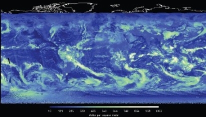
This is the First Light incoming solar radiation from CERES on Suomi NPP.
First Light incoming solar radiation from CERES on Suomi NPP.

NASA's Atmospheric Science Data Center (ASDC) is in the Science Directorate located at NASA'S Langley Research Center in Hampton, Virginia. The Science Directorate's Climate Science Branch, Atmospheric Composition Branch, and Chemistry and Dynamics Branch work with ASDC to study changes in the Earth and its atmosphere. Data products translate those findings into meaningful knowledge that inspires action by scientists, educators, decision-makers, and the public. ASDC supports over 50 projects and provides access to more than 1,000 archived data sets. These data sets were created from satellite measurements, field experiments, and modeled data products. ASDC projects focus on the Earth science disciplines: Radiation Budget, Clouds, Aerosols, and Tropospheric Composition.

Contact Information

John Kusterer, DAAC Manager
Christopher Harris, Operations Lead
Jeff Walter, Science Data Services Lead
Matthew Tisdale, Data Scientist

Langley Research Center
2 South Wright Street, Building 1268C
Mail Stop 157D
Hampton, VA 23681-2199

Website: https://asdc.larc.nasa.gov/  
ASDC

TEMPO Beta Level 1 Product Release

Feb 27, 2024

TEMPO Beta Level 1 (L1) data are available from the ASDC via NASA Earthdata Search as of February 26, 2024 (learn more).

These datasets are at beta maturity, which means that the product is minimally validated but may still contain significant errors; it is based on product quick looks using the initial calibration parameters. Because the products at this stage have minimal validation, users should refrain from making conclusive public statements regarding the science and applications of the data products until a product is designated at the provisional validation status.

A User Guide describing the data products in the beta L1 release and associated known issues can be found here. The TEMPO Level 1 Algorithm Theoretical Basis Document (ATBD) is still being finalized. To access Version 1.0 ATBD, please get in touch with the ASDC at larc-dl-asdc-tempo@mail.nasa.gov.

The data products are provided in netCDF4 format and are designated at a “beta” maturity level (see end of article). The Level 1 Geolocated Earth Radiance/Solar Irradiance products contain information on radiometrically and wavelength-calibrated Earth radiance/solar irradiance for the UV and visible bands, corresponding noise, parameterized wavelength grid, viewing geometry, quality flags, and other ancillary information. The Level 1A Dark Exposure product contains information on dark current rates of all frames and their average for the UV and visible bands, pixel quality flags, and other ancillary information.

L2 and L3 data are expected to be released publicly in April 2024.

For inquiries about this or other TEMPO data releases, please get in touch with larc-dl-asdc-tempo@mail.nasa.gov or post/view questions on the  Earthdata Forum.

More information about TEMPO and the services the ASDC provides may be found in the TEMPO storymap.

SAGE III-ISS Level 2 Aerosol Auxiliary Product Release Announcement

Feb 16, 2024

Stratospheric aerosol plays an important role in chemistry and climate. Space-based observations of their optical properties have been key elements of the study of the effects of major volcanic and extreme fire events. To aid users of SAGE III/ISS Level 2 aerosol data, the mission is releasing a Level 2 aerosol auxiliary product that identifies cloud-free observations using the method of Kovilakam et al. 2023 (https://doi.org/10.5194/amt-16-2709-2023). The algorithm is similar to that developed for the Global Space-based Stratospheric Aerosol Climatology (GloSSAC), in which SAGE III/ISS data plays a crucial role alongside other space-based measurements (asdc.larc.nasa.gov/project/GloSSAC ). The new Level 2 aerosol auxiliary product is released at the same cadence as the L2 solar products. For general ease of use, the results are grouped into monthly netcdf file.

Information about these new data products can be found at the following ASDC link:

https://asdc.larc.nasa.gov/project/SAGE III-ISS

These data products are available from the ASDC via the following options:

Earthdata Search

Direct Data Download

OPeNDAP

CALIPSO Lidar Level 2 Blowing Snow Products Release Announcement

Feb 5, 2024
The CALIPSO mission team announces the release of two new CALIOP Level 2 monthly data products:
  • CAL_LID_L2_BlowingSnow_Greenland-Standard-V1-00
  • CAL_LID_L2_BlowingSnow_Antarctica-Standard-V2-00

  • The Blowing Snow monthly data products, developed by Dr. Stephen Palm, isolates blowing snow events determined from the CALIOP lidar atmospheric attenuated backscatter measurements and obtains the spatial and temporal frequency, layer height, and optical depth of these events over Antarctica (updated version 2.00) and Greenland (new version 1.00) data for June 2006 through June 2023. These new products rely on the recently released V4.51 Lidar Level 1 and Lidar Level 2 data products as input.

    Information about these new data products can be found at the following ASDC link:
    https://asdc.larc.nasa.gov/project/CALIPSO

    An in-depth data description document can be found in the following CALIPSO link:
    https://www-calipso.larc.nasa.gov/resources/calipso_users_guide/data_desc/cal_lid_l2_blowingsnow_antarctica_v2-00_desc.php

    These data products are available from the ASDC via the following options:
  • Earthdata Search
  • Direct Data Download
  • OPeNDAP
  • Last Updated

    You Might Also Be Interested In

    Filter By

    Content type