Cars, trucks, power plants, and other industrial facilities emit nitrogen dioxide (NO2) as a product of burning fossil fuels. Once in the air, nitrogen dioxide can aggravate respiratory conditions, especially in people with asthma, leading to an increase of symptoms and hospital admissions. Long-term exposure can lead to the development of asthma and potentially increase susceptibility to respiratory infections.
Nitrogen dioxide can quickly transform into ground-level ozone, a major respiratory pollutant and one of the main ingredients of summertime smog.

Nitrogen dioxide levels decrease when businesses and factories close, or when there are fewer vehicles on the road. Past observations have shown that air pollution usually decreases during China's Lunar New Year celebration, for example, and then increases once the celebration is over. But this year nitrogen dioxide didn't rebound as it usually does.
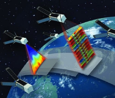
A preliminary analysis by NASA researchers, discussed on NASA's Earth Observatory, compared nitrogen dioxide values detected by the Ozone Monitoring Instrument (OMI) on NASA's Aura satellite in 2020 with the average amounts detected at this time of year from 2005–2019. In early 2020, nitrogen dioxide values in eastern and central China were 10 to 30 percent lower than what is normally observed for this time period. There is corroborating evidence that the change is at least partly related to the economic slowdown following the outbreak of coronavirus.
In addition to OMI, the Tropospheric Monitoring Instrument (TROPOMI) on the European Space Agency's Sentinel-5 satellite also measures nitrogen dioxide. The maps produced by Earth Observatory compare TROPOMI measurements of nitrogen dioxide density across China from January 1–20, 2020 and February 10–25.
Access NO2 Data
You can access research-quality NO2 data to assess regional air quality and potential trends in industrial activity. The data are available at a daily time step (one view per day, when clouds allow) from TROPOMI and OMI using Earthdata Search. Giovanni and Worldview can be used to explore and visualize the data.
- Earthdata Search provides OMI NO2 data in daily gridded (0.25 degree latitude x 0.25 degree longitude) and non-gridded products at the native resolution (minimum pixel size of 13x24 km2). Data are in Hierarchical Data Format Release 5 (HDF5) format and can be opened using the freely available NASA tool, Panoply. The data are typically provided with a 48-hour lag. A tutorial on using OMI NO2 data, from NASA's Health and Air Quality Applied Sciences Team (HAQAST), is available as a PDF. An Earthdata webinar, Subset NASA Ozone Monitoring Instrument Data, provides information on subsetting OMI data.
- TROPOMI NO2 data can be accessed in Earthdata Search and at NASA's Goddard Earth Sciences Data and Information Services Center (GES DISC) via cooperative agreement with the European Space Agency (ESA). The data are at a minimum of 5.5x3.5 km2 pixel resolution in Network Common Data Form (NetCDF) that can also be opened in Panoply. These TROPOMI data are typically available 10 days after measurement by the instrument. ESA provides additional information on this data product.
Access TROPOMI NO2 Data from Earthdata Search
Access TROPOMI NO2 Data at GES DISC
Visualize NO2 Data
The Global Nitrogen Dioxide Monitoring Home Page visualizes OMI NO2 data for major cities around the world for January through April 2020, compared to a 2015 to 2019 baseline. For example, these data show a 30 percent drop in NO2 over the Northeast United States for March 2020 compared to baseline.

You can explore the latest NO2 data available from OMI on Worldview, as well as three-year running average NO2 density for 1996–1998 and 2010–2012. These data were derived from Global Ozone Monitoring Experiment (GOME), Scanning Imaging Absorption Spectrometer for Atmospheric Chartography (SCIAMACHY) and Global Ozone Monitoring Experiment-2 (GOME-2) satellite retrievals. They can be used to compare a running average of ground level NO2 density over time.

Visualize OMI NO2 Data in Worldview
Visualize Running Averages of NO2 in Worldview
Explore NO2 Data in Giovanni
OMI NO2 data can be visualized with the interactive NASA tool called Giovanni. The data can be viewed as a time-averaged map, an animation, seasonal maps, scatter plots, or a time series. Follow these steps to plot data in Giovanni:
- Select a map plot type; for more information on choosing a type of plot, see the Giovanni User Manual. The figure below is a "Time Averaged Map."
- Select a date range and a region of interest. Data are in multiple temporal resolutions, so be sure to note the start and end date of the desired dataset. In the "Select Region" box, you can choose a country, state, or province of interest, or leave it blank for global data.
- Check the box of the variable in the left column that you'd like to include and then plot the data. It is also possible to find data with keywords, such as "NO2" or "nitrogen dioxide". You can download maps created in Giovanni in GeoTIFF, KMZ (useful in Google Earth), or PNG formats.

Explore OMI NO2 Data in Giovanni
NASA's Air Quality site provides more information on NO2, as well as trend maps and pre-made images of NO2 over cities and power plants. The Health and Air Quality Data Pathfinder provides instructions on how to access data related to other air pollutants such as particulate matter and sulfur dioxide.