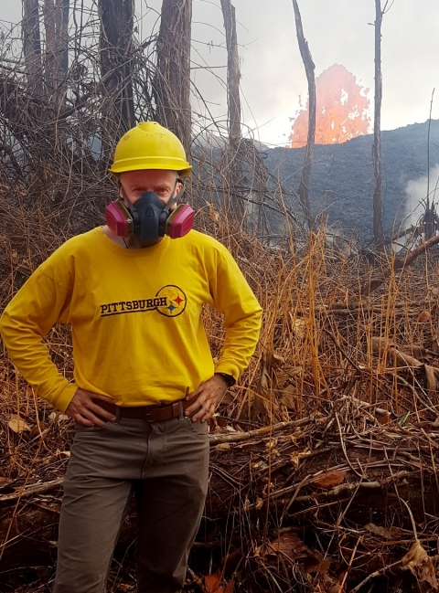
Dr. Mike Ramsey, Professor of Volcanology and Planetary Science, Department of Geology and Environmental Science, University of Pittsburgh, Pittsburgh, PA
Research interests: Thermal infrared spectroscopy and remote sensing applied to a variety of Earth and planetary surface processes, especially the study of active volcanoes using ASTER data.
Research highlights: According to legend, the Hawaiian goddess of fire, Pele, lives in the Halemaumau Crater at the summit of Kilauea Volcano on the Big Island of Hawaii. She is reported to take many forms, sometimes appearing as a white dog, an old woman, or a beautiful young woman. Her most common form, though, is that of lava pouring across the ground.
Like Pele, lava, too, takes different forms, including smooth, ropy pahoehoe (“pa-hoy-hoy”) and lumpy, rough a’a (“ah-ah”). Whether smooth or lumpy, all lava has one element in common—it is made from molten rock that can be hotter than 2,000 degrees Fahrenheit, according to the U.S. Geological Survey (USGS). This intense heat can be detected by instruments aboard Earth observing satellites. For volcanologist Dr. Mike Ramsey, these thermal data are a cornerstone of his work using infrared spectroscopy and remote sensing data in his studies of active volcanoes. He and his students currently are working at volcanoes in Guatemala (Fuego, Pacaya), Russia (Tolbachik), Hawaii (Kilauea), Italy (Etna, Stromboli), and Reunion Island (Piton de la Fournaise).
His current research focuses on understanding the spectral emissivity of volcanic products like lava. Emissivity is a unitless term that varies with wavelength between 0 and 1 and is based on the composition of an object. An object with high emissivity (closer to 1) is better able to radiate energy than an object with lower emissivity. The emissivity spectrum of a surface or a lava plume allows Ramsey to map its composition, particle size, and even micron scale roughness. He is particularly interested in the unique changes in emissivity from molten surfaces compared to their solidified counterparts. These changes reveal fundamental information about lava’s molecular structure and govern its radiant cooling. This information, in turn, can be used to improve eruption forecasting and for developing models that predict the path of lava flow.
A primary source of satellite-based instrument data used by Ramsey is the Advanced Spaceborne Thermal Emission and Reflection Radiometer (ASTER). ASTER is a partnership between NASA, Japan’s Ministry of Economy, Trade and Industry, the National Institute of Advanced Industrial Science and Technology in Japan, and Japan Space Systems (J-spacesystems), and is one of five instruments aboard the Terra Earth observing satellite (launched in 1999). The instrument obtains high-resolution images of Earth in 14 different wavelengths ranging from visible to thermal infrared. These data are used to create detailed maps of land surface temperature, emissivity, reflectance, and elevation. Ramsey is a member of the ASTER science team and uses ASTER’s unique moderately high spatial and spectral resolution in the instrument’s five thermal infrared (TIR) wavelength bands in his studies of active volcanoes. As of 2016, all ASTER data are available at no charge through the Land Processes Distributed Active Archive Center (LP DAAC).
A unique feature of ASTER is that the targeted instrument’s telescopes can be pointed to collect imagery and data at specific locations. Ramsey utilized this feature to create the ASTER Urgent Request Protocol (URP) system. The URP is a sensor web designed to rapidly detect new thermal activity and target ASTER to collect data of that activity. This sensor web uses satellite-based instruments such as the Moderate Resolution Imaging Spectroradiometer (MODIS) and the Advanced Very High Resolution Radiometer (AVHRR) coupled with ground-based sensors to detect areas of high thermal activity. When new activity is detected, this triggers a request for ASTER data collection at the location of the detected activity. The program was established in 2004 and has been fully functional in its current state since 2011. It now results in nearly one new ASTER image per day of global eruptive activity.
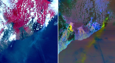
The URP system was used extensively during the recent eruption of Kilauea in Hawaii. As Ramsey notes, the triggering for ASTER imagery was almost immediate due to the intense thermal signature given off by the first presence of new lava from the eruption. Daily thermal alerts continued as lava was flowing from the volcano, and ASTER was targeted to acquire data at every possible opportunity. Because the lava radiance was so intense, a special request for off-axis pointing of ASTER’s Visible Near-Infrared (VNIR) subsystem also was used to increase the number of observations and to collect data at night. An analysis of these data by Ramsey and Dr. Vincent Realmuto at NASA’s Jet Propulsion Laboratory (JPL) in Pasadena, CA, shows that the sulfur dioxide (SO2) plume from the volcano is easily detected in the ASTER TIR data.
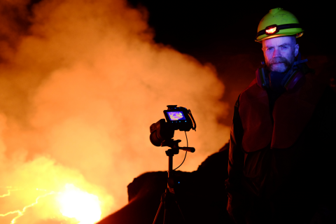
Ramsey also is using ASTER data to create continually updated thermal maps of the Kilauea eruption for scientists at the Hawaiian Volcano Observatory (HVO), which is part of the USGS Volcano Hazards Program. HVO scientists supplement ASTER observations with ground-based high resolution thermal video data collected through periodic helicopter flights over the lava flows. ASTER data are being compared with ground and helicopter-based multispectral TIR data from a new instrument developed by Ramsey to provide a better understanding of how the lava flow channels develop and to track the emissivity changes with time as the lava channels cool.
Through the use of ASTER data coupled with ground-based observations, Ramsey and his colleagues are gaining a better understanding of the physical processes governing molten rock. This knowledge is being applied to the development of better tools and instruments that enable scientists and public officials to deal more effectively with volcanic activity and allow homeowners to live more safely in these areas.
Representative data products used:
- ASTER data available through LP DAAC:
- Level 1BE Expedited Data Sets produced as part of the URP Project
- Level 2 products for retrospective analysis:
- AST_05: ASTER Surface Emissivity V003 (doi:10.5067/ASTER/AST_05.003)
- AST_07: ASTER Surface Reflectance VNIR and SWIR V003 (doi:10.5067/ASTER/AST_07.003)
- AST_07XT: ASTER Surface Reflectance VNIR and Crosstalk Corrected SWIR V003 (doi:10.5067/ASTER/AST_07XT.003)
- AST_08: ASTER Surface Kinetic Temperature V003 (doi:10.5067/ASTER/AST_08.003)
- AST_09: ASTER Surface Radiance VNIR and SWIR V003 (doi:10.5067/ASTER/AST_09.003)
- AST_09T: ASTER Surface Radiance TIR V003 (doi:10.5067/ASTER/AST_09T.003)
- AST_09XT: ASTER Surface Radiance VNIR and Crosstalk Corrected SWIR V003 (doi:10.5067/ASTER/AST_09XT.003)
Read about the research:
Reath, K.A., Ramsey, M.S., Dehn, J. & Webley, P.W. (2016). Predicting eruptions from precursory activity using remote sensing data hybridization. Journal of Volcanology and Geothermal Research, 321: 18-30. doi:10.1016/j.jvolgeores.2016.04.027
Ramsey, M.S. (2016). Synergistic use of satellite thermal detection and science: A decadal perspective using ASTER. In Harris, A.J.L., De Groeve, T., Garel, F. & Carn, S.A. (eds.), Detecting, Modelling and Responding to Effusive Eruptions, Geological Society, London, Special Publications, 426: 115-136. doi:10.1144/SP426.23
Ramsey, M.S., Harris, A.J.L. & Crown, D.A. (2016). What can thermal infrared remote sensing of terrestrial volcanoes tell us about processes past and present on Mars? Journal of Volcanology and Geothermal Research, 311: 198-216. doi:10.1016/j.jvolgeores.2016.01.012
For more information
- Advanced Spaceborne Thermal Emission and Reflection Radiometer (ASTER)
- ASTER Urgent Request Protocol (URP) system
- Moderate Resolution Imaging Spectroradiometer (MODIS)
- Advanced Very High Resolution Radiometer (AVHRR)
- Hawaiian Volcano Observatory (HVO)
- USGS Volcano Hazards Program
