In The Day After Tomorrow, a doom and gloom Hollywood film, buoys signal plunging temperatures in the North Atlantic Ocean, a symptom of a major current collapsing. Catastrophic storms ensue. Sea levels rise with the force of a bursting dam. A climatologist’s model proves true: the stalled current triggers an ice age. New York City plunges into a polar, subarctic freeze, and the Statue of Liberty disappears beneath hundreds of feet of snow, leaving only her torch of icicles visible.
Though the science in the film is flawed and the events exaggerated, scientists acknowledge that if enough freshwater dumps into the North Atlantic Ocean, the large-scale Atlantic Meridional Overturning Circulation that transports heat from the tropics to the North Atlantic could slow down and potentially lead to colder climate in Europe. The actual mechanisms behind the trigger are complex. To fully understand the intricacies of ocean circulation, researchers need to add a missing piece—salinity, or the saltiness of the ocean surface.

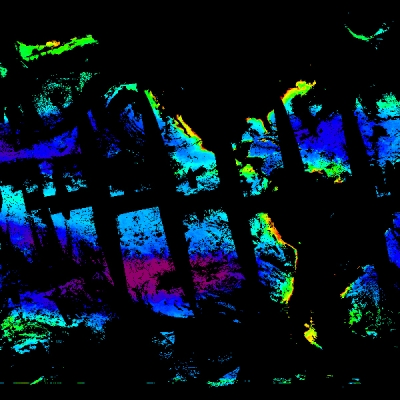
Ocean motion

“This is one of the untapped areas, looking at salinity across the globe,” said Michelle Gierach, a research scientist at NASA's Jet Propulsion Laboratory (JPL) in California. To measure sea surface salinity (SSS) from space with an accuracy equivalent to one-eighth teaspoon of salt per gallon of water, NASA and the Argentina Comisión Nacional de Actividades Espaciales (CONAE) launched the Aquarius/Satélite de Aplicaciones Científicas (SAC)-D mission in June 2011.
While 3.5 percent of Earth’s ocean is salt, freshwater added to the ocean dilutes salinity values. For example, strong rains across the equatorial Pacific from South American to Indonesia form a band of low salinity water. But warm areas with much evaporation and little precipitation increase salinity. So the atmosphere and ocean respire as one giant organism, exchanging breaths between seasons, even days. Within each breath is a redistribution of heat and salt.
With Aquarius launched, scientists hope to better monitor ocean currents and the global water cycle. “Understanding how water moves on this planet is really important,” said Jorge Vazquez-Cuervo, another JPL scientist on the study. Gierach added, “We’ve always had these views of what it should look like, but to now observe it and monitor it, that’s what’s really interesting to me.”
But Aquarius had limitations. No one expected it to pick up a salinity signal in marginal seas, seas partially enclosed by islands, archipelagos, or peninsulas, like the Mediterranean or the Gulf of Mexico. “We did not have high expectations for the quality of the signal near land because of land contamination and radio frequency interference,” Gierach said. The brightness of nearby land compared to the dark ocean would swamp the satellite signal, and given the waveband of Aquarius instruments, radio frequencies could interfere with satellite readings.

An added bonus
Still, Gierach wanted to try. More than half of the freshwater input in the Gulf of Mexico comes from the Mississippi River. If Aquarius could see this freshwater signal, scientists could better monitor how freshwater plumes affect these smaller seas. Gierach said, “We need to see how this discharge affects the regional system. Then we can see potential global implications.” In May 2011, the Mississippi flooded, becoming one of the largest and most damaging inundations in U.S. history. To save Baton Rouge and New Orleans, a spillway opened and drowned 4,000 square miles of rural Louisiana. Gierach combed the Aquarius data on the chance it had seen this surge of freshwater off the Louisiana coast.
“Aquarius picked up the signal, so that was a pleasant surprise,” Gierach said. But there was something else, the extent. “This wasn’t just something you saw one kilometer outside of New Orleans,” Vazquez-Cuervo said. “The effect traveled a thousand miles and hugged the Mississippi coast, down Florida, and almost the entire eastern part of the Gulf of Mexico. So that was surprising.”
But was the freshwater signal real? To check, Gierach turned to the European Space Agency’s (ESA) Soil Moisture Ocean Salinity Mission (SMOS), which also measures SSS, and the Moderate Resolution Imaging Spectroradiometer (MODIS) on NASA's Aqua satellite, from which biological activity at the sea surface can be inferred. Since river discharge carries higher concentrations of nutrients, it enhances biological activity. So MODIS served as a passive tracer of the freshwater plume. Both SMOS and MODIS validated Aquarius. What Gierach was seeing was real.
Gierach does not expect the Mississippi River discharge alone to have a significant global impact, but because Aquarius can read signals within marginal seas, scientists can look to other seas, then to other freshwater discharge events like floods, monsoons, and glacial and ice sheet melt. Reading these freshwater plumes may tell stories about what changing climate means for critical ocean circulation patterns. “That’s sort of unknown and very interesting, scientifically and societally. But it’s going to take a bit of time. Right now we only have approximately three years of data,” Gierach said.

The climate pendulum
Sea surface salinity values are saying something else about the ocean. “Currents have a different salinity structure than the surrounding environment, a gradient right at the current boundary that the satellite picks up,” Vazquez-Cuervo said. Shifts in salinity can disrupt these barriers, altering ocean circulation. “This seems basic but the reality is we know very little about salinity in the oceans and how it changes.”
Temperature and salinity govern seawater density, or its buoyancy. Density differences then drive deep-water currents, or thermohaline circulation, into a submarine river of warm and cold waters churning through the ocean. Ocean currents move heat poleward where heat is released into the atmosphere to maintain and regulate higher-latitude climate. As seawater freezes, it rejects salt, rendering the remaining seawater cold and salty, and thus, heavier and denser. But freshwater dumps, either from a change in rain patterns, glacial melt, or increased river runoff, would make the cold water less salty, thus less dense. This, in turn, could rattle the salinity component of thermohaline circulation, slowing down the sinking of dense water and the associated thermohaline circulation.

So to be able to finally capture salinity means scientists can monitor aspects of the thermohaline circulation. One set of combinations may swing the pendulum into a period of freeze, while another may trigger a melt. Though the exact formula is not fully understood, it is clear ocean circulation is a critical component. Aquarius adds the missing link, even if only on the surface because surface salinity measurements can still provide insight to what might happen at depth.
Take for instance the Gulf Stream, which hugs the U.S. East Coast and then branches off into the Northwest Atlantic. As it goes north, the waters cool and density increases. Further north, sea ice forms, pinching salt out of the ice and into surrounding waters. It consolidates. This more salt-laden, cold water sinks. Known as deep-water formation in the Northwest Atlantic, it moves around the globe, and then comes up in different places. But if over time temperatures warm and less sea ice sets, less sinking will occur, further affecting the global climate.
Salinity may not get the same news buzz as sea level rise. The impact of salinity is much more indirect. Gierach said, “If you change the overall ocean circulation, for example, slow down the thermohaline circulation, you’re not bringing as much warm water north or cold water south, so you’re changing temperature regimes, atmospheric regimes, weather patterns, but also the biology which adapts to certain environmental conditions.” Everything would be impacted. Ice may not encase the Statue of Liberty, but density shifts will alter climate as we currently know it.
References
Gierach, Michelle M., J. Vazquez-Cuervo, T. Lee, and V. M. Tsontos. 2013. Aquarius and SMOS detect effects of an extreme Mississippi River flooding event in the Gulf of Mexico. Geophysical Research Letters 40: 5,188–5,193, doi:10.1002/grl.50995.
NASA Physical Oceanography DAAC (PO.DAAC). 2011. Level 3 Sea Surface Salinity. Pasadena, California, USA.
NASA Ocean Biology DAAC (OB.DAAC). 2011. MODIS Level 3 Ocean Color Web. Greenbelt, Maryland USA.
For more information
NASA Ocean Biology Distributed Active Archive Center (OB.DAAC)
NASA Physical Oceanography DAAC (PO.DAAC)
NASA Moderate Resolution Imaging Spectroradiometer (MODIS)
| About the remote sensing data used | ||
| Satellites | Aquarius | Aqua |
| Sensors | Aquarius SAC_D | Moderate Resolution Imaging Spectroradiometer (MODIS) |
| Data sets | Level 3 Sea Surface Salinity | Level 3 Chlorophyll a |
| Resolution | 1.0 degree | 9 kilometer |
| Parameters | Sea surface salinity | Chlorophyll a |
| DAACs | NASA Physical Oceanography Distributed Active Archive Center (PO.DAAC) | NASA Ocean Biology DAAC (OB.DAAC) |
The image in the title graphic was cropped from a photograph of sea water. (Courtesy Jyi1693/Wikipedia)