In the winter of 1978, the merchant ship MS München set out across the Atlantic Ocean to deliver cargo to the United States. With a length of 200 meters (656 feet), the ship was one of the biggest ever built at the time and was designed to withstand intense storms and hurricanes. But on December 12 at 3 a.m., the München tapped out an S.O.S. Though nearly a hundred ships and planes combed the Atlantic, the München was never found. It was concluded that an “unknown weather-related event” caused its disappearance. Whatever the event, it was extreme.
Powerful weather systems like hurricanes generate ocean swell, which spawns waves that roll out over great distances. When rolling waves collide with surface waves, they create what scientists call very extreme sea states, the kind that scuttle ships and destroy derricks. Meteorologist Val Swail and his late colleague, meteorologist Vincent Cardone, wanted to predict these very extreme sea states. If they could identify where and when heavy weather caused high seas, they might be able to prevent catastrophes like the sinking of the München.

A sea change
After the München’s demise, many speculated that a rogue wave, a monstrous wave that appears out of nowhere, was to blame. Though somewhat controversial, scientists have recently defined a rogue wave as roughly twice as high as the surrounding waves. In a very extreme sea state, where waves reach at least 14 meters (46 feet), a rogue wave could crest at nearly 28 meters (92 feet). Yet because they are inherently difficult to measure, there are only a handful of measurements of such waves in high seas.
“Rogue waves are the needle in the haystack,” Swail said. “You need to be either really unlucky to encounter one, or really lucky to measure one.” Instruments on the Draupner E oil platform in the North Sea captured a 25.6 meter (84.0 foot) wave in 1995. “But most rogue waves actually occur in quite low sea states where the average waves are two meters. So you get one that’s four meters,” Swail said. “For an oil platform that got 46 feet last week, who cares. Yes it’s a rogue wave, but not an impactful one.” Researchers have found that very extreme sea states, not rogue waves, destroy most ships and structures at sea.
As early as the 1960s, Cardone had been searching for new ways to measure extreme sea states. With a team at New York University, he developed the first spectral wave model, a mathematical model that attempted to predict how waves interact at different frequencies. The team created the model for the U.S. Navy using real-time wind and storm data from reconnaissance flights and other naval programs like the Joint Typhoon Warning Center (JTWC). For the first time, forecasting the sea state became possible.
That model not only made Navy operations safer; it helped build more seaworthy oil and gas rigs. The experience led Cardone, a former research scientist and professor, to co-found a company called Oceanweather based on providing ocean wind and wave forecasting data. Andrew Cox, president of Oceanweather, said, “Way back, if you wanted to do structure design, you looked at very extreme sea state data and maps and took an educated guess of what the wave climate would look like. This was a fundamental change in how things were done.”

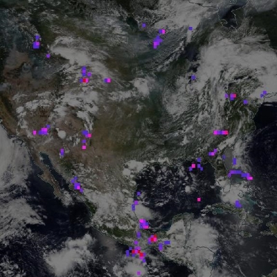
Model data
Then, in 1982, an oil rig off the Atlantic coast of Canada was pummeled by 190-kilometer-per-hour (100-knot) winds and waves up to 20 meters (65 feet) high. All eighty-four people on the rig died. Five more deadly oil rig accidents occurred before 1990, underscoring the need for more reliable models. Swail and Cardone found that their models performed poorly above 12 meters (40 feet). “There was something missing,” Swail said. “So we said let’s find a data set that can validate the models and get them to perform in these extreme cases.”
One thing they were missing was better wave data. Measuring wave heights over the open ocean is challenging even today. Mariners have traditionally reported their observations of wave heights to the National Weather Service (NWS), but these are fairly subjective. Wave recorders mounted on ships and buoys also have their limits. Cardone’s colleagues found that the recorders on ships are only reliable for waves up to 9 meters (30 feet), and buoys are moored along coasts, far from the open ocean.
Satellites soon provided a better way to gather wave data, but there was one drawback: the many different algorithms used in processing made the data unwieldy. GlobWave, a database of altimeter data from seven satellites, solved this problem. It applied a single algorithm to the data from all satellites. Radar altimeter measurements from Poseidon/TOPEX and Jason-1, available at NASA's Physical Oceanography Distributed Active Archive Center (PO.DAAC), were used to build the database. They finally had a consistent record of extreme wave data, and it validated their models.

Separating truth from tale
When they combined that record with a global wave model from Oceanweather called GROW2012, the results confirmed their suspicions. The model spanned thirty-three years and included wind and wave data from many sources, such as satellites, visual observations, buoys, and wave recorders. “We saw things that surprised some people, but they weren’t that surprising to us,” Swail said.
With GlobWave, they sorted through more than 5,000 instances of extreme sea conditions where waves were higher than 12 meters (39 feet). They found the highest average waves were more than 18 meters (59 feet) and occurred in the North Atlantic and North Pacific oceans, with more than twice the number occurring in the North Atlantic. Just three had a peak slightly higher than 20 meters (66 feet). In the Southern Ocean, where sailors have dubbed the latitudes from 40 to 70 degrees south the “Roaring Forties,” “Furious Fifties,” and “Shrieking Sixties” due to high winds and large waves, only three peaks were higher than 18 meters (59 feet).
“We were able to verify that the average wave climate in the Southern Ocean is higher, but the extreme wave climate is not as severe as the North Pacific or even parts of the Pacific,” Swail said. They also verified something ship builders have long known. Swail said, “Because of the land masses to the west and the strong storm formation there, the North Atlantic is the most extreme wave climate in the world.” For more than a century, in fact, ship design classification societies have used visual observations from the North Atlantic as the basis for design.
Ship rerouting

Still, the question remained: What was the risk that a vessel like the München would encounter catastrophic waves? Cardone called on Henry Chen, a researcher at Jeppesen Marine. Like Cardone, Chen routed ships for a living. Together they created a software program called TowSim. Cox said, “TowSim simulates a ship leaving a port every three or six hours and, as it travels on its route, it picks up global wind and wave information from GROW2012. So we’ll get companies towing large structures who need to know what the conditions are along the route.”
With TowSim, their research showed that the probability of sea states to cause catastrophic damage over thirty-three years is surprisingly small. On average, a ship could be exposed to extreme sea states for only about three hours on six of the nine routes and up to ten hours on two of the routes, they found.
They also noted that the chances that seas would swell to make monster waves were highest in the North Atlantic and North Pacific during winter, especially December, putting the München in exactly the wrong place and time. The most treacherous routes were along the great circle between the midsection of U.S. East Coast and the entrance to English Channel, and from Yokohama to Seattle.
Their work has made ship routing safer, and it has become the basis for structure design in the offshore oil and gas industry. Perhaps most importantly, it has advanced very extreme sea state modeling so more improved models can follow. Cox said, “We can now test our models in these most extreme storms to make sure the physics are appropriate all the way up into the high extent that we can measure.”
References
Cardone, V. J., B. T. Callahan, H. Chen, A. T. Cox, M. A. Morrone, and V. R. Swail. 2015. Global distribution and risk to shipping of very extreme sea states (VESS). International Journal of Climatology 35(1): 69–84, doi:10.1002/joc.3963.
JASON-1. 2008. Jason-1 Altimeter Geophysical Data Record (GDR) NetCDF. Ver. 1. PO.DAAC, CA, USA.
NASA/JPL/PODAAC. 1998. TOPEX/POSEIDON Altimeter Merged Geophysical Data Record Generation B. Ver. B. PO.DAAC, CA, USA. doi:10.5067/TPMGD-BIN0B.
For more information
NASA Physical Oceanography Distributed Active Archive Center (PO.DAAC)
| About the remote sensing data | ||||
| Satellites | TOPEX/Poseidon | Jason-1 | ||
| Sensors |
TOPEX-A |
Poseidon 2 Radar Altimeter | ||
| Data sets | Level 2 TOPEX/Poseidon Altimeter Merged Geophysical Data Record Generation B (MGDR-B) | Level 2 Altimeter Jason-1 Geophysical Data Record (J1 GDR) | ||
| Resolution | 11.2 kilometer (Along-track) x 5.1 kilometer (Across-track) | 11.2 kilometer (Longitude) x 5.1 kilometer (Latitude) | ||
| Parameters | Significant Wave Height | Significant Wave Height | ||
| DAACs | NASA Physical Oceanography Distributed Active Archive Center (PO.DAAC) | NASA PO.DAAC | ||