Dr. Faisal Hossain; Professor, Department of Civil and Environmental Engineering, University of Washington, Seattle, WA
Research interests: Using remotely-sensed data to address challenges of limited water, food, and energy resources in South and Southeast Asia with the overall goal of accelerating economic development in these regions.
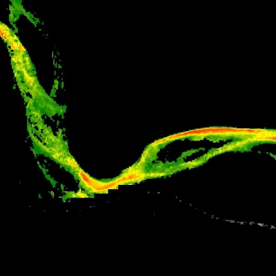
Research highlights: The Indus River begins its journey to the sea on a glacier near a sacred Tibetan mountain that is not to be climbed. The trickle of melting snow and glacial ice broadens and picks up speed as it flows northwestward through Tibet and into India, where it forms the westernmost river system in the Indian Subcontinent. The river turns south, and its path through Pakistan can easily be traced as a dark, greenish strip running the length of the country until it finally transitions into a broad delta where it empties into the Arabian Sea.
The Indus River basin spans more than one million square kilometers, and crosses the borders of China, India, Afghanistan, and Pakistan. For Dr. Faisal Hossain, the importance of the Indus River is not just the four countries it touches, but the approximately 300 million lives it touches. Having been born and spent part of his childhood in Southeast Asia, another vast region heavily dependent on water resources, Hossain experienced firsthand how a lack of information about water resources and a lack of access to Earth science data can make a country less resilient to natural or human-created vulnerabilities.
Now, as a professor of civil and environmental engineering at the University of Washington, he uses remotely-sensed Earth observing data as an integral resource in his work helping developing nations in South and Southeast Asia address challenges of limited water, food, and energy against a backdrop of accelerated economic development. Hossain uses satellite data from numerous NASA and international missions in his work. Data from many of these missions are available through NASA’s Earth Observing System Data and Information System (EOSDIS), particularly NASA’s Physical Oceanography Distributed Active Archive Center (PO.DAAC), which archives and distributes NASA EOSDIS hydrologic data along with physical oceanographic data.
Hossain’s projects are undertaken primarily through his Sustainability, Satellites, Water, and Environment Research Group, which is located at the University of Washington. These projects are designed to foster better, more efficient use of water resources that can help improve the livelihoods of people dependent on freshwater systems across Asia. For work across such a broad swath of Earth, the spatial range of satellite data are an invaluable resource.
The Indus basin is a key example of a developing area experiencing the challenges Hossain and his colleagues are working to address. According to the United Nations Office for Disaster Risk Reduction, the region is one of the most important river basins in the world in terms of human dependence, with a high population density relying on the river’s water for uses including drinking, agriculture, and hydroelectric power. The resources provided by the river play a vital role in the economic development and environmental health of the region, but, as noted by the World Bank, population growth, urbanization, and climate change are exacerbating the basin’s already stressed natural resources.
As Hossain observes, Pakistan is a country that does not have a comprehensive in situ groundwater monitoring network. Using water mass data acquired from the joint NASA/German Aerospace Center Gravity Recovery and Climate Experiment (GRACE, operational 2002 to 2017), Hossain and his research group developed techniques to help the government of Pakistan overcome costly groundwater management challenges in an area impacting more than 100 million residents. The project team plans to use similar water mass data from the joint NASA/German Research Centre for Geosciences GRACE-Follow On (GRACE-FO) mission (launched in 2017) to further improve irrigation efficiency for growing staple crops like rice and wheat.
In another project in Pakistan, Hossain and his group used data from the joint NASA/Japan Aerospace Exploration Agency Global Precipitation Measurement Core Observatory (GPM, launched in 2014), the Moderate Resolution Imaging Spectroradiometer (MODIS) instrument aboard NASA’s Aqua satellite (launched in 2002), and instruments aboard the joint NASA/USGS Landsat series of satellites to develop a satellite-based irrigation advisory text messaging system designed to conserve water and improve crop yield. From an initial pilot-scale test involving 700 farmers, the success of this system enabled its expansion to 10,000 farmers in early 2017 and to 100,000 farmers in 2018. Through the application of satellite data and numerical weather models, crop water demand is now estimated for all of Pakistan using evapotranspiration estimation methods at nowcast and forecast scales that are available to farmers through text messaging.

For farmers receiving these irrigation advisories, this system has helped conserve approximately 2.5 cubic kilometers of groundwater per 100,000 farmers per year, and has doubled the annual income of farmers receiving these alerts through increases in crop yield. With the anticipated integration of GRACE and GRACE-FO data to detect regions where groundwater is being rapidly depleted, Hossain plans to increase the efficiency of the advisory system by providing targeted alerts to individual farmers in areas facing greater groundwater shortages.
The success of the satellite-based irrigation advisory system in Pakistan enabled its expansion to roughly 1,000 farmers in India and 150 farmers in Bangladesh. Evaluations of the impact of these pilot systems reveal tremendous savings of irrigation water in Northern India along with increases in wheat yield.
Hossain’s applied research using precipitation data from GPM and altimeter data from the joint NASA/French Space Agency Ocean Surface Topography Mission (OSTM)/Jason-2 and Jason-3 missions contributed to the development of a flood forecasting system that is currently serving over 80 million people in Bangladesh. Recently, this forecasting scheme evolved to one based on global numerical weather prediction (NWP) forecasts using the NOAA Global Forecast System. Hossain’s group developed an improved forecasting technique that can save approximately 5 to 10 hours each day of computer processing time while extending flood lead time by an extra five days.
In Southeast Asia, Hossain and his colleagues have applied their work using satellite-based observations to improving water management along the Mekong River. The Mekong River basin supports the livelihood of more than 60 million people as it flows through China, Myanmar, Laos, Thailand, Cambodia, and Vietnam. The many dams and reservoirs along the river create a myriad of socio-environmental challenges. While these reservoirs and dams provide hydropower generation, flood control, irrigation, and water supply, Hossain points out that they also alter river flow, contribute to thermal pollution, and limit the transport of sediments, nutrients, and biota.

In a recent research project partially supported by a NASA Applied Sciences grant, Hossain and his colleague, Dr. Matthew Bonnema, combined satellite observations with physical models using satellite-based data to infer the residence time of water in non-gauged reservoirs along the Mekong River. The research team defines residence time as a measure of the time delay between when water enters a reservoir and when it is released by human operating decisions. The team used a combination of satellite-derived radar altimetry-based water surface elevations from the OSTM/Jason-2 satellite and spectral (visible) band‐based water surface area data acquired from instruments aboard the Landsat series of satellites. Hossain and Bonnema conclude that remotely-sensed satellite data can help the science community better understand the potential impacts of extensive reservoir construction in the developing world, where accurate gauging stations may be limited. This, in turn, will help improve water management, planning decisions, and reservoir operations for stakeholders of the basin.
Meanwhile, snow still falls near the sacred mountain in Tibet that is not to be climbed, and slowly makes its way to the sea. Through the use of NASA Earth observing data, Hossain and his colleagues are helping ensure that the economic, social, and environmental benefits to the people dependent on this water will continue to increase.
Representative data products used:
- Available through NASA’s PO.DAAC:
- JPL GRACE/GRACE-FO Gridded-AOD1B Water-Equivalent-Thickness Surface-Mass Anomaly RL06 dataset for Tellus Level-3 1.0-degree grid (short name: GRC-GFO_GRIDDED_AOD1B_JPL_1-DEG_RL06; doi:10.5067/GGAOD-3GJ60)
- OSTM/Jason-2 and Jason-3, various altimetry data products
- MODIS Land Cover Type (MCD12Q1; doi:10.5067/MODIS/MCD12Q1.006); available through NASA’s Land Processes DAAC (LP DAAC)
- GPM Integrated Multi-satellitE Retrievals for GPM (IMERG) data; available through NASA’s Goddard Earth Sciences Data and Information Services Center (GES DISC)
- Sentinel-1 synthetic aperture radar (SAR) imagery; available through NASA’s Alaska Satellite Facility DAAC (ASF DAAC); NASA’s provision of the complete European Space Agency (ESA) Sentinel-1 SAR data archive through the ASF DAAC is by agreement between the U.S. State Department and the European Commission (EC)
- Landsat Thermal Infrared Sensor (TIRS) and visible data; available through the USGS EarthExplorer online search, discovery, and ordering tool
Read about the work and research:
Ahmad, S.K. & Hossain, F. (2020). Maximizing Energy Production from Hydropower Dams using Short-Term Weather Forecasts. Renewable Energy, 146: 1560-1577. doi:10.1016/j.renene.2019.07.126
Bonnema, M., Hossain, F., Nijssen, B. & Holtgrieve, G. (2020). Hydropower’s Hidden Transformation of Rivers in the Mekong. Environmental Research Letters, 15(4). doi:10.1088/1748-9326/ab763d
NASA Global Precipitation Measurement. (2020). Guiding Farmers with NASA Satellites. NASA’s Goddard Space Flight Center in Greenbelt, MD. Available online (video).
NASA Global Precipitation Measurement. (2020). Q&A with Faisal Hossain. NASA’s Goddard Space Flight Center in Greenbelt, MD. Available online (video).
Biswas, N., Hossain, F., Bonnema, M., Okeowo, M.A. & Lee, H. (2019). An Altimeter Height Extraction Technique for Dynamically Changing Rivers of South and South-East Asia. Remote Sensing of Environment, 221(2019): 24-37. doi:10.1016/j.rse.2018.10.033
Eldardiry, H. & Hossain, F. (2019). Understanding the reservoir operating rules in the transboundary Nile River Basin using macroscale hydrologic modeling with satellite measurements. Journal of Hydrometeorology, 21(11): 2253-2269. doi:10.1175/JHM-D-19-0058.1
Hossain, F., Bonnema, M., Biswas, N., Ahmad, S., Duong, B. & Luong, N. (2019). When Floods Cross Borders, Satellite Data can Help. Eos, 100. doi:10.1029/2019eo115775
Sikder, S., Hossain, F. & Green, D. (2019). Faster Flood Forecasting to Improve Responses. EARTH Magazine, American Geosciences Institute, February 2019. Available online (link).
Bonnema, M. & Hossain, F. (2017). Inferring reservoir operating patterns across the Mekong Basin using only space observations. Water Resources Research, 53(5): 3791–3810. doi:10.1002/2016wr019978
Hossain, F., Shum, C.K., Turk, F.J., Biancamaria, S., Lee, H., Limaye, A., Hossain, M., Shah-Newaz, S., Mazumder, L.C., Ahmed, T., Yigzaw, W. & Siddique-E-Akbor, A.H.M. (2014). A Guide for Crossing the Valley of Death: Lessons Learned from Making a Satellite based Flood Forecasting System. Bulletin of American Meteorological Society (BAMS), 95(8): 1201-1207. doi:10.1175/BAMS-D-13-00176.1