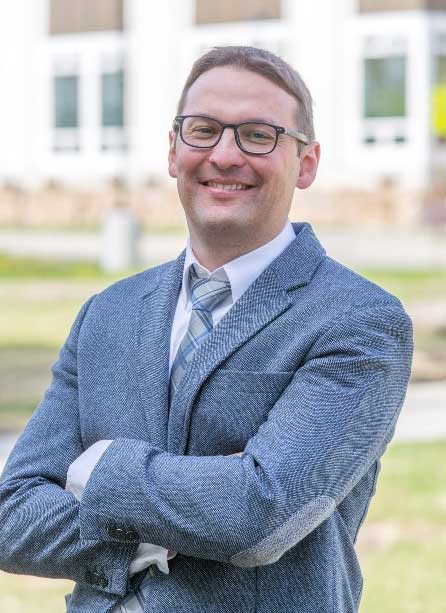
The Alaska Satellite Facility at the University of Alaska Fairbanks is the home of NASA’s Alaska Satellite Facility Distributed Active Archive Center (ASF DAAC). ASF DAAC is one of NASA’s Earth Observing System Data and Information System (EOSDIS) Distributed Active Archive Centers (DAACs), and is responsible for processing, archiving, and distributing synthetic aperture radar (SAR) data. For Dr. Franz Meyer, ASF Chief Scientist and an associate professor at the University of Alaska Fairbanks Geophysical Institute, SAR is on the verge of entering an exciting new phase of development.
For more information about SAR, interferometric synthetic aperture radar (InSAR), and SAR technology, check out the ASF "About SAR" webpage.
Why is now an interesting time in SAR and SAR technology?
I’m quite excited about my job right now because I think we’re truly seeing the migration of SAR from a laboratory environment to more of an operational, production phase. We may be witnessing a similar transition in SAR that we saw in GPS technology 20-30 years ago, where that technology moved from being experimental to a globally accepted service.
What does this mean for SAR data users?
A lot of things have happened in just the past few years in the SAR community. We have new sensors that are better in providing large-scale data sets with high resolution. We also have systems with more frequent acquisitions, such as Sentinel-1A, which monitors the entire globe over a routine pre-defined period. For most areas in the U.S., we know we have an acquisition every 24 days.
We also have SAR data sets that are affordable. NASA has provided open access to its data for a very long time, but it has been rare to find free and open access to radar data. Sentinel-1A is one of the first globally observing data sets that has a free and open data policy. We have future players in the SAR data market emerging, such as the NASA-Indian Space Research Organisation Synthetic Aperture Radar (NISAR) mission. NISAR will provide high resolution [images], very reliable high-frequency repeat, and free and unrestricted data access.
There also is a rise in the amount of community tools to extract information from SAR data. We are trying hard to work with the groups creating these tools to come up with standardized looks, feels, and training. We are quickly working toward a “radar for the masses” model, and a broader acceptance of this technology by the community through our attempts to make these data more accessible to people who are not radar experts. Overall, we are seeing a change from providing data, which is what we mostly did in the past, to providing what I would call information.
What do you mean when you say a shift from providing data to providing information?
Let me reference GPS again. In the GPS world, individual observations made by a GPS receiver are what I would call “data.” To the end user, these data are not particularly useful. Instead, the GPS user is interested in position and motion “information”—where am I, how fast am I going. This information is derived from these original data. So, “information” for me is a geophysical parameter that is available in geographic coordinates and is easier to interpret by the end user.
The SAR community has traditionally focused on the distribution of data, mostly in the form of hard-to-interpret complex matrices. Only recently has the community started to provide information layers along with these data. At ASF, we are providing SAR images fully geocoded, in meaningful radiometric quantities, and in easy to use GeoTIFF formats. This helps move our products much closer to the “information” domain and helps improve the user experience.
You mentioned the NASA and Indian Space Research Organisation (ISRO) joint NISAR mission, which is scheduled for launch in 2020. How will this affect NASA, ASF, and the SAR community?
For one, ASF was just announced as the DAAC for NISAR. This is wonderful for us! ASF will be the curator of the NISAR data sets and provide access to these global archives. NISAR will benefit from NASA’s forward thinking data policy. NASA has always been on the leading edge when it comes to free and open data policies, and we have learned how beneficial open data access is for the acceleration of research. I’m sure that with NISAR there will be an acceleration in the development of SAR technology leading to the broadening of the user community.
I think NISAR will be a game changer by providing full global coverage with Interferometric SAR (InSAR)-capable image data about every 12 days. For certain areas, NISAR will also provide value-added products like deformation maps that will be processed operationally by either the NISAR project or ASF DAAC. Also, NISAR will provide L-band microwave data, which is a frequency that provides a lot of bang for the buck and can be used in many scientific disciplines.
What makes L-band radar so much better?
Overall, L-band systems are among the most flexible radar systems available. The longer wavelengths of L-band allow for deeper penetration into - or through - vegetation canopies, which improves the sensor’s ability to characterize both vegetation and surface properties. L-band also comes with improved abilities to measure surface deformation over large areas and long time scales. This means that L-band sensors are generally better at describing geodynamic processes such as earthquakes, volcanoes, sea and land ice motion, and permafrost decay.
Along with SAR data from the Sentinel-1A and upcoming NISAR missions, what other services does ASF DAAC provide to data users?
ASF DAAC has a 25-year archive of SAR data sets from many historic and ongoing missions. Besides being NASA’s DAAC for SAR data, ASF is also interested in broadening its user base by pioneering new data products and by improving how we distribute SAR data to the world. Our goal is to not only serve traditional SAR data users, but also grow this user base and attract new communities to SAR that may not have used these data before.
For example, we recently took the entire archive of Advanced Land Observing Satellite (ALOS-1) Phased array L-band synthetic aperture radar (PALSAR) data, which was a Japan Aerospace Exploration Agency mission flying from 2006 to 2011, and turned them into geo-coded and radiometrically terrain corrected images. Now all these images are provided as easy to use GeoTIFF layers. You can go in to our Vertex search engine, find the images you need, and load them right into your GIS system.
As I noted, ASF now provides access to Sentinel-1A SAR data. In fact, we are one of only two data providers for Sentinel-1A along with the European Space Agency. The ASF Sentinel-1A archive will host a complete collection of every Sentinel-1A image from the first image to the last photon collected by the mission.
To facilitate InSAR users, ASF developed an ad hoc InSAR service. If an earthquake above a certain magnitude occurs, our InSAR processing routines kick off and produce deformation maps. Interested users can work with us to get access to processed InSAR data for specific areas. For example, we currently work with the volcano hazard community here in Alaska and with colleagues in Arizona who are interested in deformation maps related to groundwater pumping.
Tell me a little about your outreach efforts
We outreach to communities through training and workshops, such as to the Transportation Research Board (TRB). For example, at the TRB Annual Meeting workshop [this past January], we tried to show applications of SAR technology to the specific needs of this community.
We also try to show cost-benefit analyses at these targeted workshops. This is fascinating to me. It’s always difficult to show that when you pull in a new technology, you actually can save money. The fact that [an economist working for the Virginia Department of Transportation] was able to show that if you use InSAR technology, there are cases where we can show you mathematically that you will save money—this is amazing!
This sounds like a lot of activity in the SAR community
I really believe that a lot is happening in the SAR community right now and that in a few years the SAR landscape is going to look quite different.
Read more about Franz in a SAR Scientist Highlight on the ASF DAAC homepage.


