Hannah Barnes remembers the day she saw it spawning. She was sitting in a shipping container, under a radar, on a tiny island in the Indian Ocean. “There was a lot of rain and low, gray clouds. But it wasn’t anything huge,” she said. “I’m from the Midwest, so it just reminded me of a fall storm.” Barnes, however, knew that the gray weather would grow into a cluster of storms more than 6,000 miles across. This armada of tall clouds would move eastward, bringing its fields of wind, humidity, and temperature. “The clouds and storms die out when they get to the dateline,” Barnes said. “But in the upper atmosphere, a signal remains and that signal propagates around the globe.”
Barnes was witnessing a massive atmospheric disturbance called the Madden-Julian Oscillation (MJO) brewing right above her and her colleagues. The MJO signal, a mélange of intense atmospheric convection, air pressure, and wind, is so strong that it can spike rainfall in the South Asian and Australian monsoons and increase the number of violent tornado outbreaks in the United States. It also interacts with other large atmospheric patterns, such as the El Niño Southern Oscillation and the North Atlantic Oscillation. Understanding it could improve long-range weather forecasts and enable scientists to further refine computer models of global climate. But scientists do not know much about the MJO and its signal, especially how and why it spawns every thirty to sixty days over the Indian Ocean. Researchers like Barnes think that important clues can be found in the massive expanse of convective clouds that help power the disturbance across the globe.
")
The size of Arkansas
Barnes’ mentor, Robert A. Houze, Jr., a professor at the University of Washington and an expert in cloud dynamics, was probing expansive groups of extremely tall convective clouds called mesoscale convective systems. “It’s when a thunderstorm grows to a very large size, like the size of the state of Arkansas, for example,” Houze said. These cloud systems bring heat and moisture from Earth’s surface high and deep into the colder upper atmosphere. And because they are so big, they release a lot of precipitation. “All that water that falls out as rain also heats the atmosphere,” Houze said. “These huge cloud systems are important elements in atmospheric heat exchange.”
In an earlier study, Houze and fellow researcher Jian Yuan found that the cloud systems are associated with 56 percent of rainfall in the tropics. So Houze suspected they played an important role in the MJO. However, both phenomena are so enormous that they are difficult for scientists to measure and observe. “The clouds propagate such a large area,” Barnes said. “It’s not like a hurricane or a tornado where you can send probes and aircraft, and profile a good portion of the event.”
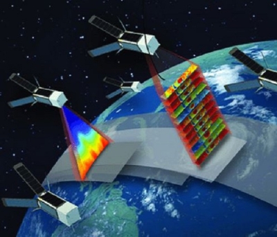
Houze enlisted Yuan to look at satellite data along a swath in the tropics, between the MJO’s spawning grounds in the Indian Ocean and where it dissipates just beyond Fiji and Tonga in the Pacific Ocean. “We wanted know more about the population, organization, and structure of deep convective cloud systems in the region, specifically those associated with the MJO,” said Yuan, now a professor of atmospheric sciences in Nanjing University. “Satellite remote sensing was perfect for this because it could see what in situ instruments could not.”
Seeing superclusters
Yuan used cloud data from the Moderate Resolution Imaging Spectroradiometer (MODIS) on the NASA Terra and Aqua satellites to pick out cloud tops that exceeded a certain degree of coldness and breadth—the colder the cloud top, the taller the cloud and the deeper the convection. He also pored through precipitation data from the Advanced Microwave Scanning Radiometer - Earth Observing System (AMSR-E) sensor on the Aqua satellite to tease out the size, intensity, and structure of each cloud system’s rainfall pattern.
The researchers found that deep, convective cloud systems in the Indo-Pacific region occurred in a pattern consistent with the eastward propagation of the MJO. They also discovered new information about how the clouds behave in the region when the MJO is present. Over continents, they tended to occur in small, separate clusters; over island regions, they occurred as large, separate clusters; and over open ocean, they merged into connected superclusters.
Houze and Yuan’s cloud catalogue of sorts was only possible because they had access to remote sensing data. “You would not be able to recognize this just from casual observations in just one place. But with the satellites we have the same measurement tool flying over the whole Earth and we were able to compare these behaviors from one region to another. So from basically knowing nothing, we pretty much got the whole picture now.” In the late 1980s, Japanese scientist Tetsuo Nakazawa hypothesized—based on his field observations—that convective cloud systems converged into superclusters. “He talked about superclusters forming over the west Pacific where the ocean is very warm. These clouds were larger than anybody really suspected,” Houze said. “We think that those we saw over the western Pacific Ocean are probably the same thing that Nakazawa saw.”

The MJO hallmark
The study, however, revealed a limitation in using MODIS data. Although the sensor could tell researchers whether a certain cloud was a deep convective cloud, it could not accurately distinguish between different kinds of convective clouds. For example, it could not separate the tall convective cloud towers from the broad, stratiform clouds within a mesoscale convective system, and this was crucial in finding out if the cloud systems and the MJO were connected.
“The stratiform region is the part of a mesoscale convective system that is extremely broad and wide,” Barnes said. “If you think of a squall line coming over you, the stratiform clouds are the lighter rain that follows after the heavy precipitation passes.” According to Barnes, these stratiform clouds produce a lot of heating in the middle of the atmosphere. “It’s that heating that is thought to have a large role in affecting weather far away,” Barnes said.
Houze worked with Barnes to replicate Yuan’s study, this time using precipitation radar data from the Tropical Rainfall Measuring Mission (TRMM), which could better distinguish cloud types. “The results were very consistent,” Houze said. “It was easier to see the difference in the cloud populations in the different parts of the MJO using TRMM, but Jian and Hannah’s studies told the same story.”
Furthermore, the researchers found that large, stratiform regions changed the most when the MJO was present. Barnes said, “Whether you are looking in the Indian Ocean or the western Pacific, when the MJO passes through you get a lot more of these clouds. What is the hallmark of the MJO? How do you know it’s there? It is when you find these large stratiform regions.”
Hotter up there

To Houze, this hints that the massive convective cloud systems play an important role in the formation of the MJO. “In these systems, more than 40 percent of the precipitation falls from the stratiform region. As it comes down, it evaporates, and actually cools the lower part of the atmosphere,” Houze said. “The upper atmosphere is being heated disproportionately compared to the lower part of the atmosphere,” Houze said. “And this affects the nature of the MJO.”
Such an unusual heating profile is strong enough to affect larger scale atmospheric circulation. The findings are valuable because scientists do not have a good handle on what sort of atmospheric mechanisms determine the organization and upscaling of deep convection. Their work will help climate modelers better reproduce MJO features in global circulation models.
“This MJO is a very large scale circulation feature which involves multiple scales of motions. You can get the behavior of the MJO incorrect if you assumed that all of the heating was going on in smaller convective clouds and not in the mesoscale convective systems,” Houze said. “Getting these heating profiles correct in the tropical atmosphere is a very important problem to solve.”
References
Barnes, H. C., and R. A. Houze, Jr. 2013. The precipitating cloud population of the Madden-Julian Oscillation over the Indian and West Pacific Oceans. Journal of Geophysical Research 118: 6,996–7,023, doi:10.1002/jgrd.50375.
Houze, R. A., Jr. “Global variability of intense convection.” Department of Atmospheric and Oceanic Sciences Distinguished Lecture, University of Colorado Boulder, October 25, 2013.
Houze, R. A., Jr. 2012. Orographic effects on precipitating clouds. Reviews of Geophysics 50 (RG1001), doi:10.1029/2011RG000365.
NASA Goddard Earth Sciences Data and Information Services Center (GES DISC) 2000. TRMM 2A-23 and 2A-25 products. Greenbelt, Maryland USA
NASA Level 1 and Atmosphere Archive and Distribution System (LAADS) Distributed Active Archive Cetner (DAAC). 2003. MODIS Level 2 Cloud Product. Greenbelt, Maryland USA
Adler, R., T. Wilheit, Jr., C. Kummerow, and R. Ferraro. 2004. AMSR-E/Aqua L2B Global Swath Rain Rate/Type GSFC Profiling Algorithm. Version 2. Boulder, Colorado USA: NASA DAAC at the National Snow and Ice Data Center, doi:10.5067/AMSR-E/AE_RAIN.002.
Yuan, J., and R. A. Houze, Jr. 2013. Deep convective systems observed by A-Train in the tropical Indo-Pacific region affected by the MJO. Journal of the Atmospheric Sciences 70: 465–486, doi:10.1175/JAS-D-12-057.1.
Zhang, C. 2013. Madden–Julian Oscillation: bridging weather and climate. Bulletin of the American Meteorological Society 94: 1,849–1,870, doi:10.1175/BAMS-D-12-00026.1.
For more information
NASA Goddard Earth Sciences Data and Information Services Center (GES DISC)
NASA Level 1 and Atmosphere Archive and Distribution System Distributed Active Archive Center (LAADS DAAC)
NASA National Snow and Ice Data Center DAAC (NSIDC DAAC)
Advanced Microwave Scanning Radiometer - Earth Observing System (AMSR-E)
Moderate Resolution Imaging Spectroradiometer (MODIS)
Tropical Rainfall Measuring Mission (TRMM)
Dynamics of the Madden-Julian Oscillation (DYNAMO)
| About the remote sensing data | |||
| Satellites | Aqua | Aqua | Tropical Rainfall Measuring Mission (TRMM) |
| Sensors | Moderate Resolution Imaging Spectroradiometer (MODIS) | Advanced Microwave Scanning Radiometer - Earth Observing System (AMSR-E) | Precipitation Radar |
| Data sets | Cloud Product MYD06_L2 | Level 2B Global Swath Rain Rate/Type GSFC Profiling Algorithm, Version 2 | Orbital 3 Radar Rain Characteristics
Orbital 5 Radar Rainfall Rate and Profile |
| Resolution | 1 kilometer and 5 kilometers at nadir | 5.4 kilometers | 5 kilometers |
| Parameters | Cloud top | Rain type (convective or stratiform) | Rainfall rate, rainfall profile, rainfall characteristics |
| DAACs | NASA Level 1 and Atmosphere Archive and Distribution System Distributed Active Archive Center (LAADS DAAC) | NASA National Snow and Ice Data Center DAAC (NSIDC DAAC) | NASA Goddard Earth Sciences Data and Information Services Center (GES DISC) |
The photograph in the title graphic shows a mesoscale convective system (MCS) building above Adu Atoll in the Indian Ocean, where the Madden-Julian Oscillation spawns. (Courtesy H. Barnes)