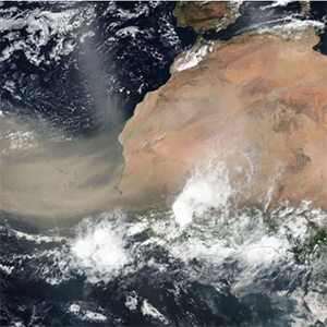
The Ozone Mapping and Profiler Suite (OMPS) aboard the joint NASA/NOAA Suomi National Polar-orbiting Partnership (Suomi NPP) satellite tracks the health of Earth's ozone layer and measures the concentration of atmospheric ozone. OMPS consists of three spectrometers: a downward-looking nadir mapper, a nadir profiler, and a limb profiler. OMPS collects total column and vertical profile ozone data and continues the daily global data produced by current ozone monitoring systems—the Solar Backscatter Ultraviolet Radiometer (SBUV/2) and Total Ozone Mapping Spectrometer (TOMS)—but with higher fidelity and larger swaths. A second OMPS will fly aboard the NASA/NOAA Joint Polar Satellite System-2 (JPSS-2) satellite that is scheduled for launch in 2022.


