Everyone loves a snow day, especially city water managers in the arid western United States. A good winter snowpack in the mountains means rushing rivers and streams during the spring snowmelt, followed by a summer of full reservoirs, fresh drinking water, open swimming pools, and lush golf courses. A poor snowpack, on the other hand, leads to depleted reservoirs and possibly water restrictions. Mild restrictions may prevent residents from using sprinklers or washing cars, but harsher restrictions can inflict water rationing and steep fines. Severe restrictions can even force businesses like meat-packing plants to temporarily shut down because there is not enough water to clean and sanitize equipment.
Water restrictions can be unpleasant, so western water managers rely on good forecasts to avert hardships by promoting water conservation in advance of potential shortages. But traditional ground methods of forecasting may not be good enough in a warming climate, where the West is drying and snow retreats to higher elevations. Researchers are now peering into satellite data and computer models to help water managers adapt to increasing drought and changing snow patterns.

Remote reservoirs
Much of the western United States receives water from major mountain chains, such as the Rocky Mountains and California’s Sierra Nevada. The deep snow blanketing those mountains in winter will melt to provide water downstream for millions of people and irrigation for billions of dollars worth of crops in the summer. Water managers want to know how much water is in that snow. So they need to know where the snow is, and how dense that snow is. They are particularly interested in denser snow, which has more water for a given depth. Skiers may love light, powdery snow, but that may only have 10 percent water. The heavy, wet snow that most people dread shoveling from their sidewalks may have 40 to 60 percent water.
Mountains in the western United States are dotted with snow telemetry stations, which take continuous measurements at remote sites and transmit data to water managers who monitor the snowpack while snug and warm in their offices. Called snow telemetry (SNOTEL) sites, the stations feature snow pillows that record the weight of the snow on top of them, and thereby the water equivalent. “The problem with the snow pillow sites is they’re all on flat ground, so they don’t represent the terrain very well,” said Jeff Dozier, a snow hydrologist at the University of California. SNOTEL sites are also few and far between, and do not account for the variations in mountain landscape. Most snow pillows are only about 80 square feet (7.4 square meters) in size, which is negligible among the millions of square kilometers of snow that cover the United States each winter.
In addition, the snowpack itself often changes over the course of a season. Each layer of snow is slightly compressed by the weight of subsequent snowfalls, gradually compacting and becoming denser. By the end of the season, the densest snowpack, usually in the Cascade Mountains of Washington and Oregon, can be 40 to 50 percent water. The extent of the snowpack changes as well. In October, only a few spots will have received snow, but by February, nearly half of the United States may be covered in snow.
SNOTEL stations are valuable, however, because they are the only reliable source of snow water equivalent data. So scientists are trying to pair these ground measurements with remote sensing to form a more comprehensive picture of mountain snowpack and its potential water supply.
Sensing snowpack
Satellites fly over these mountains regularly and can offer widespread snow measurements over the region. However, water managers are leery of satellites, and for good reason. Most satellites have a lifespan of less than ten years, and may not provide the long-term context water managers seek. Dozier said, “They hesitate to use an experimental satellite or a data source that may be around for only a few years.” So Dozier and others have been developing other meaningful ways that water managers can use satellite data in their models, and finally, they might be on to something.

Dozier and his colleague Tom Painter at NASA's Jet Propulsion Laboratory (JPL) have been testing satellite-based measurements of snow cover. Although they are analyzing the data for mountain ranges across the globe, several of their studies have focused on California’s Sierra Nevada mountain range, which offer SNOTEL sites for comparison. One of the best satellite instruments to look at snow is NASA's Moderate Resolution Imaging Spectroradiometer (MODIS), which offers broad, global coverage that allows the researchers to see snow extent across entire mountain ranges. Dozier and Painter downloaded MODIS data from NASA's Land Processes Distributed Active Archive Center (LP DAAC), using the satellite’s broad coverage to fill in the gaps between SNOTEL measurements and other ground data. Painter said, “You can stick all of the SNOTEL pillows that exist well within a single MODIS pixel.”
Satellite data complement the SNOTEL sites, which are often installed in middle to lower elevations, not at the highest elevations where there is more snow that lasts longer into the melt season. Climate warming models predict that the mountain West will become drier in coming decades: the snow season will start later in fall and end earlier in spring. “As the climate continues to warm, the snow-covered duration at each of the SNOTEL sites will become shorter, but there will still be snow up in the mountains,” Painter said. “Satellite data are critical for that extended vision into the mountain reservoir of water in the snowpack.”
Modeling snow
To help assemble the many complexities of snowfall into a water supply forecast, Dozier and Painter also run computer models that combine ground measurements and remote sensing data. It is the fusion of all three views that Dozier and Painter hope will form a more complete picture. One such model is the National Weather Service’s (NWS) Snow Data and Assimilation System (SNODAS), generated by the National Operational Hydrologic Remote Sensing Center. The model data, distributed by NASA's National Snow and Ice Data Center (NSIDC) DAAC. simulates snow cover and water equivalent in near-real time, offering a view of the snowpack as it develops. Dozier said, “We are using MODIS to improve the results from models such as SNODAS.” Modeling can also help span temporal and geographic gaps in the various data sources. Painter added, “There’s still a lot that is simply not observed yet, so we are squeezing the MODIS spectrum for better snow observations to help improve the community’s current and new models.”

As scientists like Dozier and Painter create meaningful ways to use remote sensing, forecasters and water managers have become more open to including it in their models. In fact, Painter will begin providing his near-real-time MODIS Snow Covered Area and Grain size (MODSCAG) data to the Colorado Basin River Forecast Center (CBRFC), which models conditions for the massive Colorado River drainage basin and generates streamflow forecasts. The basin includes all the streams and rivers that feed into the Colorado River, and covers seven western states plus northern Mexico. The river itself originates in the high mountains of Colorado and flows to the Gulf of California, providing water to Los Angeles, the Imperial Valley, and numerous communities along the way. “Roughly 30 million people get their fresh water supply from the Colorado River,” Painter said. At least 65 percent of that water comes from snowmelt.
Managing the melt
Kevin Werner at CBRFC is collaborating with Painter. Werner said, “I work with the water managers to understand what they do, how they do it, how they use forecasts, and bring that information back so that we can meet their needs better.” The CBRFC models will use the MODSCAG record to nudge their estimates of snow extent, helping to produce better forecasts of river flow and water availability downstream. “The MODIS data are a really nice complement to traditional in situ measurements,” Werner said. “Right now, we’re looking at the snow-covered area from MODIS, and eventually we’ll start looking at snow water equivalent. We have a snow model that we run for all of our basins that simulates the snowpack as a function of elevation in each one of those basins. That’s where MODIS fits into our paradigm.”
MODIS data have proven they can be a reliable addition to historic methods, laying a foundation for its follow-on mission, the Visible Infrared Imaging Radiometer Suite (VIIRS), already in orbit. VIIRS was launched as a partnership between NASA and the National Oceanic and Atmospheric Administration (NOAA), and will extend the MODIS record of snowpack and reflectivity. Dozier said, “Water managers now have some confidence that this kind of data will continue to be available.”
In addition, these solutions may also work in more remote regions of the world. Dozier said, “What I’d really like to do is look at all mountains all over the world and use these methods in ranges where there isn’t as much infrastructure.” Painter said, “It’s very important in places like the Hindu Kush and all along the Himalayan nations, because they have little to no instrumentation in the mountains.” Millions of people in those regions rely heavily on snowmelt to replenish their water supplies, particularly during annual dry seasons, and estimating snow water equivalent remotely may be one of the only viable solutions to help them manage this essential resource.
Reference
Dozier, J., T. H. Painter, K. Rittger, and J. E. Frew. 2008. Time-space continuity of daily maps of fractional snow cover and albedo from MODIS. Advances in Water Resources 31: 1,515–1,526, doi:10.1016/j.advwatres.2008.08.011.
For more information
NASA Land Processes Distributed Active Archive Center (LP DAAC)
NASA National Snow and Ice Data Center DAAC (NSIDC DAAC)
Moderate Resolution Imaging Spectroradiometer (MODIS)
Snow Data Assimilation System (SNODAS)
| About the remote sensing data used | ||
| Satellite | Terra and Aqua | |
| Sensor | Moderate Resolution Imaging Spectroradiometer (MODIS) | |
| Data sets | Surface Reflectance Bands 1-7, M0DO9 | Snow Data and Assimilation System (SNODAS) |
| Resolution | 500 meters | 30 arc seconds |
| Parameter | Surface reflectance | Snow cover, snow water equivalent |
| DAACs | NASA Land Processes Distributed Active Archive Center (LP DAAC) | NASA National Snow and Ice Data Center DAAC (NSIDC DAAC) |
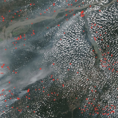
The photograph in the title graphic shows the Sierra Nevada mountain range in California. (Courtesy L. French)